Les Matins Bleu

DSC02180Our riad (guesthouse) is in the medina, the old walled city.  After we parked the car, we engaged a man with a two-wheeled cart to carry our luggage to the riad.  It cost 40 dirhams (the local currency, less than $2) and was well worth it, partly because the medina consists of small alleys and we might never have found our way otherwise.

After our long day, we roused ourselves enough to find our rooms at this beautiful place and roll down the street to a very nice dinner at this restaurant.  DSC02175We had various kinds of tagine – lamb, chicken, fish – and if I had been more awake I would have liked it even more.

The next morning we came down for breakfast in a nice room right by the reception desk.  The riad dates from the 17th century and was turned into a guesthouse only twelve years ago.  It has a central courtyard (though no fountain) and is most attractive.  This rug on the wall faced me at breakfast and may yet inspire a quilt.DSC02176


The courtyard is set with dining tables and beyond are sofas and low tables where you can have dinner if you like.  Here’s a shot of the courtyardDSC02179

and here’s a shot of the dining room ceiling, very old.DSC02178

A hard coming they had of it

How could I have forgotten our many interesting twists and turns on the way to Essaouira?  Another nice man directed us out of Sali, an industrial town with a very confusing center, but I think we might have turned off on to a minor road by mistake.  Soon enough the following road crew confronted us.DSC02172 DSC02171


DSC02173


An enormous trench on one side waited to swallow us up, and we obviously couldn’t go forward.  But at last the gentils hommes curled around us and went down the road, and there was only this horse and cart to wait for.  Soon enough we were on our way.

Casablanca to Essaouira

DSC02134I left the house at quarter to seven, rush hour traffic to National, easy flight to JFK and transfer to the international terminal.  A sandwich lunch and then Biffy, Ed and Joseph (their chauffeur of the day) showed up to much hilarity and amazement – are we really doing this?

We met the others while queuing for boarding passes.  Phyllis, Biffy’s friend, and her sister Marge, the organizer of the trip, are the two who lived in Morocco as children and have visited often.  Susan is Marge’s college roommate, and Anita and Karen are old friends who traveled with Marge in her travel agent days and went on to become friends with Marge.  It looks like a congenial group, and just the right size for easy travel and conviviality.

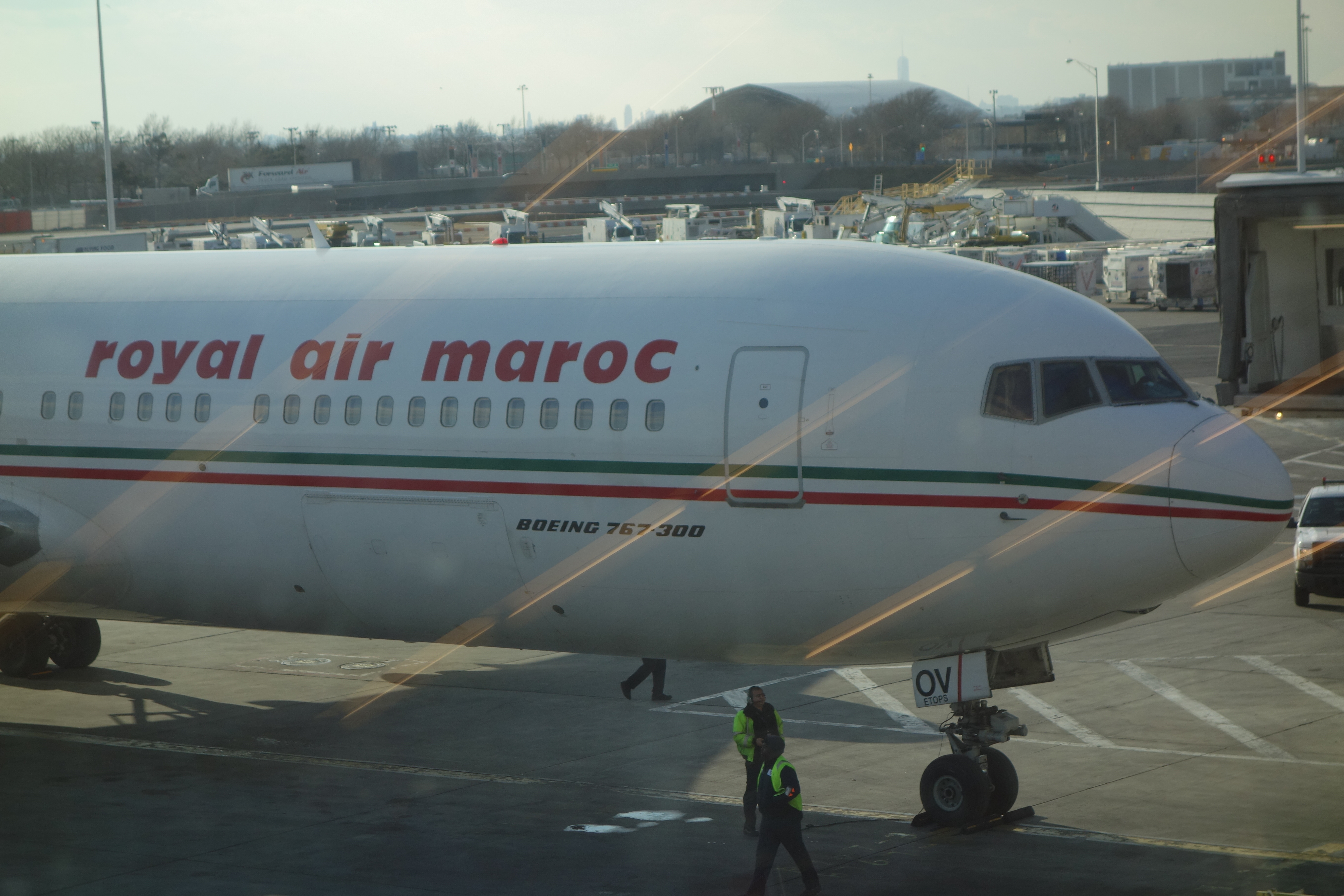
The security lines were long and tedious, but we got through and finally got on the plane close to 7:00.  A truly diverse set of passengers, many tourists but at least as many people returning home to Morocco and points nearby.  Unfortunately, a new version of the evil baby – this on screamed randomly, just enough to startle you awake – made for a rough night, not helped by the uncomfortable seats and extremely talkative neighbors.

But then we landed, to a cool, crisp dawn with palm trees on the horizon.  Picked up the luggage and the two cars (some time was taken up with these tasks),  and the first car hit the road.  Biffy is driving the Kangoo, an upright model with nice big windows for the tourists.  We made our way out of the airport and south from Casablanca to the coast.

The traffic was not too crazy, just a little, made more exciting by the often rough roads, with big potholes or worn tarmac or skimpy shoulders filled with ruts.  Add to this the occasional donkey cart, horse cart or motorcycle attached to an overflowing cart, random bicyclists and walkers, and the way is quite interesting.  At least they drive on the right!

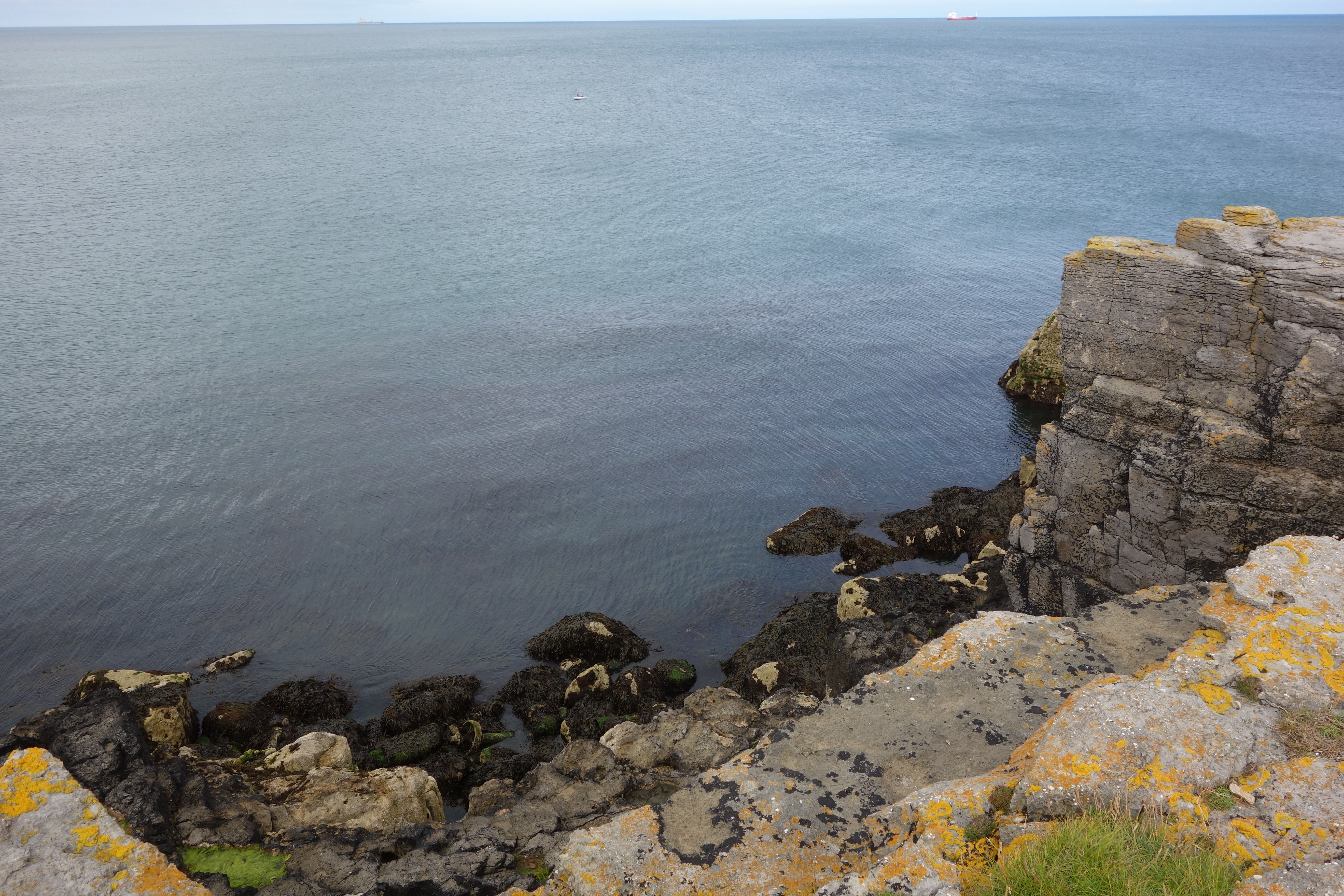
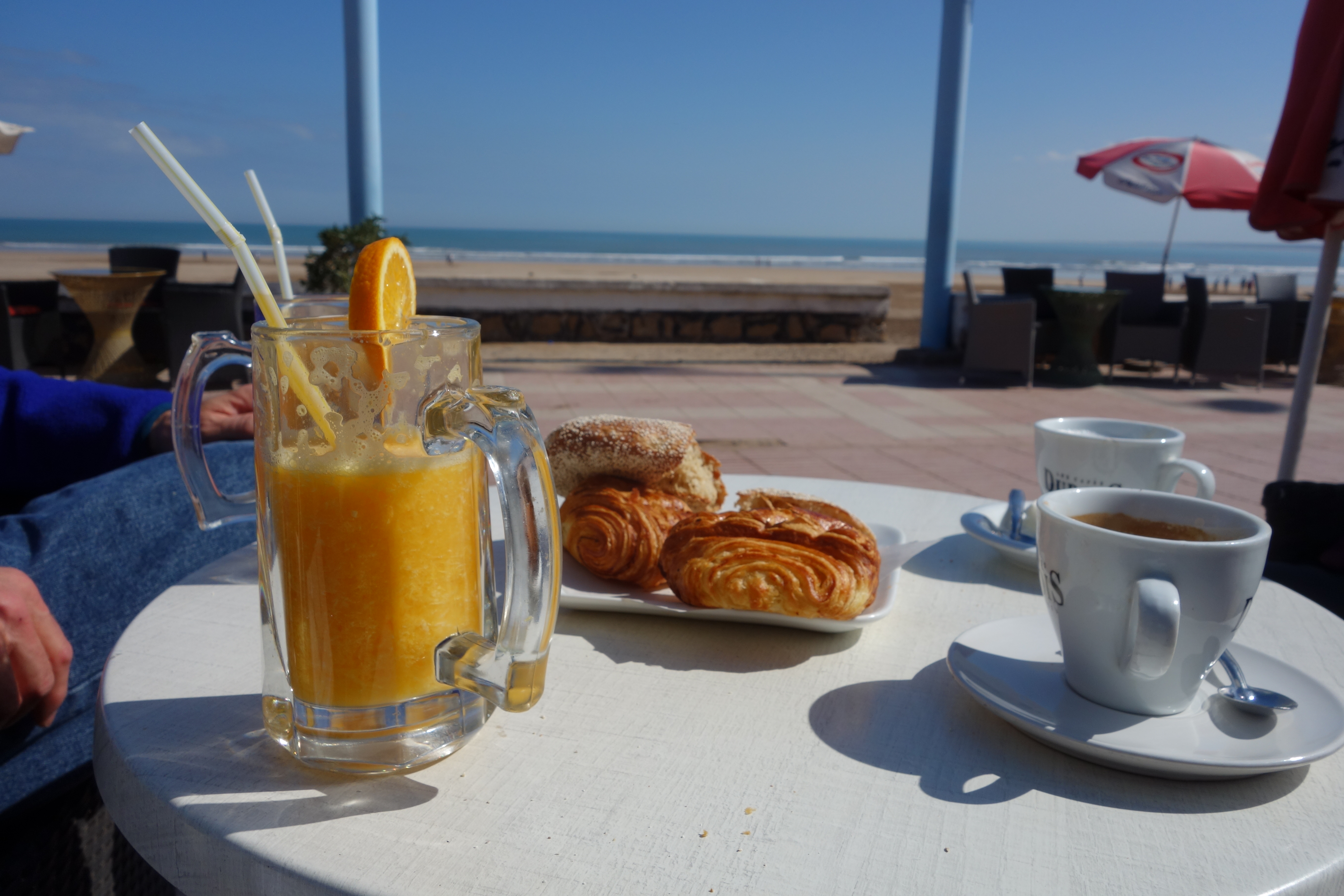
We followed a secondary road down to the old Portuguese city of El-Jedida.  Here was our first meal of the day, fresh orange juice, coffee and petits pains as we sat along the promenade and the Atlantic beach.  DSC02138 DSC02143Our effusive waiter/owner Khalid was very welcoming in English and French (plus Arabic, Turkish and Italian, he told us) and waved us off with fond farewells.  Not before a visit to the bathroom, to which we were escorted by a lovely young woman.  A tiled room with a hole in the bottom, plus a spigot at squatting level, washbasin just outside and paper towels dispensed by the young woman just beyond that.  Shades of France in 1966, but spotlessly clean.

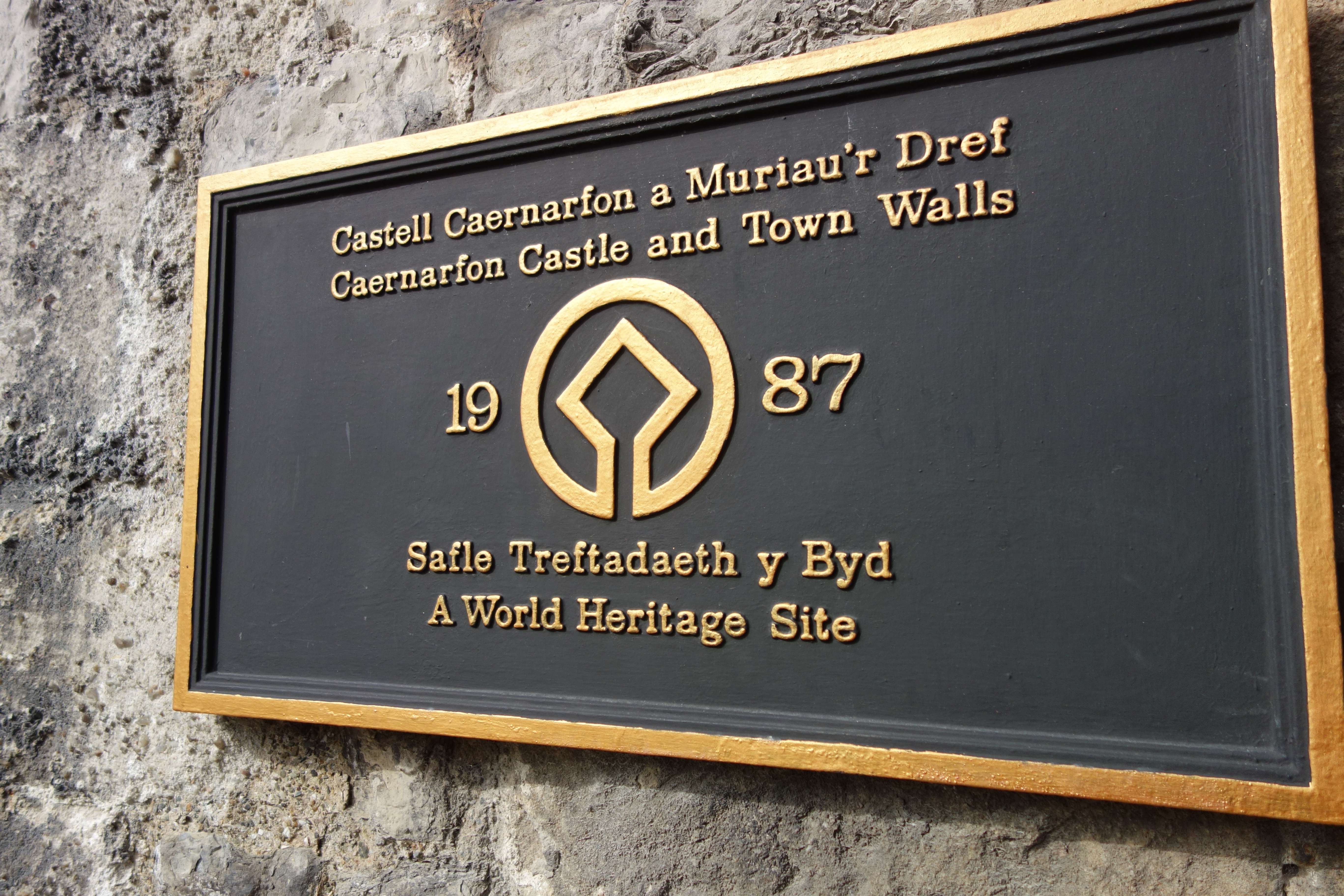
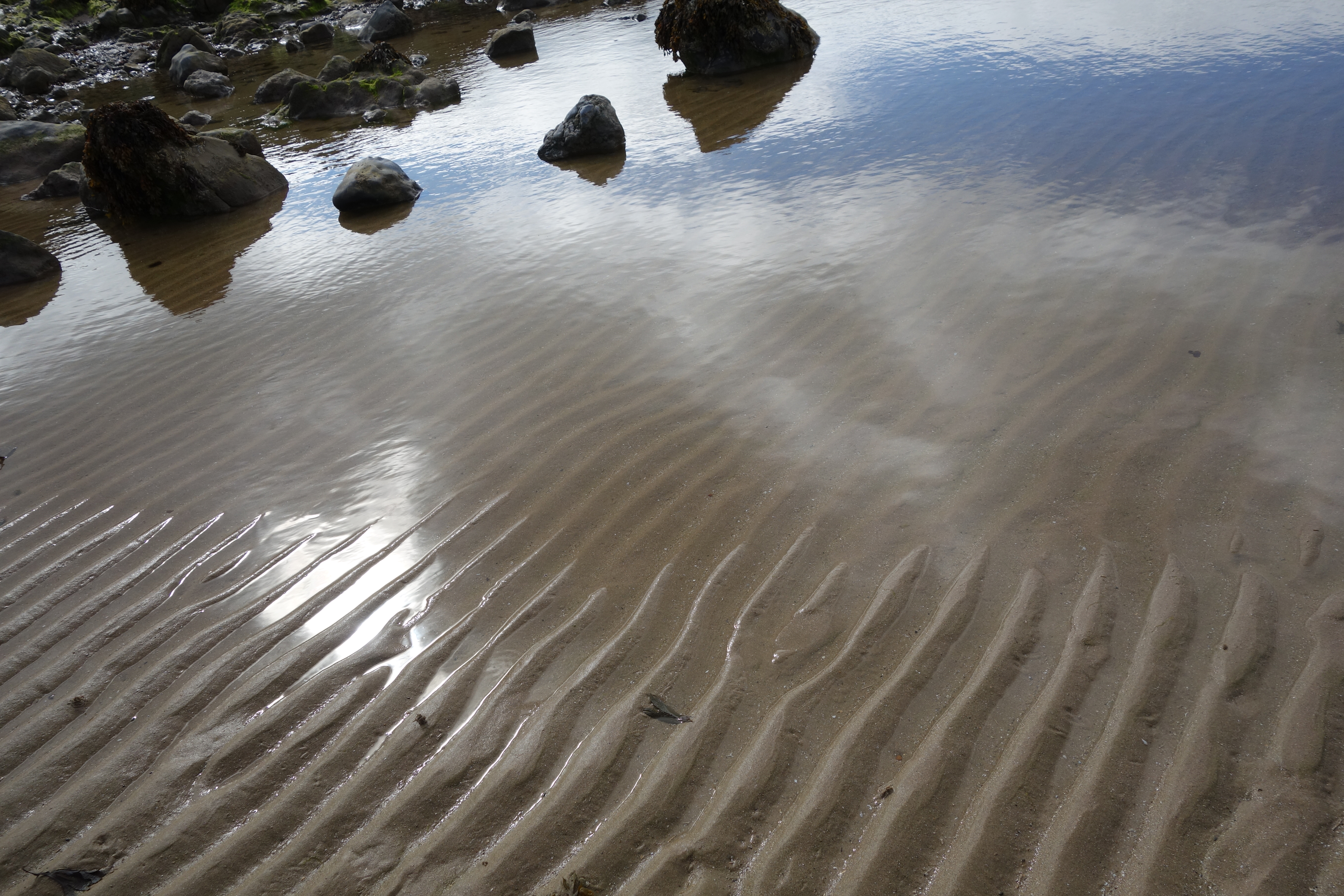
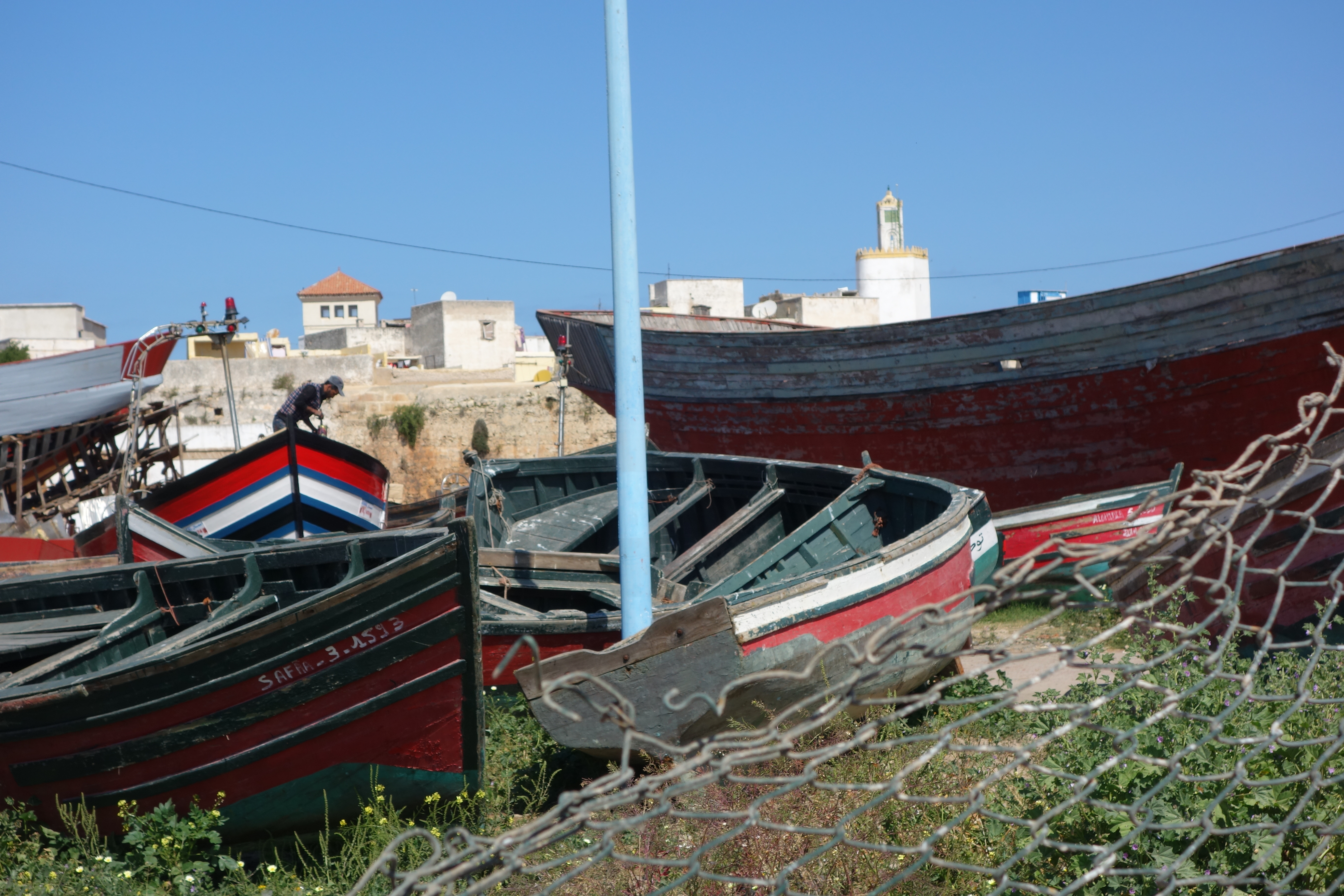
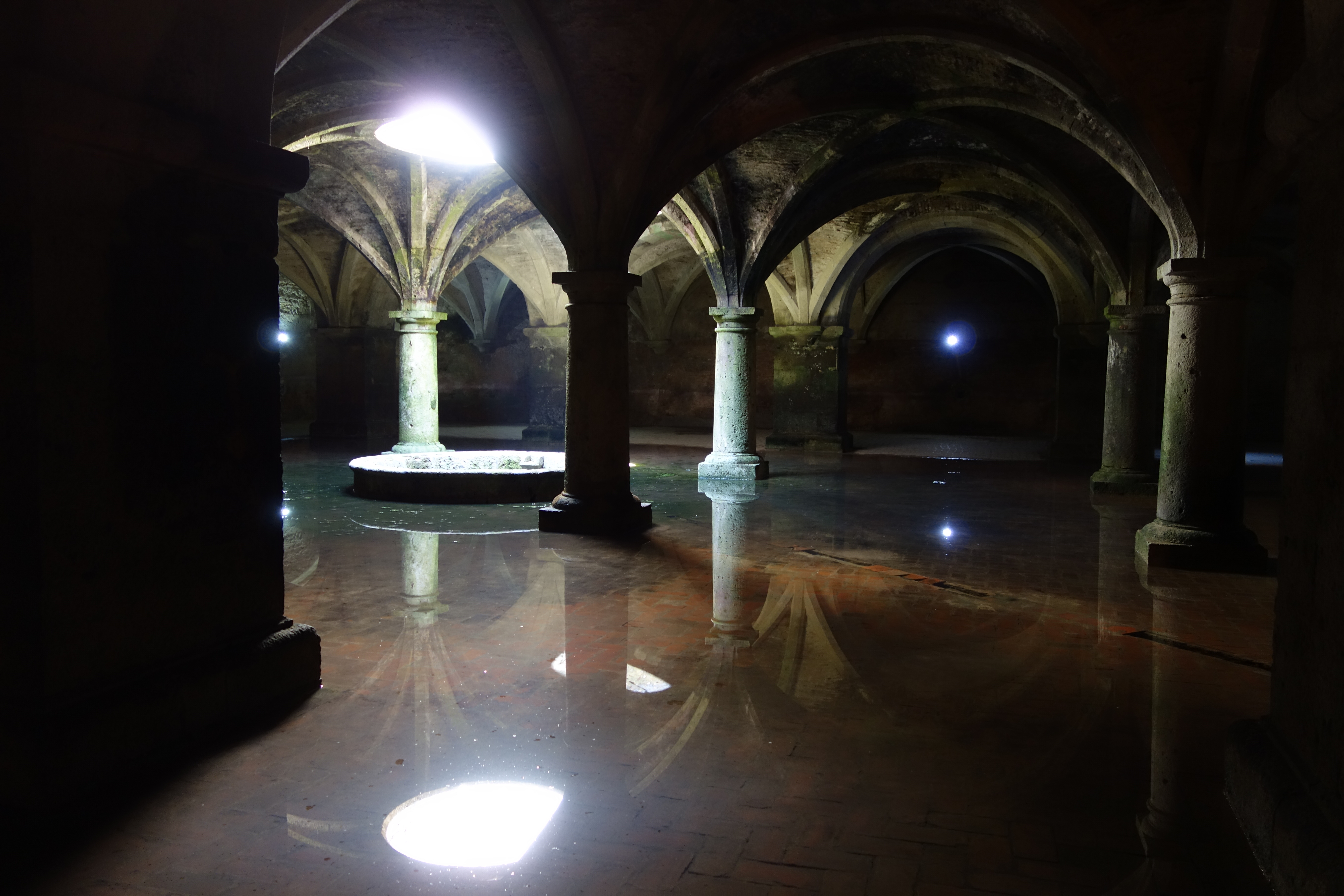
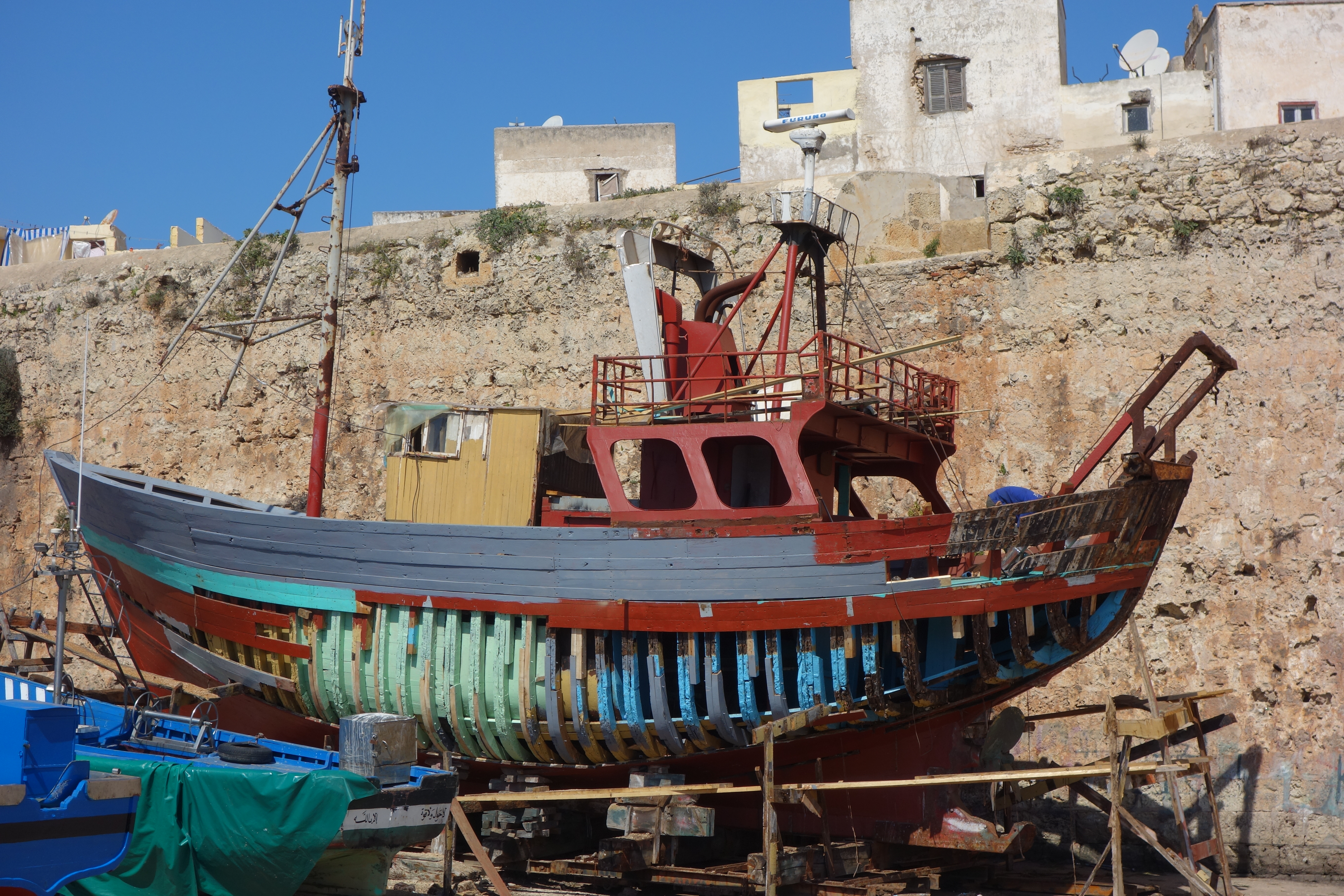
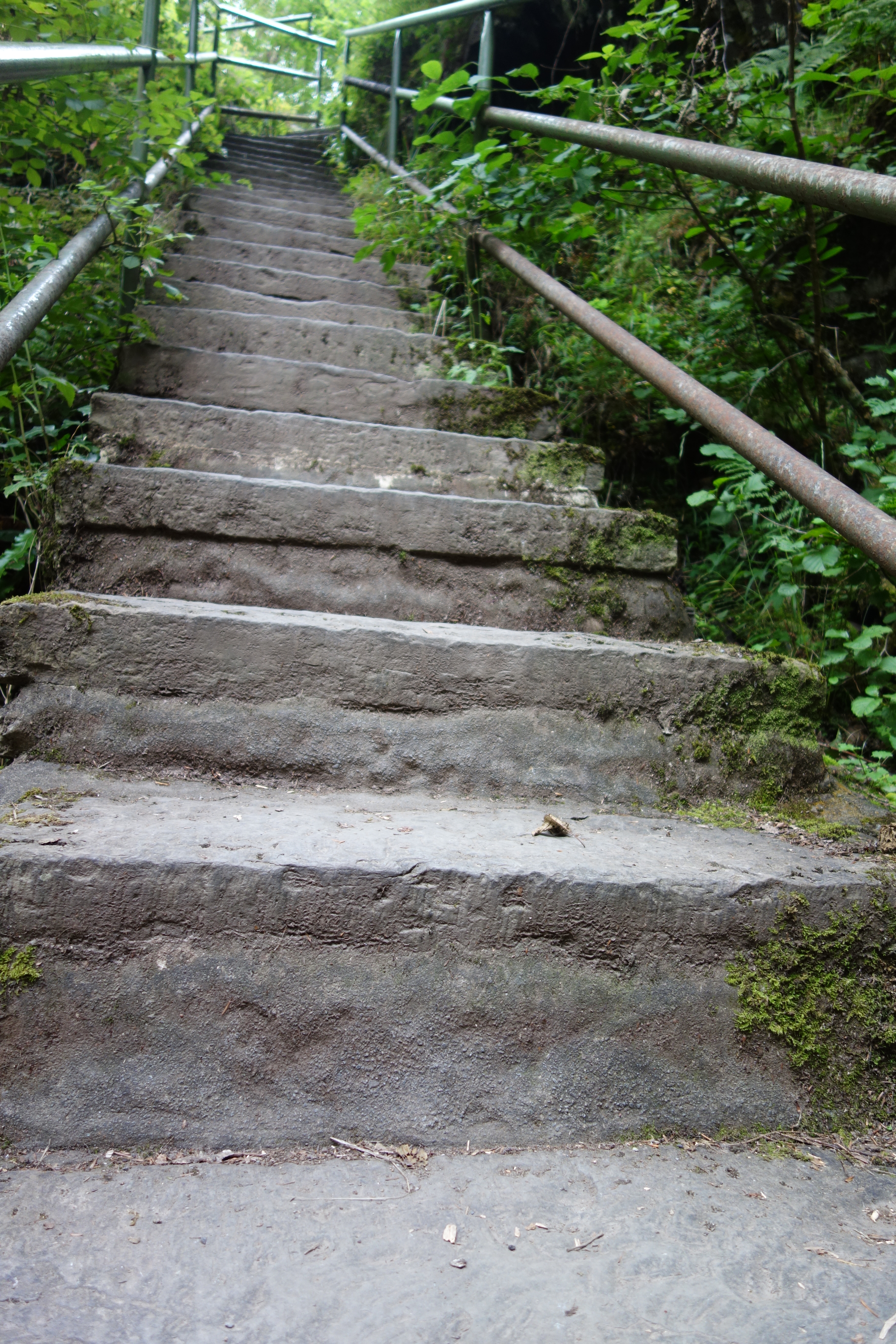
We walked from here into the medina, the walled old town, on the way stopping by this boat-building enterprise. DSC02144 Inside the medina, a World Heritage Site (check!), we stopped first at the old cistern, built in the 16th century, forgotten after the Portuguese left, and uncovered in modern times. DSC02153It’s beautifully atmospheric – we’ll have to watch Orson Welles’ 1952 Othello which was filmed there – and there’s a crystal clear reflection of the opening to the sky, which I think I finally caught.DSC02158

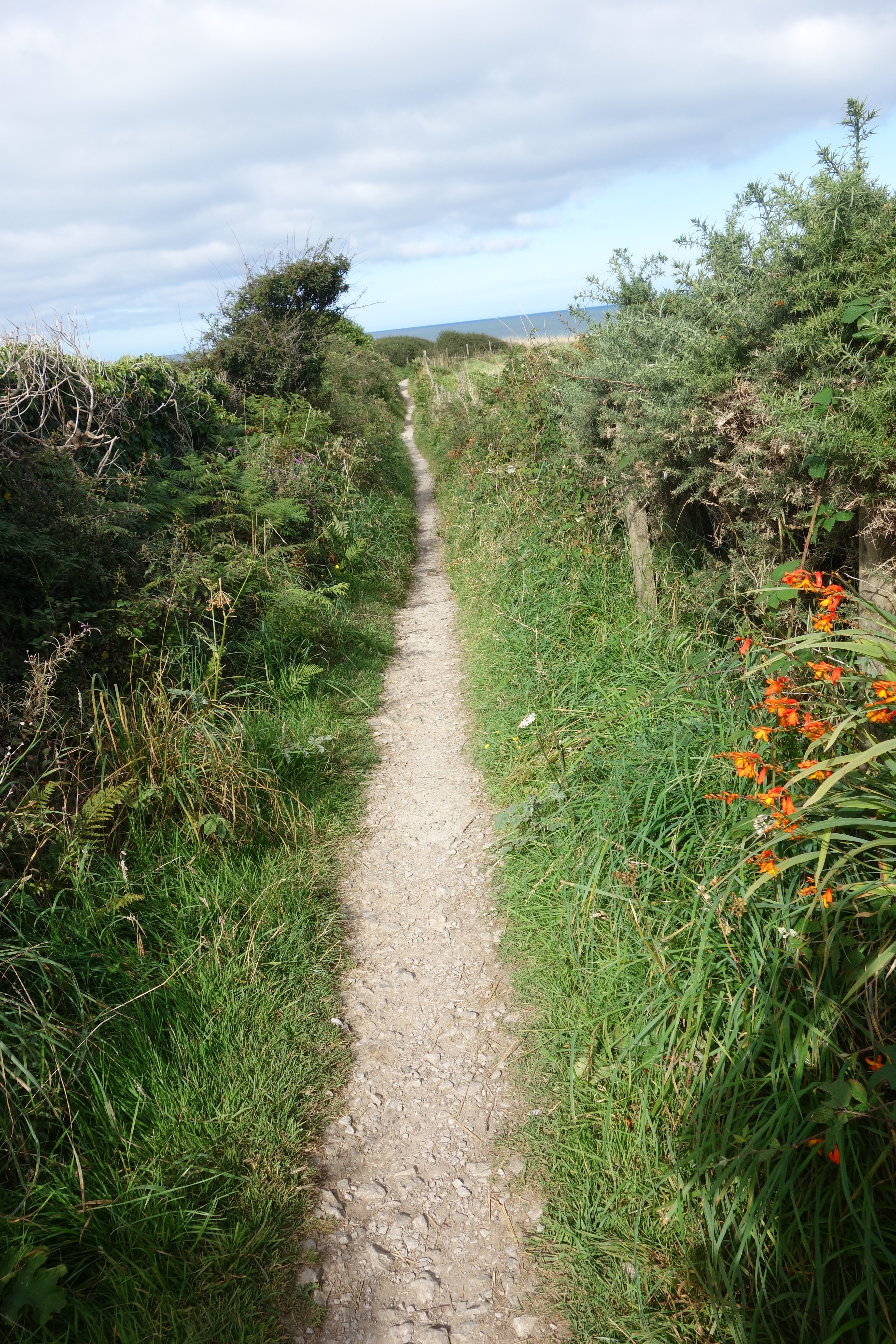
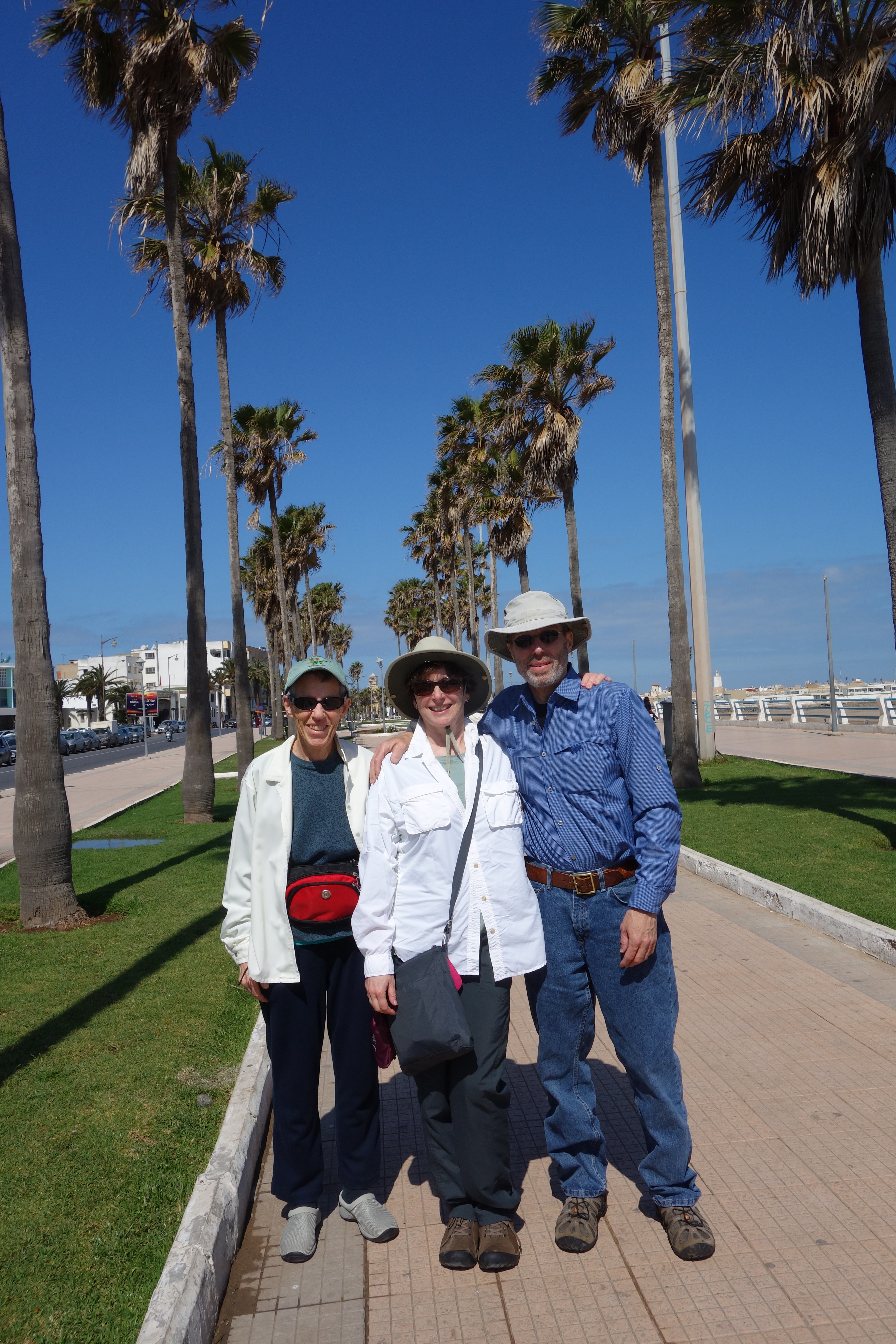
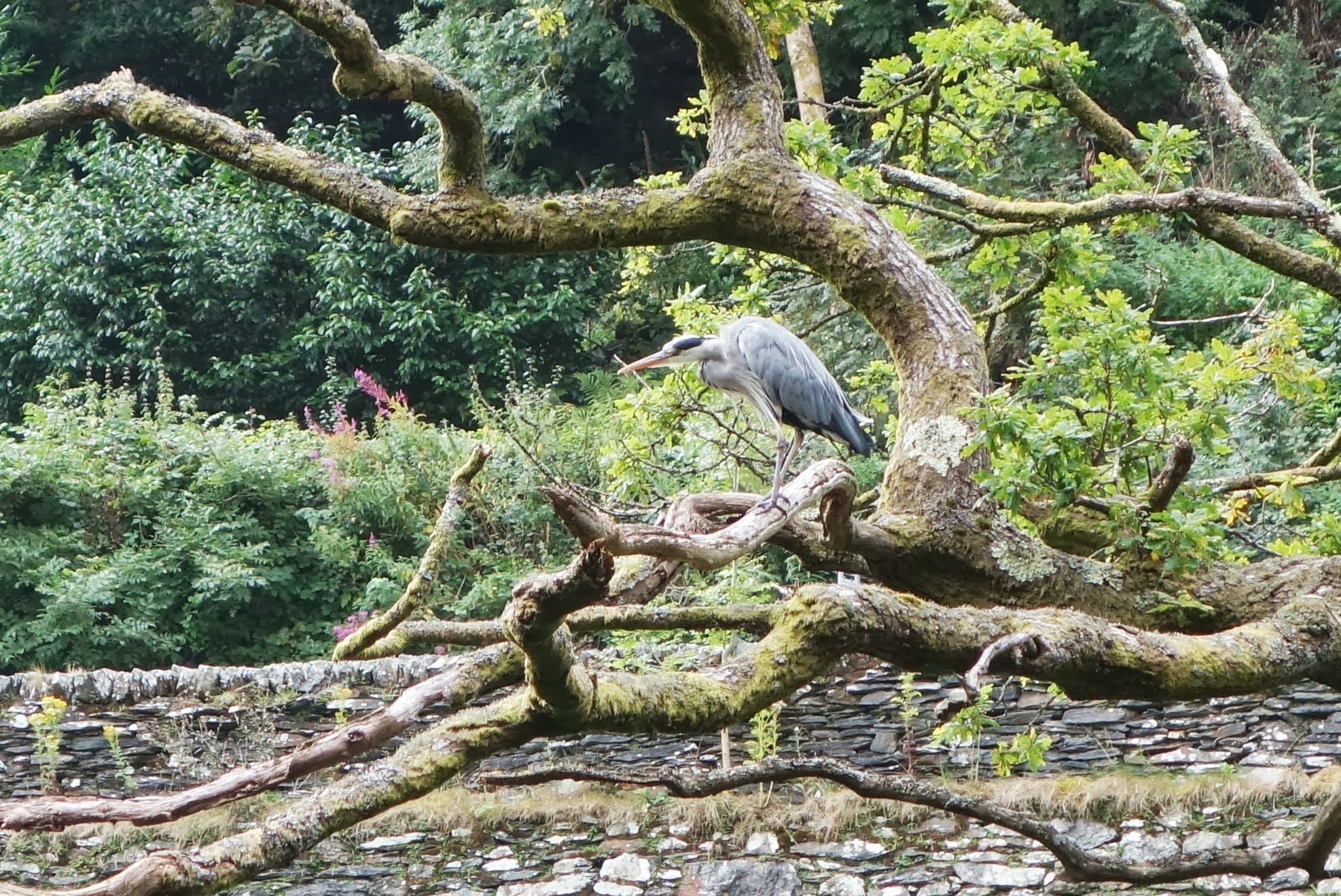
We walked along the ramparts, enjoying the views of boats, DSC02146the old building and the occasional satellite dish, then back through the town to the car.  On our way out we were a bit confused, and what should happen but that a nice man pulled up, asked where we were going and gestured to us to follow him.  Which we did, along a road that skimmed the beach and turned south. At one point he jogged right and we continued straight on, but he caught up with us again, led us farther, and then gestured to us to pull over.  He advised us with big smiles to go straight on (tout droit) and gently (tout douce) and with handshakes all around we said farewell.  And he was only the first of several gentils hommes we have met so far.

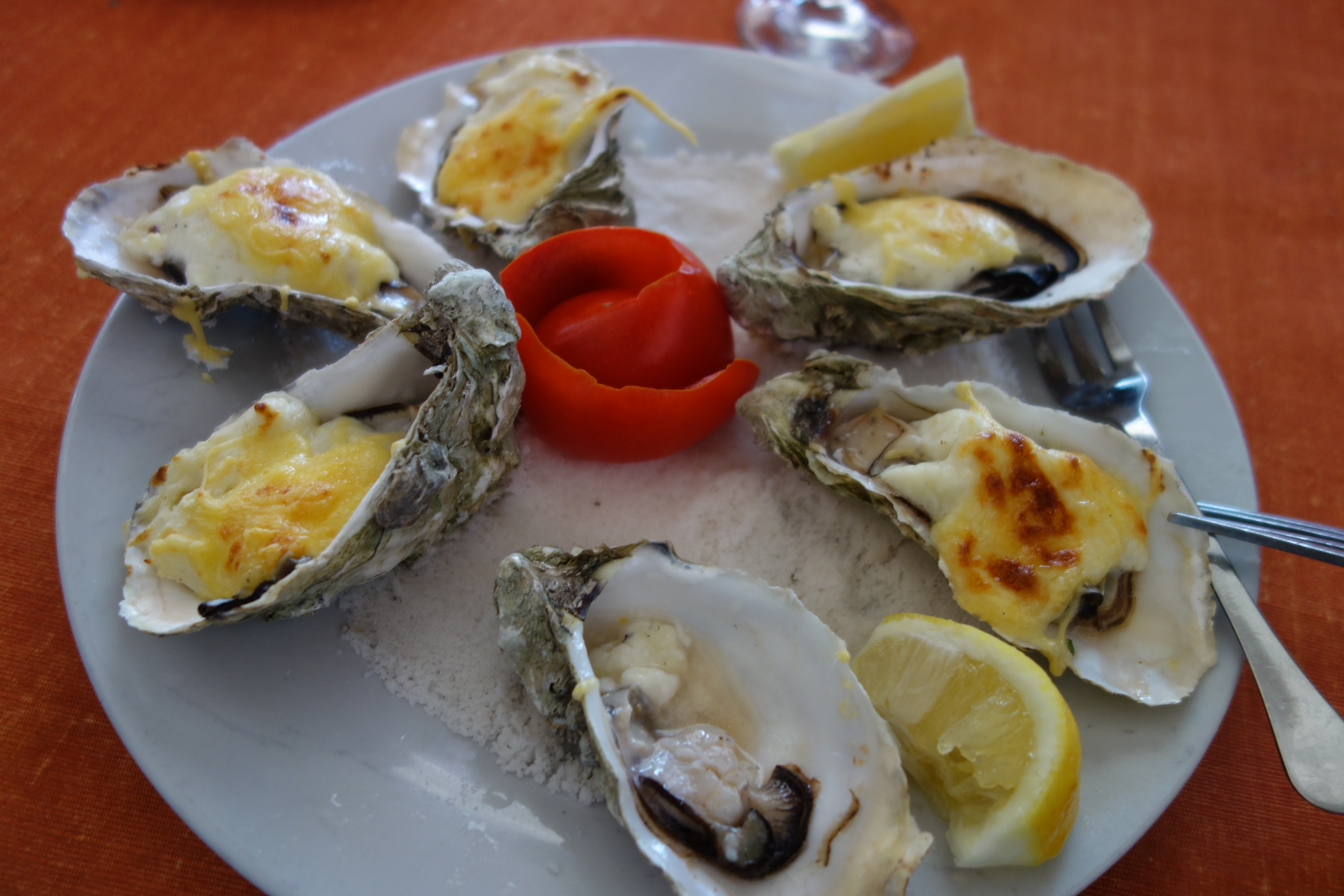
Our goal was the town of Oualidia, famous since the 1950s for its oysters which are farmed there.  We meandered through town until we came to one of the recommended restaurants and there, in the tiled room with blue paint and windows open to the blue sky, we enjoyed baked oysters (raw are a bit iffy) and sparkling water.  Delicious!DSC02165

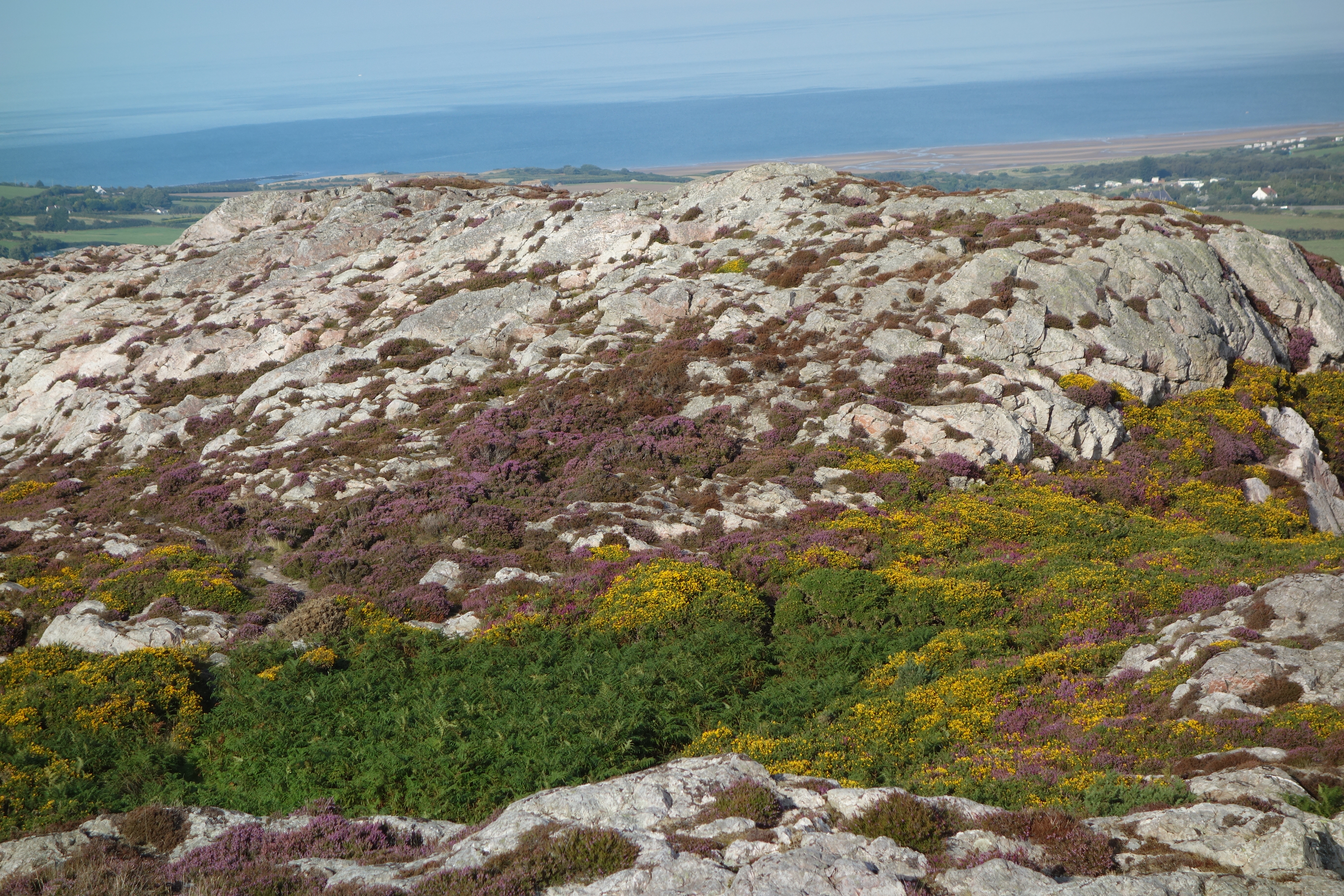
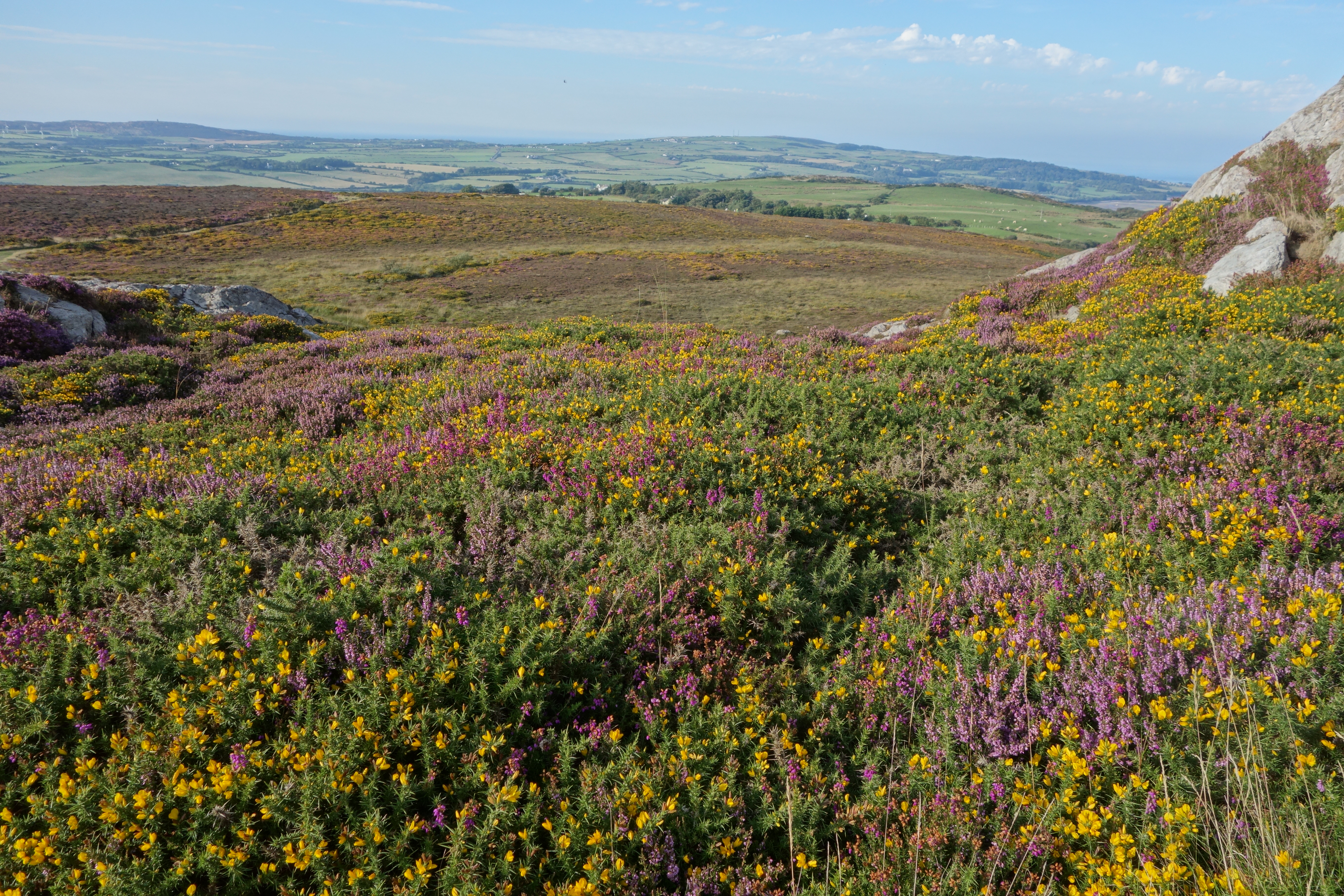
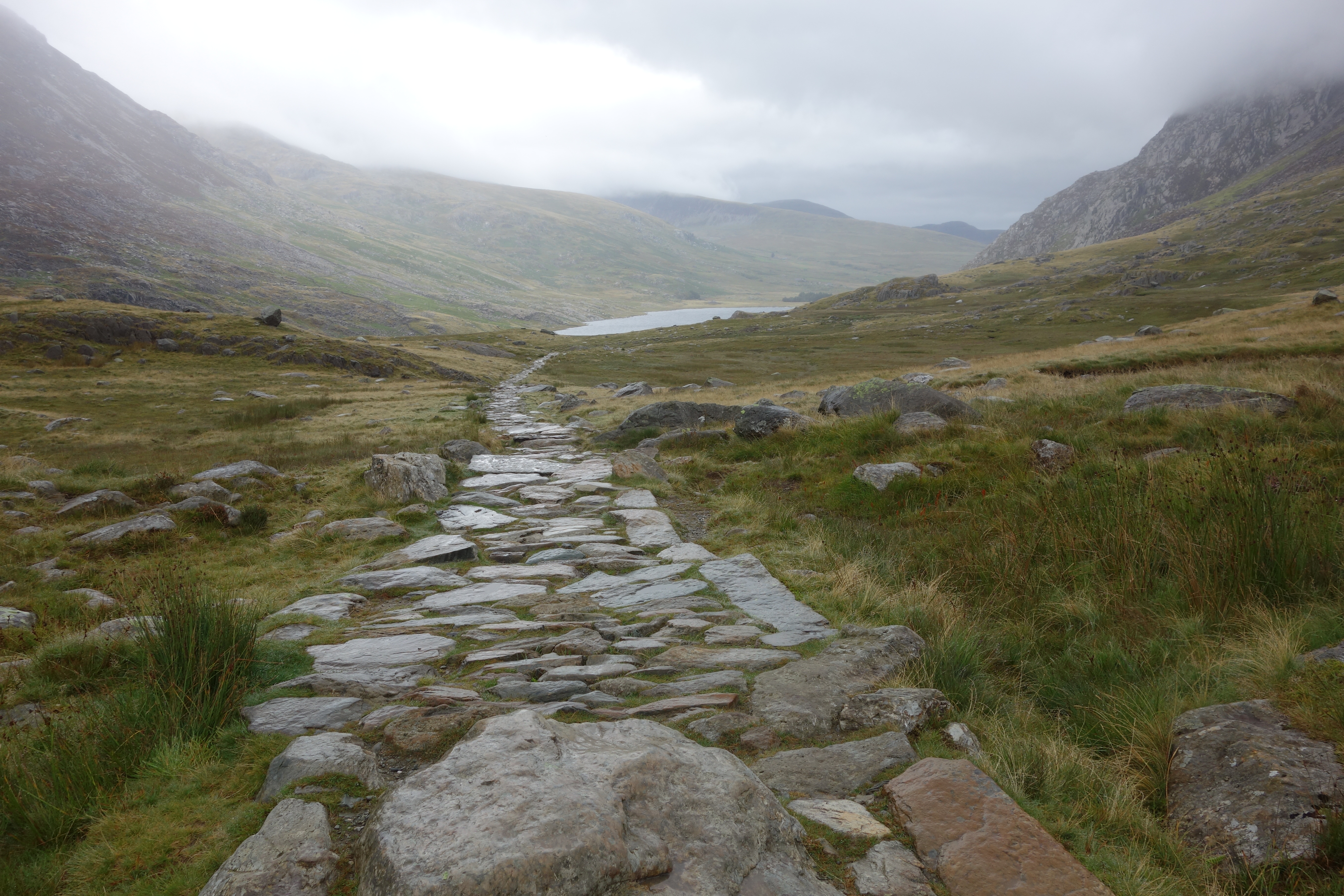
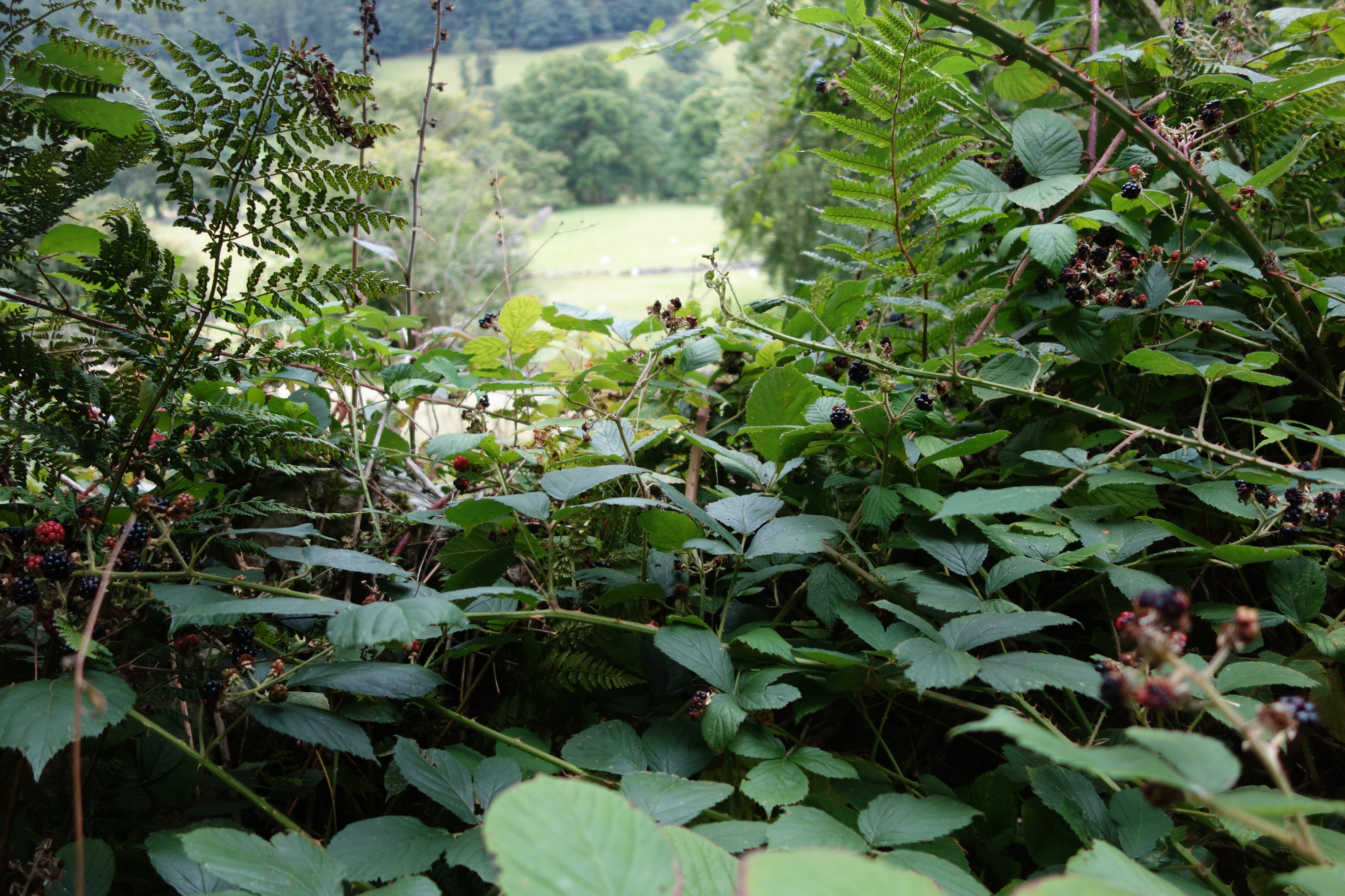
Now we had to go on to Essaouira where we will be spending three nights.  Phyllis took over the driving while Biffy dozed in the back and I did my best to remember that I was navigating.  There are road signs but never route numbers so you simply look for the signs for the next town and hope for the best.  Along the way were the most spectacular (have I already used that word?  Get used to it!) views down to the ocean.  We saw lots of truck gardens, carefully fenced with reeds against the wind, with rich soil that produces the crops we saw being brought to the roadsides for sale.  Carrots, peas (perhaps), cabbages and who knows what else were beautifully displayed in roadside stands.  Meanwhile, the waves crashed on the shores below.  It was reminiscent of Big Sur except not so golden.

It was a long trek for the sleepless, but we finally spotted Essaouira.  Just as we turned onto the long downhill stretch to town, what should we see but gendarmes gesturing us to stop.  Poor Phyllis ended up with a speeding ticket for going the equivalent of 42 mph in a 36mph zone.  Life can be so unfair! But, again, the gendarmes were so gentils that it was almost okay.

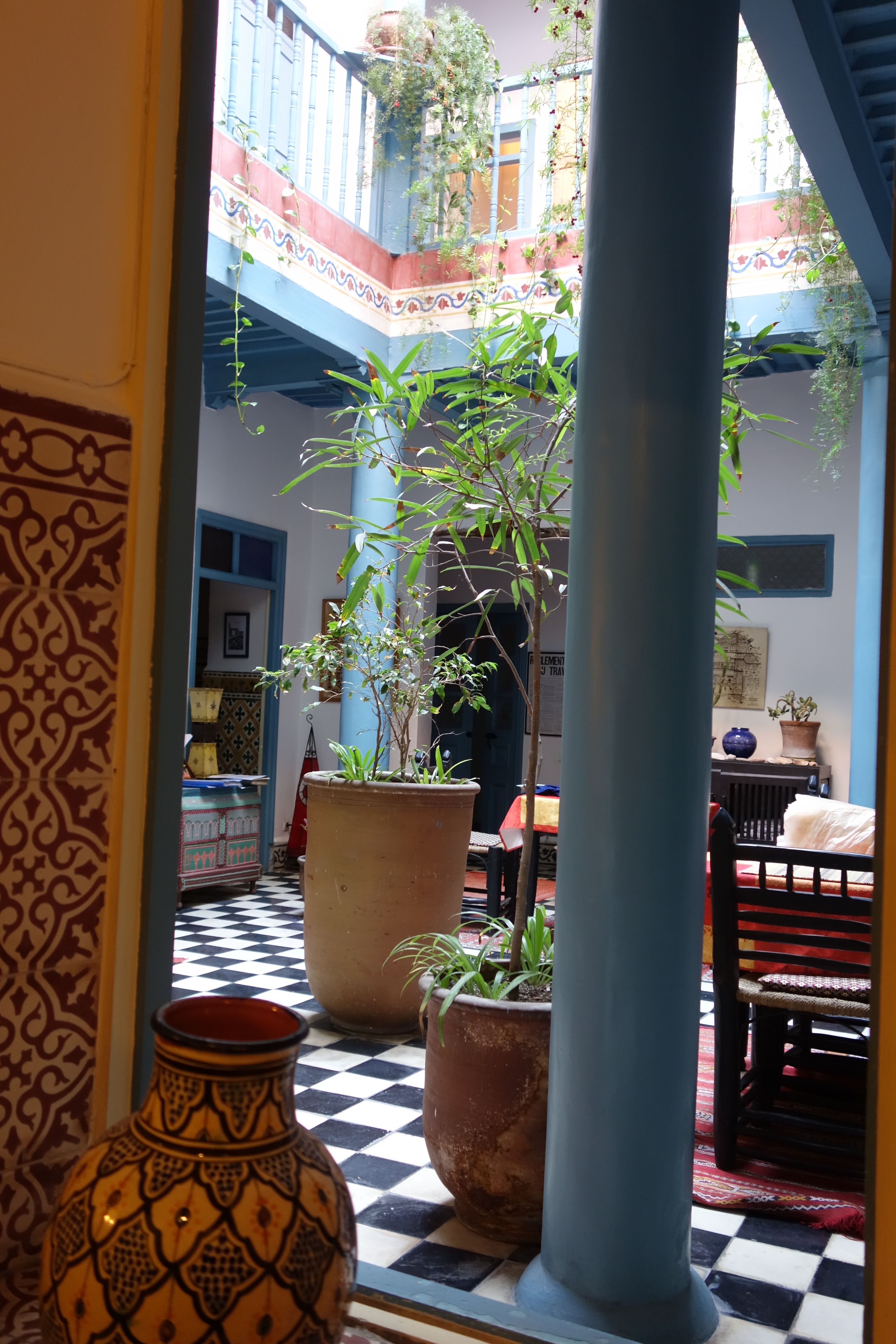
We parked the car, engaged a man with a cart to carry our luggage, and made our way to Les Matins Bleus, our riad for the next three nights.
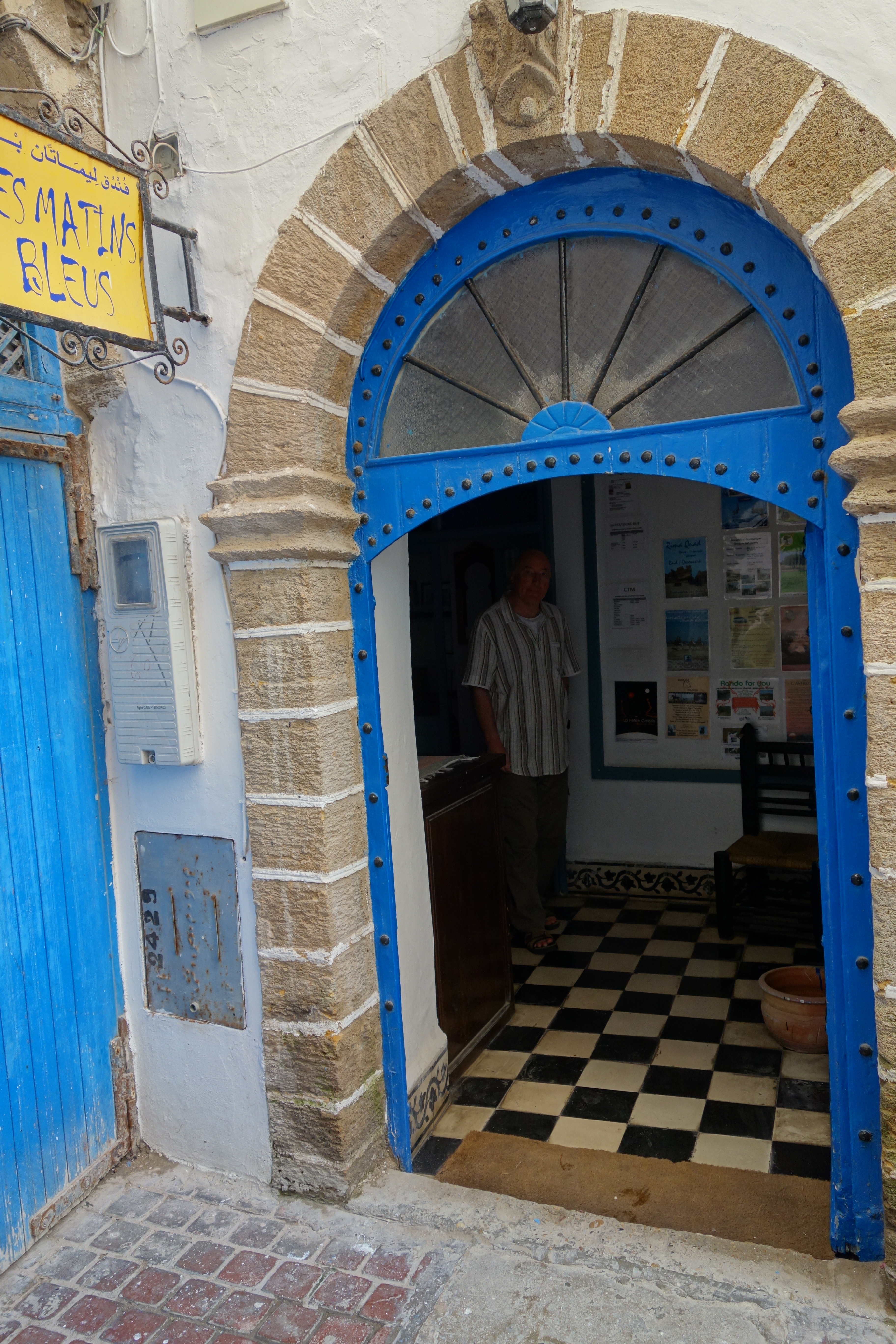
Morocco – the latest adventure

I’m heading to Morocco on just a week’s notice, thanks to a lucky break (for me).  One of the eight people signed up for this adventure had to bow out a week ago, and after some dithering I decided that I would say YES TO LIFE and go.  Pluses:  I have a current passport and a forgiving boss.  Challenges:  I have no map (hope to get one there) and only a week to bone up on a completely new culture.

Of course, as always the day before a trip, I am filled with anxiety, about those I’m leaving behind and about what I’ll encounter in the next two weeks.  (Everyone warns me not to let the camel spit on me, so it must be a thing.)  But I know from experience that once I get on the plane, even just from National to JFK, let alone Royal Moroccan Air to Casablanca, I’ll be just fine.  I can’t think of a better situation than this one – traveling to a new culture where I know only one of the two languages with my sister, my brother-in-law, and two people who grew up in Morocco.  It’s going to be great!  (That funny noise you hear is just my teeth chattering.)


p.s. To see the shared blog our group created, go here.

Two horrific hikes, well, one was, anyway

DSC01598Today was meant to be the day to climb Mt. Snowdon, but we couldn’t quite make it happen.  Now that we don’t have to be down to breakfast at a certain time, we make a leisurely morning of coffee, cereal, morning television news and making sure the devices are charged and working.  So it was not until about 9:30 that we left the house, headed off the island to the little town of Betws-y-Coed at the edge of Snowdonia.
The landscape changed dramatically in just the 45-minute trip.  We left sheep fields and pastures on Anglesey, crossed the bridge, and gradually found ourselves in hill country reminiscent of the stark mountains of Scotland or the Lake District.  The road wound about and wound about, past isolated youth hostels, an occasional house (who lives there? what do they do?), a place called the Ugly Tea Room, the Swallow Falls Hotel, quite imposing, and then we were there.
Betws -y-Coed was an art colony back in Victorian times.  Now the town is filled with shops, from crafts to tea shops to stores selling hiking gear.  At a very useful information center we sought help for our walking plans.  We had realized that walking up Mt. Snowdon would not happen today – not enough time, and one of us really didn’t want to – but what could we do instead?  The man told us there was a pleasant walk along the river to Swallow Falls and back, a four mile round trip, so we agreed and set off.
Somehow this walk was reminiscent of the doomed Red Wharf walk. First, the terrain was difficult – lots of roots and stones – and second, the walk was not as interesting as one might wish.  Yes, we saw a heron first thing, heronand that was exciting, but after that it became a bit of a slog.

DSC01565 When we came to the Miners Bridge and its steep steps down and then up again, DSC01568hearts failed just a bit but we persevered.  Once back up the steps, the path just continued, not getting any more interesting but again quite rooty and stony.  DSC01566At last we decided that there was no shame is simply turning around before we reached the falls, so that’s what we did.
We took the man’s advice and followed a different path back.  This one wended through the woods and finally met up with a hedged lane with this view over the fields.  DSC01569Because I can’t seem to read a map, I was puzzled again but later realized that this was just as the man had outlined.  We found ourselves back in the town DSC01571and had lunch at a pub/bistro.  Welsh rarebit and Orme for me, yum.DSC01572i
Now, what to do this afternoon?  I  was longing to do some hill walking.  The same man recommended Cwm Idwil, a walk around a lake about 15 minutes away from the town.  It wasn’t really up on the hills but among them and would give the feeling.  I asked him if it was level or not, and he said, oh, yes.  Alison heard him say it, too.  (Not that I mind hills, I just wanted to know the terrain.) There was even a short cut if I wanted to use it, so off I set with his printout of the hike, planning to be back by 4:15 and meet Alison by the information center.  If I was not back by 5:00, she would call Prince William to arrive with his rescue helicopter.
All was tickety-boo at the start.  I found the youth hostel without any trouble, parked and checked with a group of men at the cafe about the starting point.  I set off on a wide path, just as promised, that wound through  the bare hills up to the lake.  DSC01573The hills were  stark and arresting, and the dark, silent lake could have come out of Arthurian legend.  DSC01575The directions indicated stone steps going uphill around the far end of the lake.  I was game.  Partway up the steps was an area called the Idwal Slabs, which in Welsh means “Slopes of Cheese.”  It sounds more benign than they looked to me!  “They are primarily used as an introduction to climbing for beginners.” Among them was Edmund Hillary, training for Everest, so this is not child’s play.  And there in fact was group of climbers heading up the sheer rock walls, as you can see in this picture if you zoom in on the orange dots halfway up on the left.DSC01579
Just there was the cutoff – I could see a man with two poles walking across the end of the lake and avoiding the stone steps.  I wavered for just a minute, but I knew I could climb those steps, so up I went.  Only back at home have I found this description of the upper route, courtesy of the National Trust: “NB: An alternative high level route may be taken at this junction by following the path towards Idwal Slabs and up towards the base of the cliffs above. This route should only be attempted by competent hill-walkers as it involves very rough, steep ground and a difficult stream crossing.”DSC01580The stone steps went up and up, at some point starting to remind me of the horrible steps Frodo and Sam climb up in Lord of the Rings.  But I Crossfit, so I can do anything, right?DSC01583
Upward and upward, and every time I thought I was at the top there were more steps.  DSC01585There was more mist, too.  The good news: I could no longer see the steep hillside falling away below me.  The bad news: I couldn’t really see where I was.DSC01588
Then I came to a waterfall.  I had not read the directions before setting out, but now I was riveted.   Be careful if it’s icy, it cautioned me.  But what about if it was just wet? And what about if there was no path?  I was just to slither down and find firm footing on the other side???
I briefly considered turning back, but no.  This picture gives you a view from the first side of the waterfall, looking down. Now admittedly, this is a tiny waterfall, but the point is that there was no path of any kind across it.  I just had to – gulp- figure it out, the way the shepherds must have long ago.DSC01586Surely if I just break it down into steps I can figure this out.  And I could. I sat down on the rock and scooted down to where I could see a foothold on the other side.  I put my foot there, raised myself up and just kept going until I could see the semblance of more stone steps again on the other side. DSC01587 I had made it over the “difficult stream crossing,” with only wet pants to show for it, and I was sure that the worst was behind me.
But, no.  The directions continued, “Once you climb the steep stone steps you will be in the midst of the large boulders by Twil Du, peeled off the cliff by the retreating glacier.”  And did I mention that this mountain, Twil Du, means Devil’s Kitchen?  The problem was the mist.  It made the stones wet and slippery, and the grass was wet and slippery, too.  The mist meant that I could not see very far in front of me and had no idea how extensive the boulder field was, or where the stone steps would start again.  On a dry day, it would likely have been fine, but today it was treacherous and just a bit scary.DSC01592Notice the mist, the slope, and the lack of a trail…
Can’t go over it, can’t go under it, guess I’ll just have to go through it.  So I did, inching my way along lest I twist an ankle, knowing that down was a good direction, and instinctively heading just a bit left when the truck-sized boulders, poised on the hillside, would permit it.  And there, at last, after what felt like half an hour of careful scrambling, were the stone steps again.  DSC01593They rose uphill on my left for some distance, so if I had been able to see where I was going the boulder field would probably have been just a blip on the walk.  Instead…
So I inched my way down the wet, slippery stone steps, and every time I came to a flat stretch I hustled right along.  I finally dared to look at my watch to see if Prince William had been called out yet.  From the start of the climb to the stone steps after the boulders had taken only an hour.  It had felt like two!
As I made my way downhill, the mist lightened just a bit.  First I could spot the lake off in the distance, then the path brought me closer to it, DSC01594then I was rounding the end of the lake.  I loved this slate bridge over the last bit of water.  DSC01596
The final stretch was uneventful except for a trio of sheep that meandered over the path and scattered slowly at my approach.DSC01602 The way ahead brightened and the mist was gone.  Sadly, the cafe had closed so there was no restorative cup of tea for me.  I turned the car around and headed back to the Visitors Centre, where I picked up Alison just on the dot of 4:30 and we drove back home.
Lessons learned:  remember to bring a whistle just in case the worst happens, and learn what signals to give for help.  Read the directions before setting out (you moron).  Try not to hike alone, even on a path like this one where I encountered at least half a dozen people (until the waterfall and then not again until I was on the other side of the lake).
I was heartened to run into a photographer at Bodnant a few days later who was familiar with the path and referred to it as a “nightmare,” especially in bad weather.  So there.  But I was proud to have done it and don’t regret it in the least! Continue reading

Caernarfon Castle and a visit with real Welsh people

DSC01525Today’s plan was to visit Caernarfon Castle, one of Edward I’s ringed fortresses built in the 13th century to control the Welsh.  This meant a trip off the island, back over the Britannia Bridge to the town of Caernarfon.  The castle is right by the river, and the castle walls are still standing, making an imposing statement smack up against the town.DSC01524

While on crusade, Edward had been impressed by the castles in Constantinople, and Carenarfon reflects that style.  The walls are inset with bands of different colored stone, and the turrets are octagonal rather than round.  A good movie and a series of informative boards explained this and the larger history of the area.

The Welsh princes had been ruling their country for generations until the clash with Edward.  The Welsh prince of the time obviously underestimated Edward, refusing to pay homage to him when he was crowned king.  Edward retaliated by burning the grain fields on Anglesey, thus cutting off the Welsh food supply, and in the end the English prevailed and the Welsh were conquered.  Edward promised that one day he would give the Welsh a prince who spoke not a word of English, and this came true when his son was born, speaking not a word of English or, indeed, of any other language, and was made Prince of Wales.  Though the Welsh took the castle later on for a few months, they never ruled their own country again.

DSC01528After walking on the walls and through the tunnel-like passageways, and viewing the slate stage where Prince Charles was crowned Prince of Wales, we were ready to move on.  We had a quick lunch at a cafe on the town square DSC01531and then walked back down to the river for a cruise along the Menai Strait.DSC01533

The Strait was wider here than I had expected, and the wind blew hard.  The captain pointed out the fields of Anglesey, the peaks including Snowdon across the way, DSC01535and a fort  built during the Napoleonic era.  Oystercatchers and gulls could be seen waiting for the tide to ebb (in fact, he told us quite a bit about the tide since of course it matters a lot to a boat captain).   Mild and pleasant, with good views of the castle from the water.DSC01539

We headed back to Anglesey for our meeting with Dewi Jones and his wife Magdalen.  Alison’s brother Proal had become fascinated with the history of Welsh poet Geronwy Owen, who had died in 1769 in Brunswick County, Virginia, where the Heartwells grew up.  As part of the research for the book he wrote about Owen’s life in Virginia, Proal befriended a retired schoolteacher, poet and Owen enthusiast in Benllch and visited him when Proal and his wife came to Wales on the Owen trail.  Alison had called Dewi and Magdalen and arranged to meet them this afternoon in Benllch.

We successfully called them from a phone booth and they drove up to meet us and escort us to their house, high on a hill above the sea.  They are both getting on in years and no longer do much driving, so they could not give us the tour of the area that they had given Proal and Susie.  But we spent a brief, happy visit with them.  Dewi is clearly a scholar.  He explained the origin and meaning of Welsh words and place names in a way that reminded me of Uncle Buzz.  They were gentle and courteous and we felt lucky to spend time with them.

Then in bustled a younger man in paint-stained overalls who offered to take us on a ride to a nearby “mountain” where we could see unparalleled views of the island.  We figured out that he was their son and gladly took him up on his offer.

First we followed him to his house nearby, where we saw gorgeous views of the Strait from his living room.  He hustled us into his little car and off we set.  I was glad that I had agreed to go with him rather than follow him in our car.  He drove fast and talked even faster!  He made his way through twisting lanes, regaling us with stories of how he and some friends had found a gigantic quartz stone that was probably used in ancient times in some kind of ritual and how they had hid it in the trees where no one else could find it, and how this little mountain was on a road that was not signposted so only the locals really knew about it.

Then we arrived, and it was breathtaking.  He started off up the trail, and Alison soon decided to stay put while I went on right behind him.  Rhys (for Alison had finally asked him his name) was right, it was glorious!  Bright late afternoon sunshine illuminated the whole island.  From here we could see Holyhead and the copper mines of Amlch to the north and west, Mt. Snowdon across the Strait, Moelfre to the east, and all around.  It took only about ten minutes to climb but somehow it was situated in such a way to provide these glorious views.  DSC01552 DSC01549 DSC01544We stood there for some time, taking in the light and the landscape, and then Rhys suggested taking my picture at the top.  Done!DSC01553

We returned to earth and he drove us back to his house so that he could show us some musical links.  One is to the Welsh Men’s Choir he belongs to, and he showed us a couple YouTube videos of their performance, quite beautiful.  His daughter, about to start university, acts in a Welsh soap opera that has given her enough money to buy a car and pay for two years of school, and he showed us a video of her performance singing in an eisteddfod.  Altogether, a talented family of musicians and storytellers.  What a treat to have met them.

Tonight we decided to go out to a restaurant in Moelfre that’s about as upscale as it gets here in the country.  Ty Ddrew is a converted farmhouse just up the road from our cottage and down a long driveway.  Inside was very nicely appointed, with a beamed ceiling and just a few tables taken.  We started with rabbit terrine, which was just okay, and then both chose the lamb shanks, which were delicious.  We ended with a platter of Welsh cheeses, quite an excellent way to finish the meal.  When we came outside, we caught the tail end of a dramatic sunset that seemed to embody all the Welsh mysteries Rhys had told us about.DSC01557

Ancient monuments

Our plan was to drive around the island to Holyhead and see the South Stack Lighthouse.  But wait – first, we drove by some ancient monuments and one of us had to stop.  There were three things to see.  First was a ruined chapel, Hen Capel Lligwy, a so-called “chapel of ease” that was connected to a larger church.  It was very poignant sitting in the middle of the sheep fields.  DSC01461Next, up the road was the Lligwy burial chamber, a Neolithic structure that would have been covered in earth when it was made 5,000 years ago.  DSC01459We almost missed the last one, but as we returned to the car a chatty man told us we should also visit the hut remains, where he and his family had found some ancient artifacts, including a brooch that they had sent off to Aberystwth but had never gotten back.

The setting here was appropriately mysterious.  We walked through a silent woods, slightly uphill, and then the woods opened up into a clearing with a complex of buildings – foundations only – that made up the farm and workshop of a first and second century community.  DSC01464You really could start to imagine them living here, perhaps walking down through the woods to the sea to catch fish.  Well worth the walk through the fields.DSC01463
We got back on the road and made our way counter-clockwise around the island through Amwlch and along the coast to Holyhead.  Our plan was to visit the  Maritime Museum and have lunch there, but we were foiled when we opened the door only to be told cheerfully that a, the museum was closed for filming and b, they were never open on Mondays anyway.  On their advice, we drove along the Promenade and had a restorative lunch of mushroom soup and prawn cocktail at a restaurant up the way.
Next up was the South Stack Lighthouse, which some of us viewed with apprehension.  At the visitors center it all became clear.  Walk up the road and then down 400 steps alongside the cliff to a bridge across to the island where the lighthouse is situated.  DSC01467The whole area is now a bird preserve, but the best time to see birds is in spring and summer, when the cliffs are white with seabirds.  Puffins?  Not so much, and definitely not now.
Only slightly daunted, I made my way down the steps which fortunately were bordered by chest-high walls, just enough to feel safe while allowing for amazing views.  It was quite reminiscent of Niest Point in Scotland.  The only really scary bits were a set of very steep aluminum steps towards the end, and the bridge over the water that was no longer a suspension bridge, thank goodness, but still offered too clear a view of where you were walking.  DSC01474I turned down the invitation to walk even higher up into the lighthouse and took a brief tour of the museum.  The best feature was this room full of equipment, none of which I could really understand.  This one’s for you, Pat!DSC01470DSC01471
Guess what!  There were more historic monuments nearby!  We climbed over a stile and came to more hut circles.  DSC01479These lucky Neolithic people had gorgeous views of the sea, though I bet the wind blows cold here in the winter.
From here we drove into the center of the island to visit Oriel Ynys Mon, a museum devoted to the art of Kyffin Williams, among other things. The current exhibit was right up our alley, being devoted to the artist’s views of Venice.  The introductory film gave a very good picture of Williams, who was Welsh and loved the countryside here despite spending thirty years teaching art in London.  He came back to live in an old house on the coast but also paid visits to Venice and, interestingly, to the Welsh settlements in Patagonia, something I’d like to know more about (though I have a faint memory of reading about this in someone’s book about Chile).  The exhibit was all about light and water and very good.


We picked out some trinkets – slate necklaces and books about Williams – and made our way back to Moelfre.  Dinner tonight was at the Kimmel Arms, the local pub with wonderful views of the harbor, and the curries we had were unexceptional but just fine.

Success on the coastal path

After our disastrous morning, I decided to try yet again for the coastal path. My original plan was to take the bus to Pentraeth and walk back to Moelfre, but  I was scarred by the morning and decided to keep it simple, just walking out the door and taking the path out of Moelfre and back again.
It turned out to be a sparkling afternoon, in contrast to the cloudy, humid morning.  I set off on the path right from the middle of town, first paved and then graveled, and clearly marked.  Moelfre Island loomed just offshore, DSC01500home to cormorants, who all seemed to live on the left hand side, and gulls, tucking their heads under their wings on the right hand side.  As the path went along, the cliffs revealed wonderful geological formations. DSC01502DSC01515Wild flowers of all kinds were everywhere (time to consult the booklet on coastal wildflowers for identification).
Then, after a walk along the edge of a field and through a narrow way bordered by high hedges,DSC01514 the most amazing beach was revealed.  DSC01506Traeth Lligwy at low tide is a huge expanse of sand, dotted this afternoon with maybe half a dozen people.  I made my way down some steep stone steps to the strand.  Rippled sand, pools of water reflecting blue sky and the sun on the wet beach were hypnotic.  What a treat to find this!

DSC01509
Reluctantly, I reversed direction and enjoyed the walk back just as much.  I took a short detour, climbing over a stile and up a path to the monument to the victims of the Royal Charter.  DSC01516This was a famous shipwreck, written about by Charles Dickens, who visited a few days after the rescue, and the site of a similar shipwreck 100 years later almost to the day.  A statue in Moelfre commemorates the coxswain who rescued so many people back in 1959.  Both events obviously loom large in the minds and hearts of the locals, for good reason.
Home in time for dinner, this time lamb steaks and this delicious salad, ;both made by Alison.  A very nice end to an up and down day!

In which we get lost but keep on going

DSC01489
This morning was meant to be a simple walk along the coastal path, a circular route that would take us on the coastal path at the start, then around an ancient fort and along some lanes back to the beginning.  It was marked to start at the Llandollan Beach carpark, so we parked at Red Wharf Bay by the Ship Inn, where we would have lunch.
Oddly, the directions to the path didn’t make any sense, but a nice woman walking her dog walked with us to find the start of the coastal path, and we were off.  She noted that the path right along the coast was likely to be “splodgy,” so we took the alternative route just above the coast.  We saw this wonderful fence made of branches, DSC01488while on the other side we saw, of course, sheep.  The path soon went back down to the coast and we followed it along.  DSC01491And then followed it some more.  And more.  It was flat, slightly splodgy, and it just kept on going.  Plus, the directions for the walk didn’t seem to work – where was the little wooden bridge?  And weren’t we supposed to go uphill pretty soon towards the fort?  Of course, the coastal path is pretty easy, right?  Just keep the coast on your left (or your right if you’re walking counter-clockwise), and how can you go wrong?
It was at the carpark we came to next that I realized my first mistake:  the route we were taking was supposed to start here, not at the carpark 45 minutes back.  No wonder the directions to the path had made no sense!  Nevertheless, we kept going.
We came to an intersection on a paved road DSC01497and took the coastal path route to the right.  Now we were walking on a lane that snaked upwards towards some woods.  This seemed to make sense, since we were supposed to come to an ancient fort on top of a hill, so we kept going.  This path, always signed as the coastal path, wended through woods, past blackberry bushes with perfectly ripe berries, up along farm houses, through ferny woods, through a number of kissing gates, and…we were lost.  None of this matched either the walk OR the ordnance survey, which I thought was like the voice of God and always right.

After two hours, the estimated time of the entire circular walk, we emerged onto, wait for it, the coast.  DSC01498Where were we??  We walked by a house where  a man emerged and helpfully told us we were on Red Wharf Bay and pointed the way back to the Ship Inn, just along the coast.  So we set off again, with our destination in the distance.  An older couple walking their dog assured us that we were right for the Ship Inn and that we would be fine, after all we had our sticks (hiking poles).  And indeed, we were seeing signs for the coastal path as we walked, so we just kept going.  We came back to the intersection we had encountered earlier and saw with fresh eyes that it signed the coastal path IN BOTH DIRECTIONS.  DSC01497We took the upper path that went through the woods but clearly we were supposed to take the version that went along the coast instead.  See the little words on the left-hand signpost that say Coastal Path?
After a total of three hours, we were back at the carpark and settled in to the Ship Inn for a well-deserved lunch (ham sandwich and a half-pint of McKellans).  To this moment, I cannot figure out what happened.  The only clue is that our coastal path book states, “There is no true coastal path between here [Penmon Point] and Red Wharf Bay. . .Paths and lanes inland must be used instead.” But why there were signs for the coastal path all through the woods, while the OS map showed it along the coast, I will never know.

I hope this doesn’t sound peevish.  It’s mostly that I am still baffled.  The walk itself was fine, though not outstanding, but the anxiety about the path made it more stressful than it otherwise would have been.  However, any walk is better than no walk, and a good lunch at an old pub makes everything better.DSC01496

Beaumaris and the priory

Today we’re off to Beaumaris to see the castle and the town.  Edward I built his infamous ring of castles around Wales, and the castle here is the last one he built.  It’s not very imposing because it’s not very big, but if you walk all around it, you realize its defensive strength.  First is the moat, and back in the old days you could sail your ship right up to the castle gates to offload your supplies or your soldiers.  Beaumaris Castle moatNext comes a thick wall with arrow slits that allow you to aim and fire but are small enough that the enemy can’t fire back.  Finally comes the castle itself, with 16′ walls complete with more arrow slits and towers from which you could cover the archers’ fire.  The concentric design is simple but effective.DSC01435
The best part of this fairly mild visit was watching two fathers and a group of children touring the grounds.  In England, not only do children fight with play swords and shields, but they do it on the grounds of an actual 13th century castle!English children playing at soldiers
We walked along Castle Street to see what we could see and ended up at a nice waterside restaurant for a steak and ale pie and a bottle of local beer. DSC01443 We scoped out the two butchers and decided to come back later for MEAT.
Off now to Penmon Priory, a few miles up the coast. DSC01453 This is said to have been founded in 547 AD, destroyed by the Vikings (of course) and rebuilt in the twelfth century.  What’s there now is a church and remains of the priory where the monks (Augustinians, eventually) slept and ate.  The church is dim and medieval, not very big, and interesting for its ancient artifacts, two thousand year old stone crosses and a fertility figure of a woman with spread legs, hanging on the wall.  Almost as good was an array of various jars containing the vicar’s chutney, which he was selling in return for a donation to the church fund.  (We had some last night with our lamb steaks and it was delicious!).
The graveyard consisted of contemporary slate tombstones and an older section that was romantically neglected.  DSC01447There was also an old stone dovecote that once supported a thousand doves, raised for food.
From here we walked about a mile down the lane towards Trwyn Du lighthouse and Puffin Island, DSC01449where there were a scattering of people on the stony beach, plus a few scuba divers setting out.  We stoped for tea in the cafe – scones with cream and jam – and sat outside next to a table full of Weasleys, I swear.  Very pleasant.
We went back into Beaumaris to pick up some dinner, and Alison came out of the butcher shop with local beef and lamb steaks. Yum!  By now it was late afternoon, so we headed home for a leisurely steak dinner at the cottage.  Very nice to cook something simple for ourselves at our own schedule – although we do have to do the dishes…