Category Archives: Wales

Two horrific hikes, well, one was, anyway

DSC01598
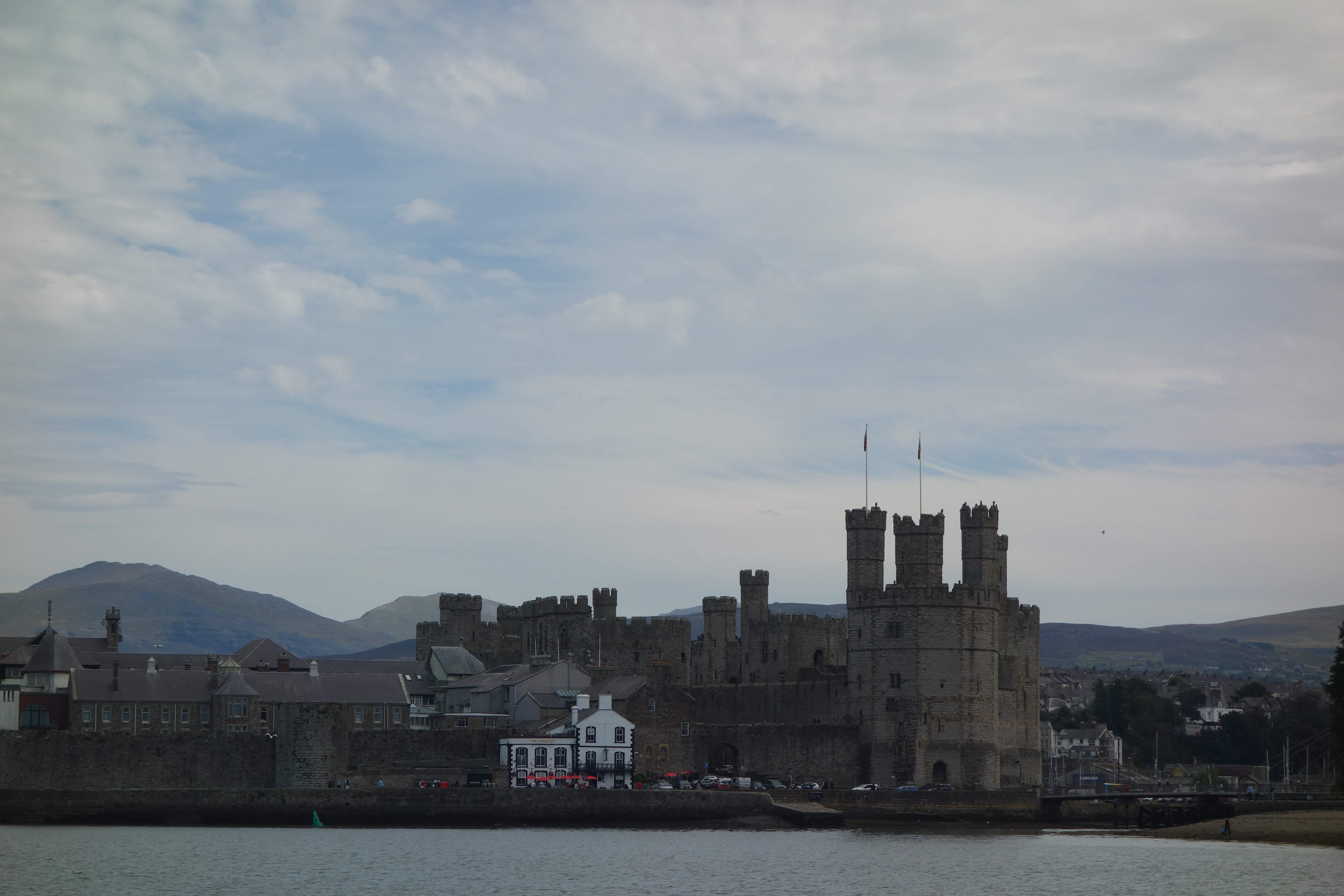
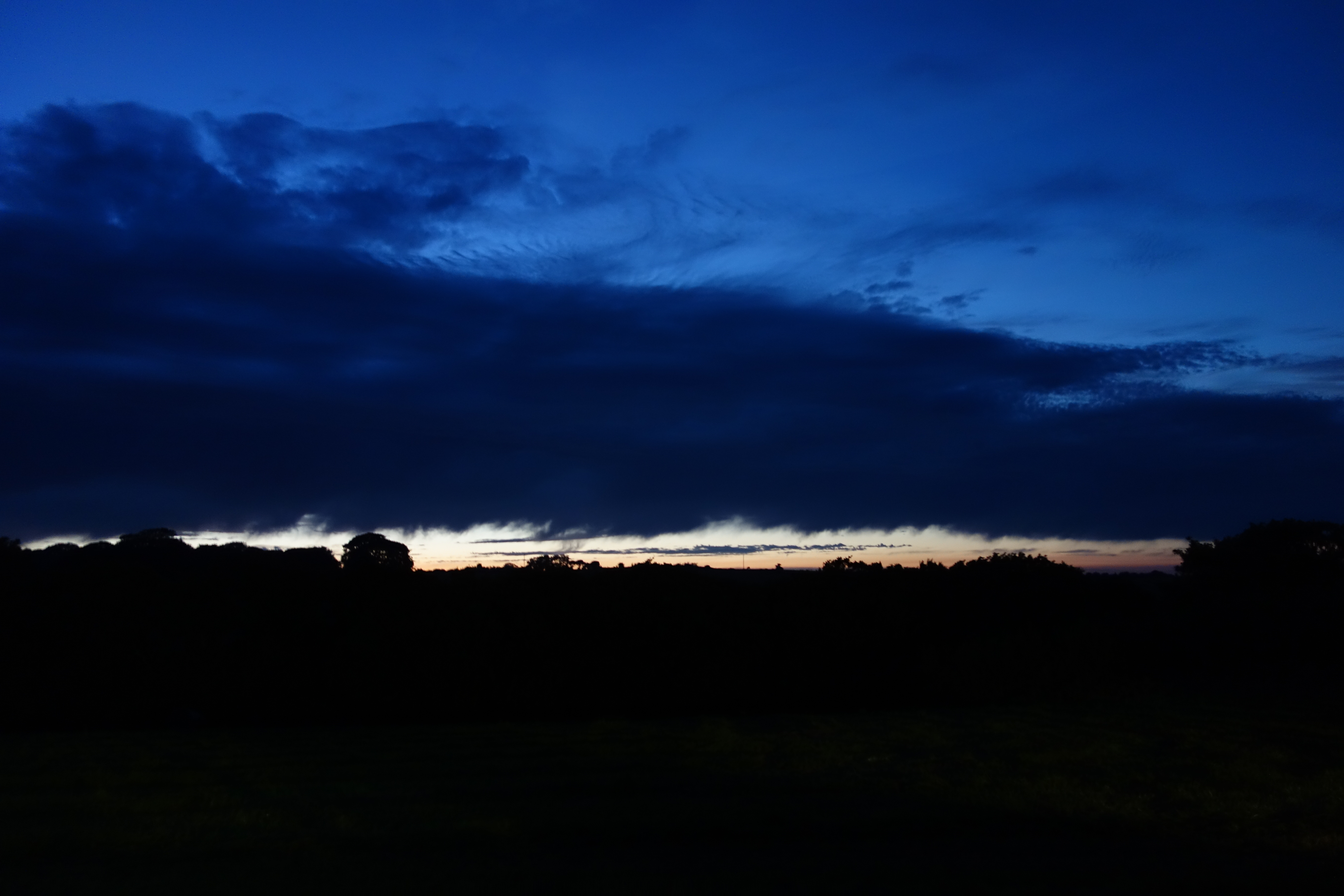
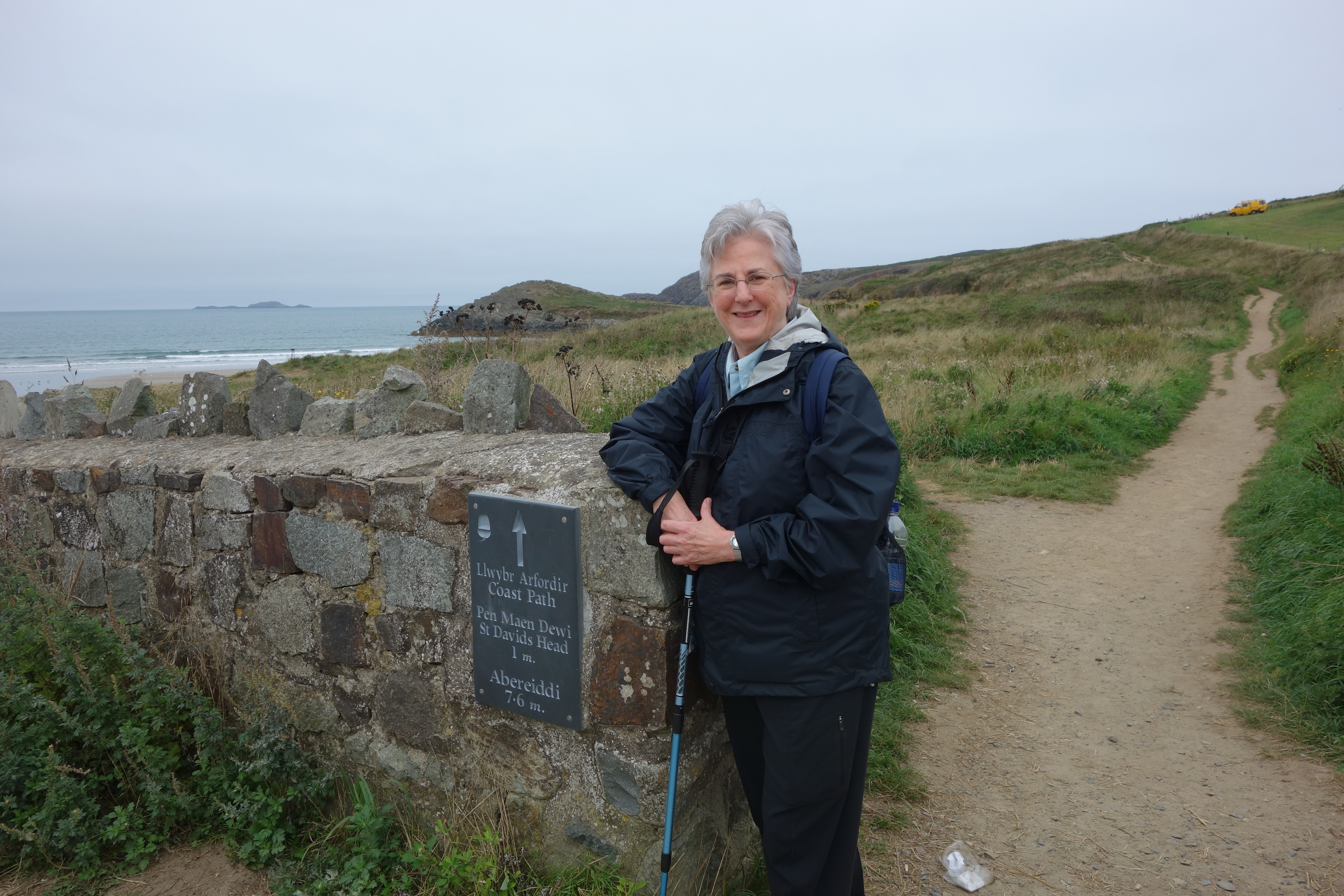
Today was meant to be the day to climb Mt. Snowdon, but we couldn’t quite make it happen.  Now that we don’t have to be down to breakfast at a certain time, we make a leisurely morning of coffee, cereal, morning television news and making sure the devices are charged and working.  So it was not until about 9:30 that we left the house, headed off the island to the little town of Betws-y-Coed at the edge of Snowdonia.
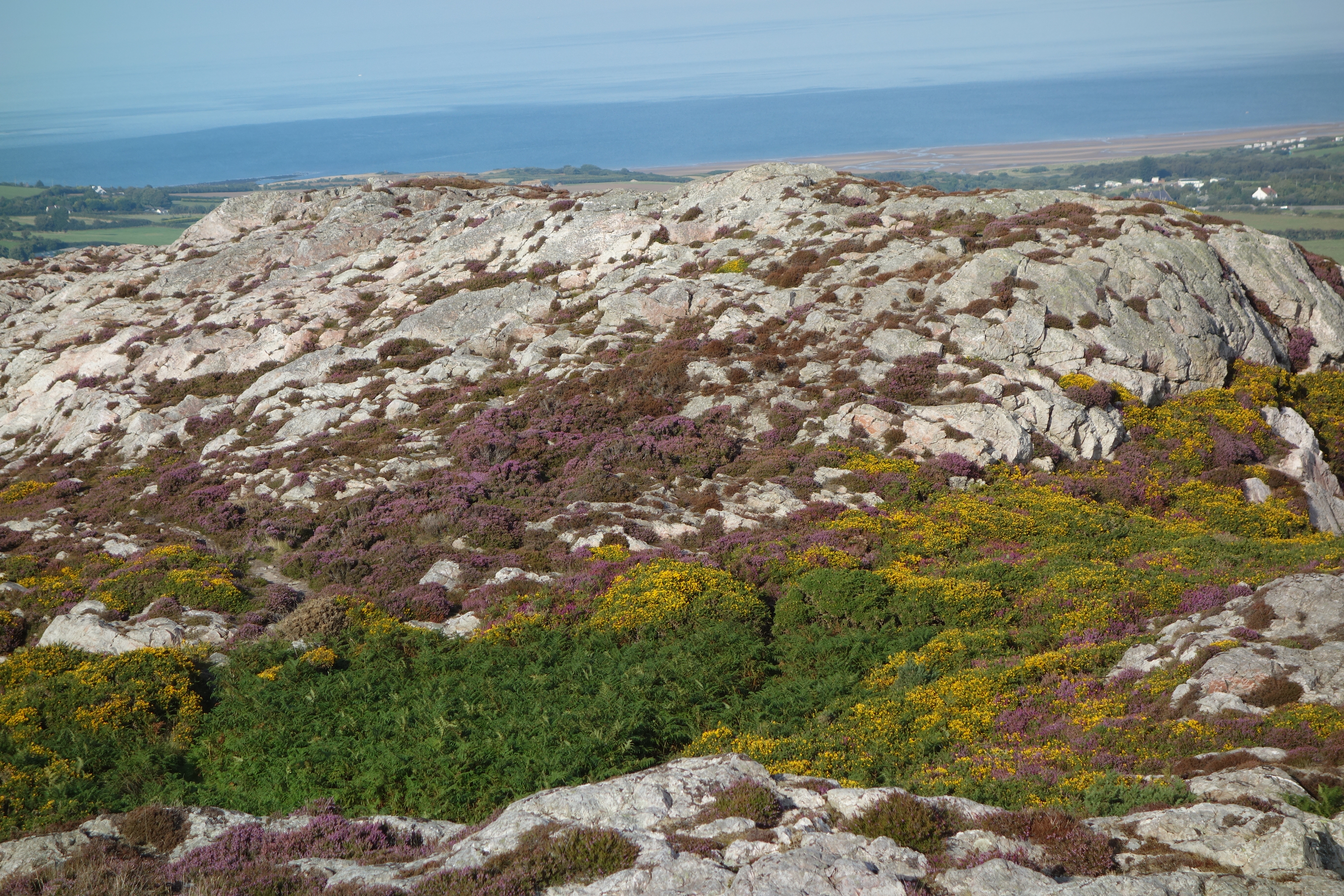
The landscape changed dramatically in just the 45-minute trip.  We left sheep fields and pastures on Anglesey, crossed the bridge, and gradually found ourselves in hill country reminiscent of the stark mountains of Scotland or the Lake District.  The road wound about and wound about, past isolated youth hostels, an occasional house (who lives there? what do they do?), a place called the Ugly Tea Room, the Swallow Falls Hotel, quite imposing, and then we were there.
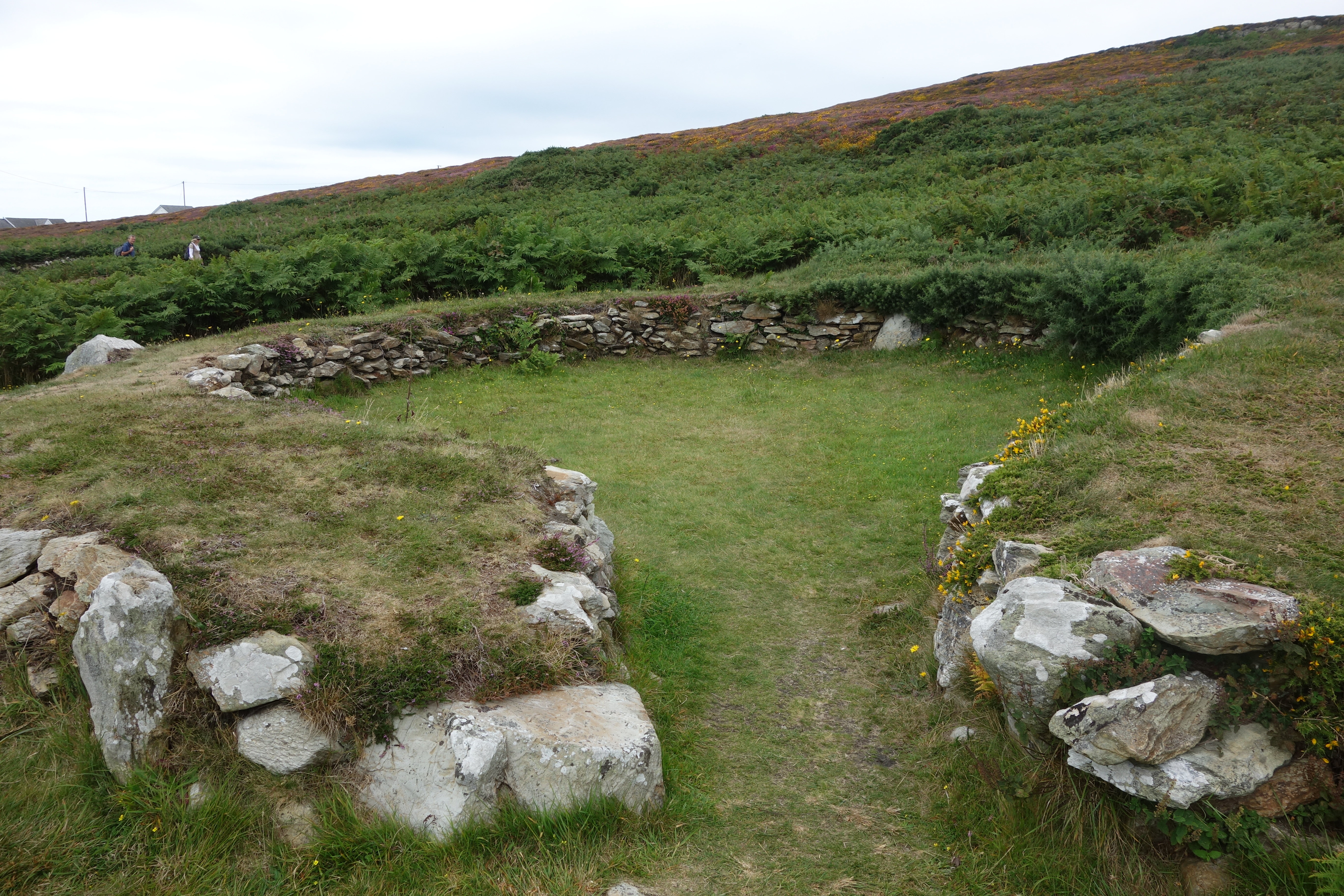
Betws -y-Coed was an art colony back in Victorian times.  Now the town is filled with shops, from crafts to tea shops to stores selling hiking gear.  At a very useful information center we sought help for our walking plans.  We had realized that walking up Mt. Snowdon would not happen today – not enough time, and one of us really didn’t want to – but what could we do instead?  The man told us there was a pleasant walk along the river to Swallow Falls and back, a four mile round trip, so we agreed and set off.
Somehow this walk was reminiscent of the doomed Red Wharf walk. First, the terrain was difficult – lots of roots and stones – and second, the walk was not as interesting as one might wish.  Yes, we saw a heron first thing, heron
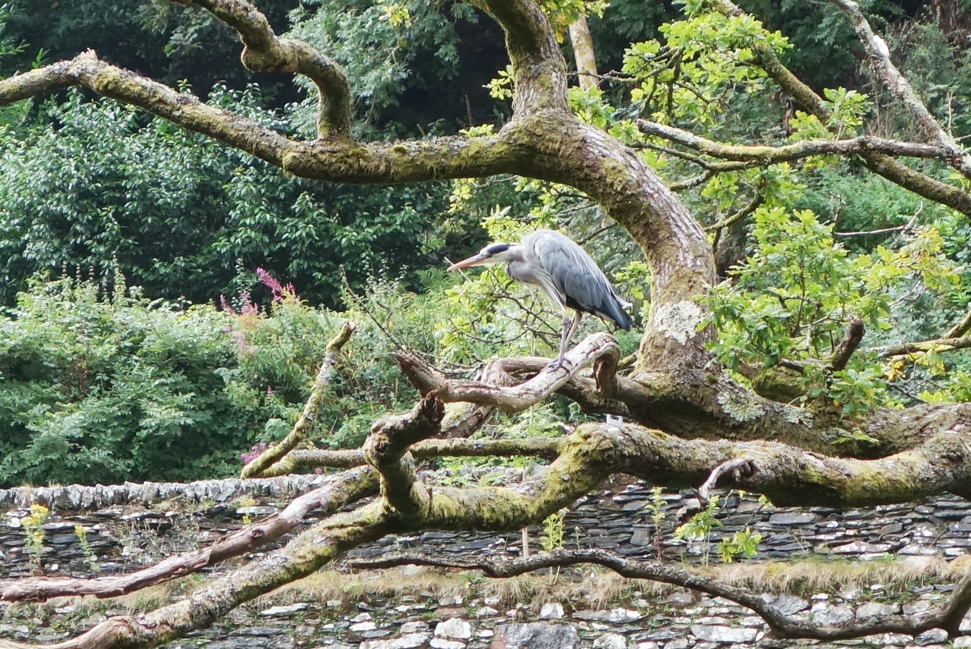
and that was exciting, but after that it became a bit of a slog.

DSC01565 When we came to the Miners Bridge and its steep steps down and then up again, DSC01568
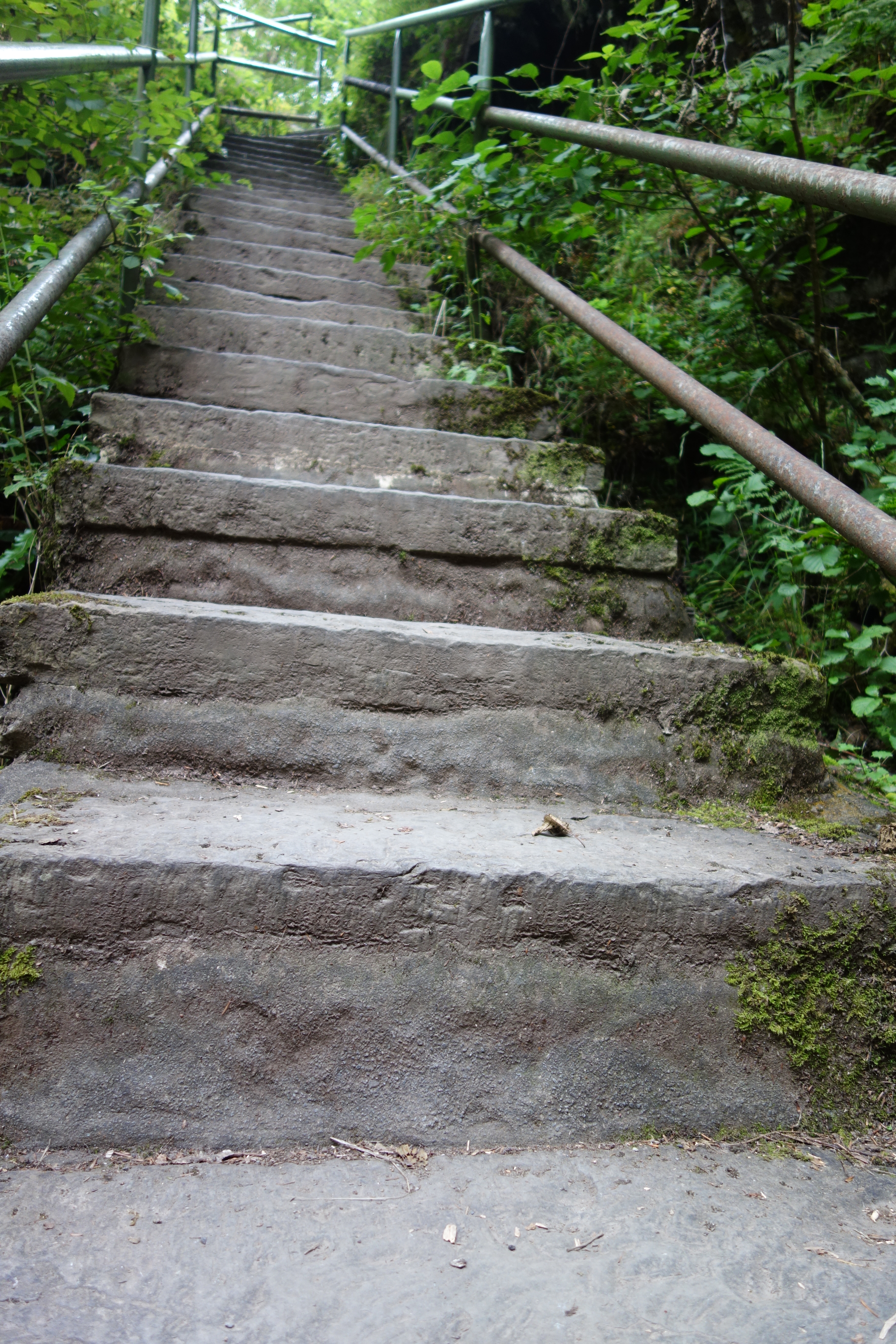
hearts failed just a bit but we persevered.  Once back up the steps, the path just continued, not getting any more interesting but again quite rooty and stony.  DSC01566At last we decided that there was no shame is simply turning around before we reached the falls, so that’s what we did.
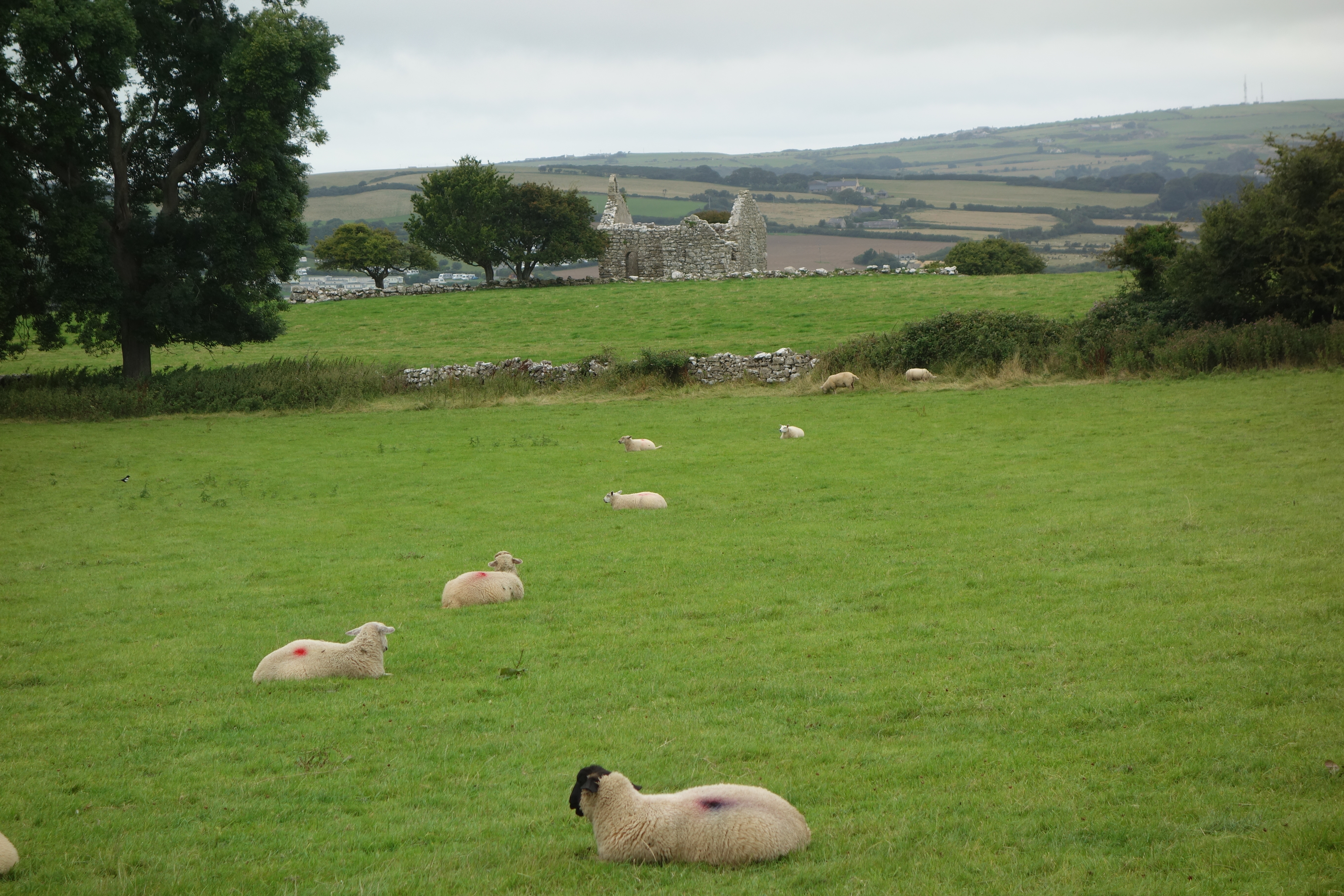
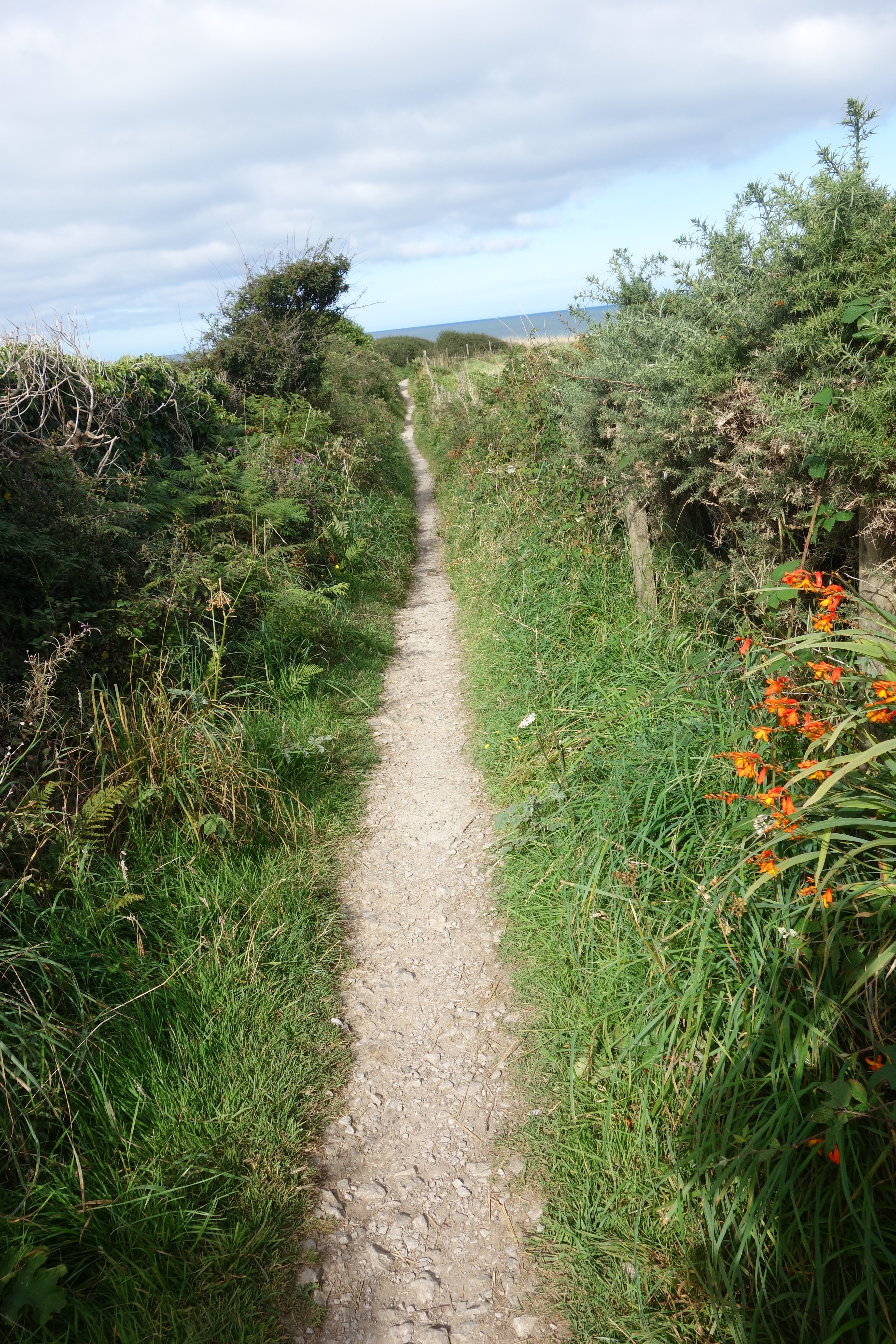
We took the man’s advice and followed a different path back.  This one wended through the woods and finally met up with a hedged lane with this view over the fields.  DSC01569
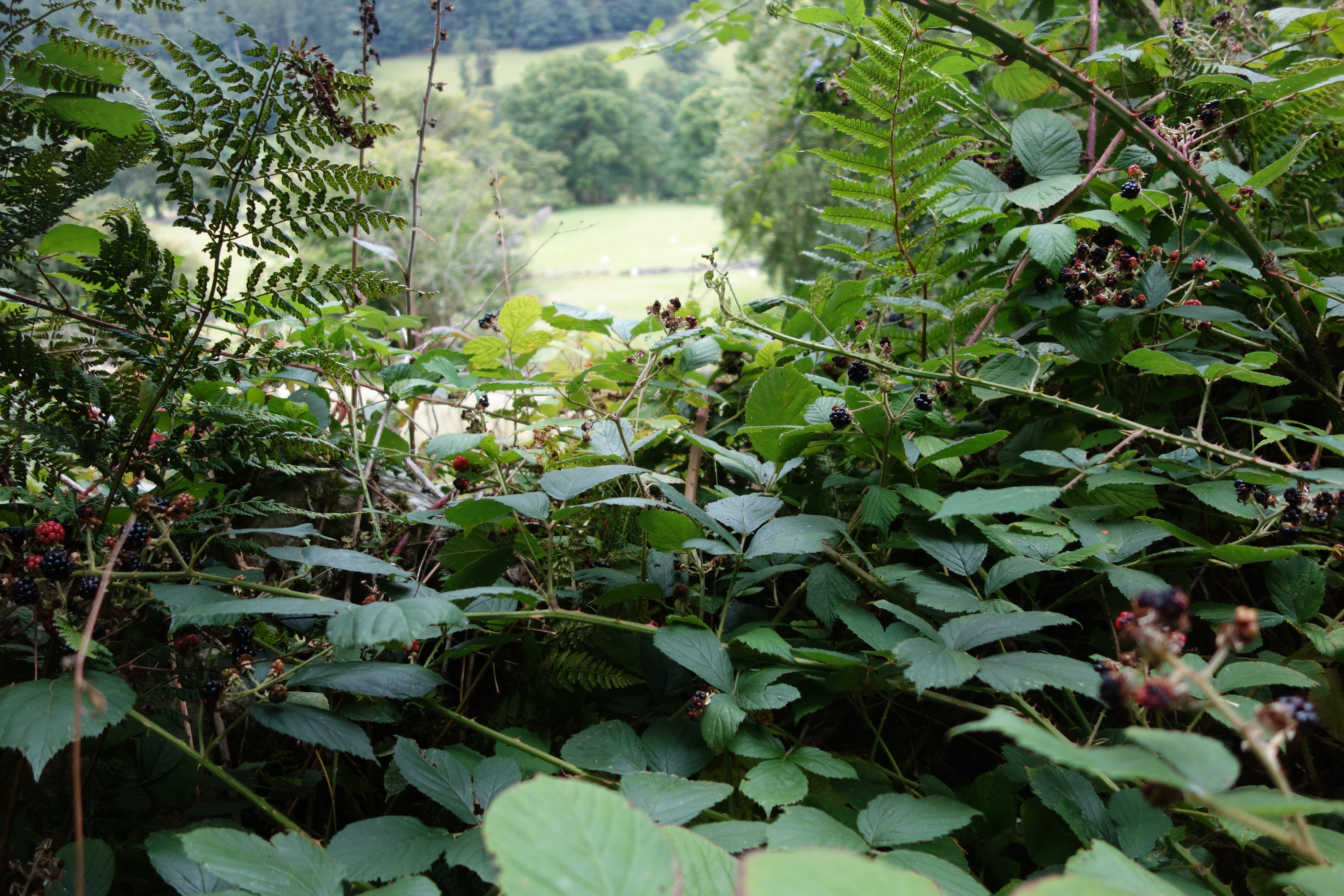
Because I can’t seem to read a map, I was puzzled again but later realized that this was just as the man had outlined.  We found ourselves back in the town DSC01571and had lunch at a pub/bistro.  Welsh rarebit and Orme for me, yum.DSC01572i
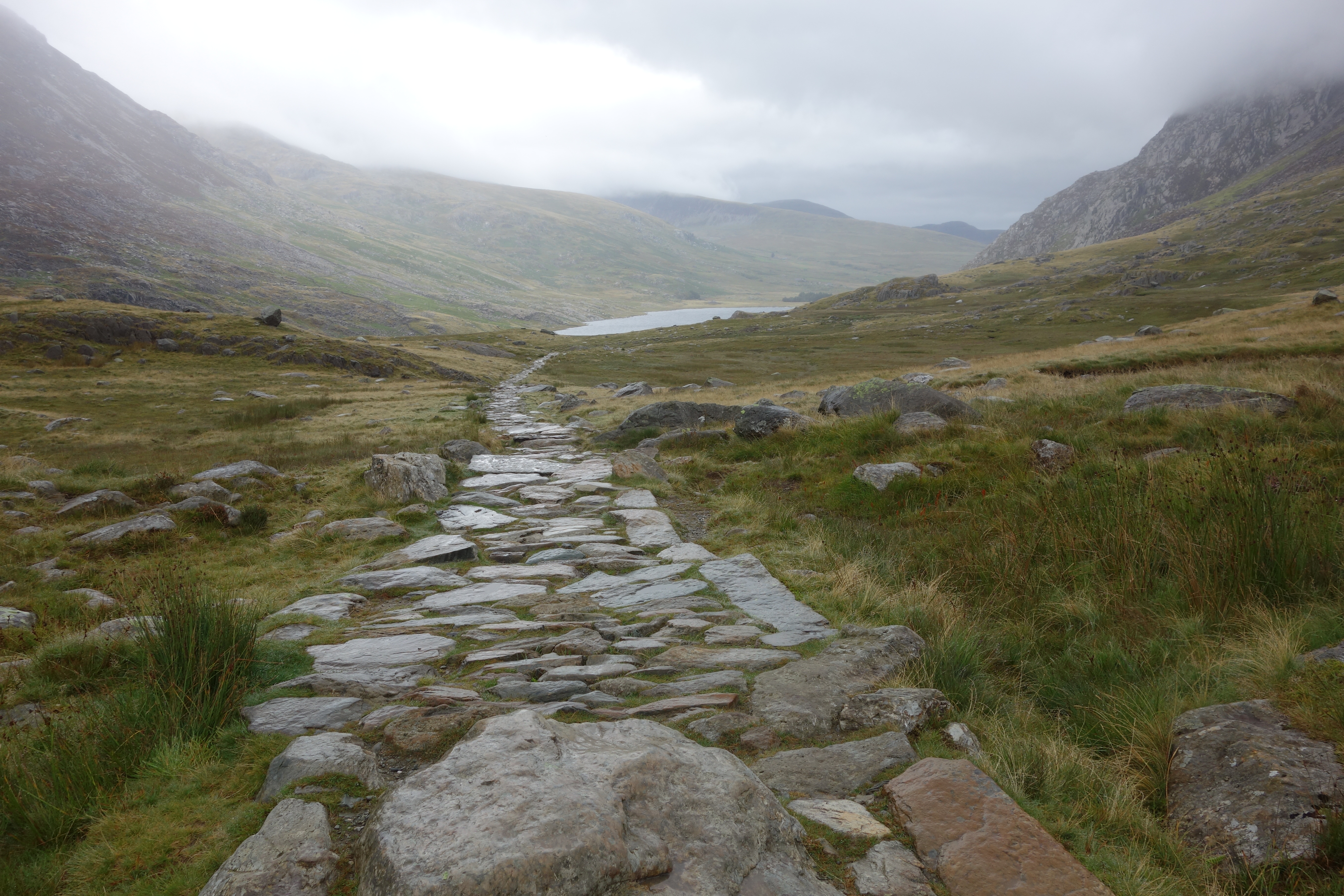
Now, what to do this afternoon?  I  was longing to do some hill walking.  The same man recommended Cwm Idwil, a walk around a lake about 15 minutes away from the town.  It wasn’t really up on the hills but among them and would give the feeling.  I asked him if it was level or not, and he said, oh, yes.  Alison heard him say it, too.  (Not that I mind hills, I just wanted to know the terrain.) There was even a short cut if I wanted to use it, so off I set with his printout of the hike, planning to be back by 4:15 and meet Alison by the information center.  If I was not back by 5:00, she would call Prince William to arrive with his rescue helicopter.
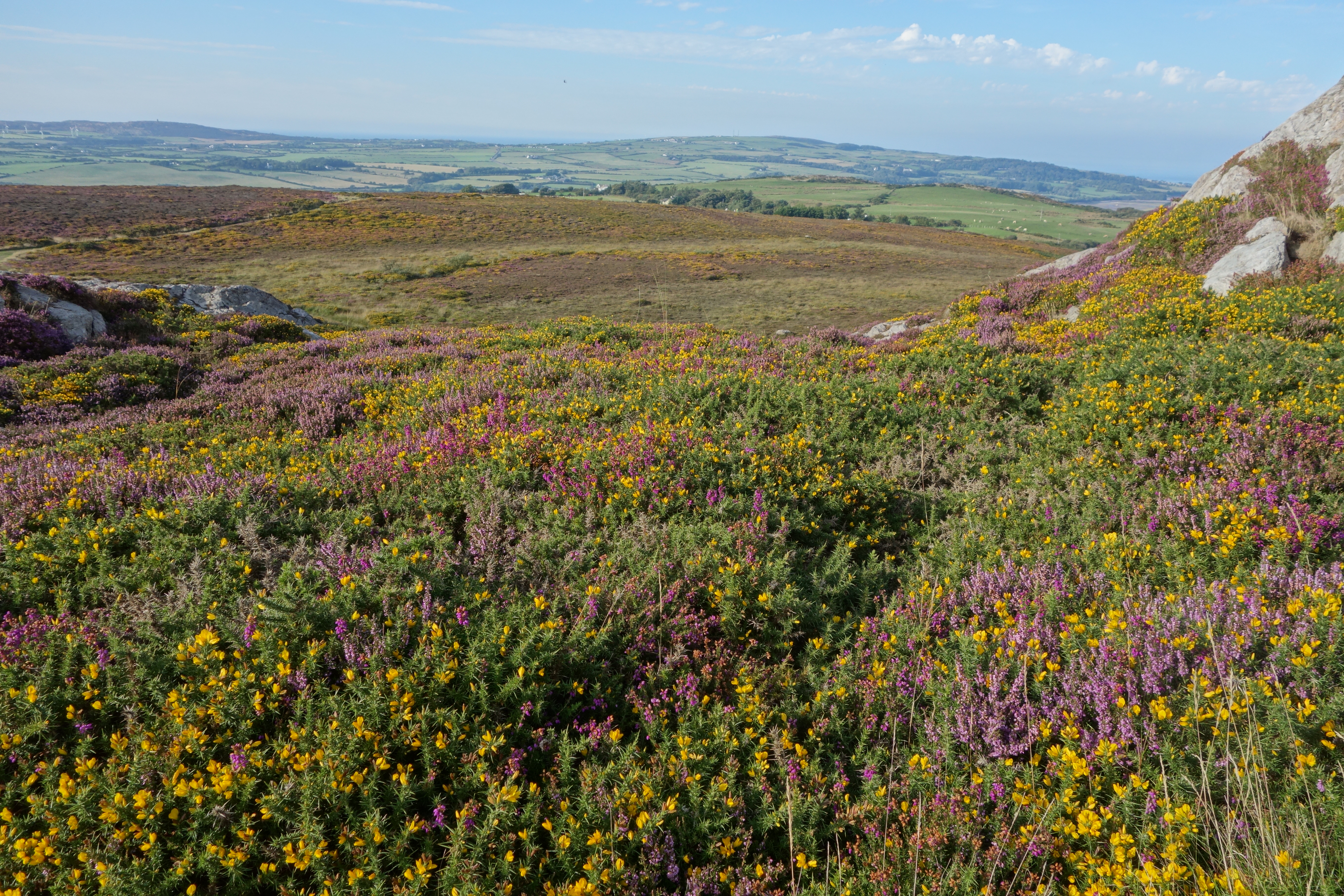
All was tickety-boo at the start.  I found the youth hostel without any trouble, parked and checked with a group of men at the cafe about the starting point.  I set off on a wide path, just as promised, that wound through  the bare hills up to the lake.  DSC01573The hills were  stark and arresting, and the dark, silent lake could have come out of Arthurian legend.  DSC01575
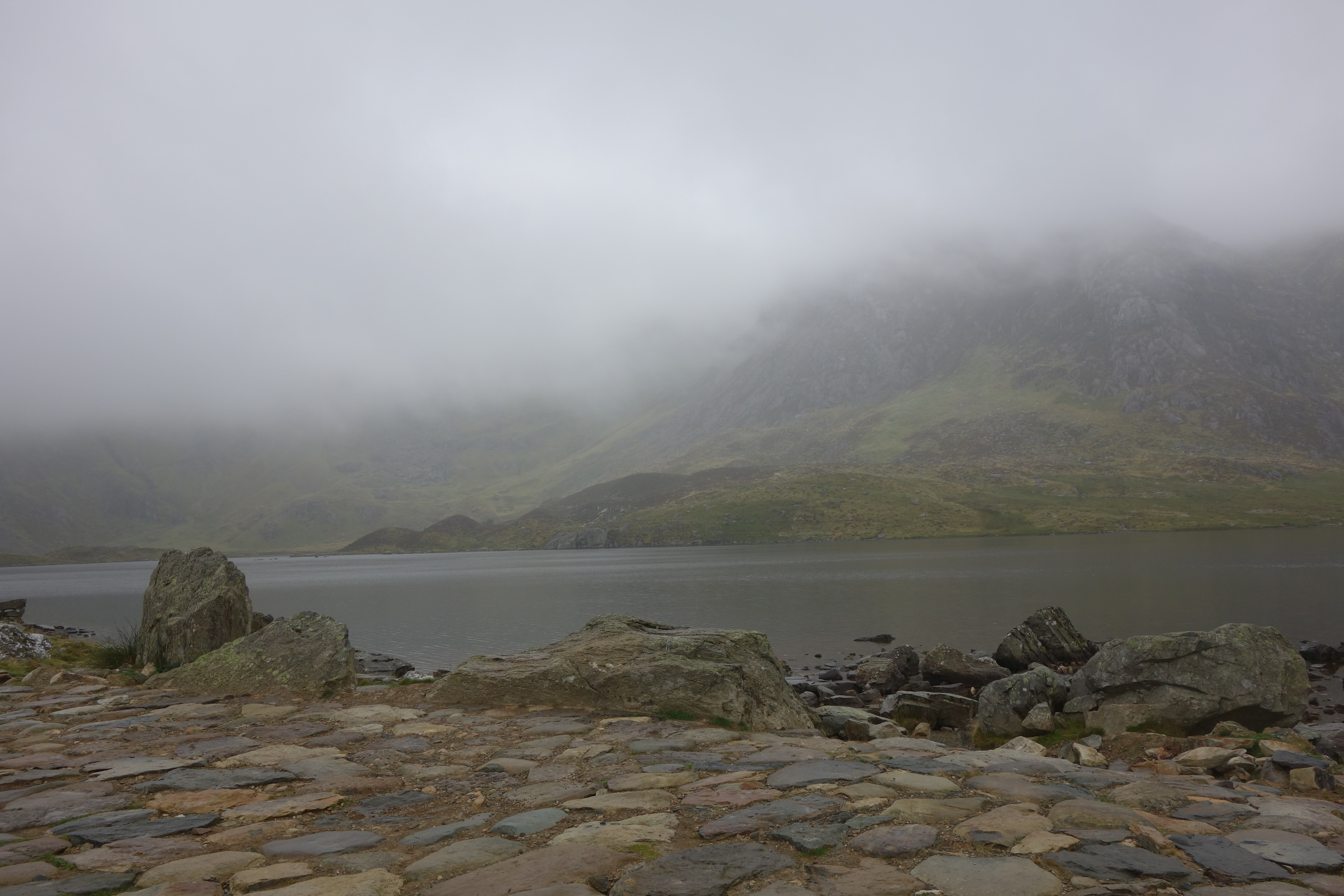
The directions indicated stone steps going uphill around the far end of the lake.  I was game.  Partway up the steps was an area called the Idwal Slabs, which in Welsh means “Slopes of Cheese.”  It sounds more benign than they looked to me!  “They are primarily used as an introduction to climbing for beginners.” Among them was Edmund Hillary, training for Everest, so this is not child’s play.  And there in fact was group of climbers heading up the sheer rock walls, as you can see in this picture if you zoom in on the orange dots halfway up on the left.DSC01579
Just there was the cutoff – I could see a man with two poles walking across the end of the lake and avoiding the stone steps.  I wavered for just a minute, but I knew I could climb those steps, so up I went.  Only back at home have I found this description of the upper route, courtesy of the National Trust: “NB: An alternative high level route may be taken at this junction by following the path towards Idwal Slabs and up towards the base of the cliffs above. This route should only be attempted by competent hill-walkers as it involves very rough, steep ground and a difficult stream crossing.”DSC01580
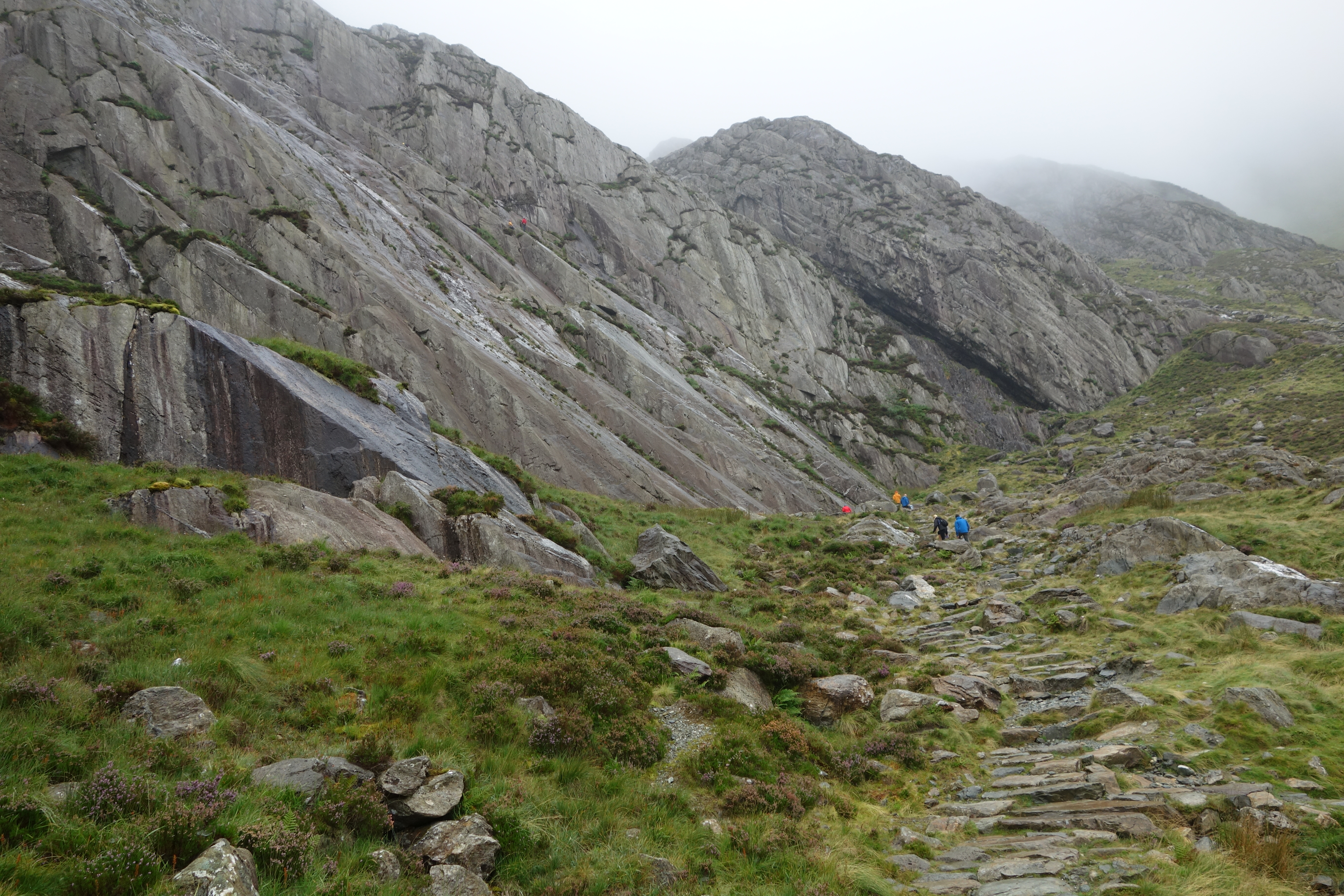
The stone steps went up and up, at some point starting to remind me of the horrible steps Frodo and Sam climb up in Lord of the Rings.  But I Crossfit, so I can do anything, right?DSC01583
Upward and upward, and every time I thought I was at the top there were more steps.  DSC01585
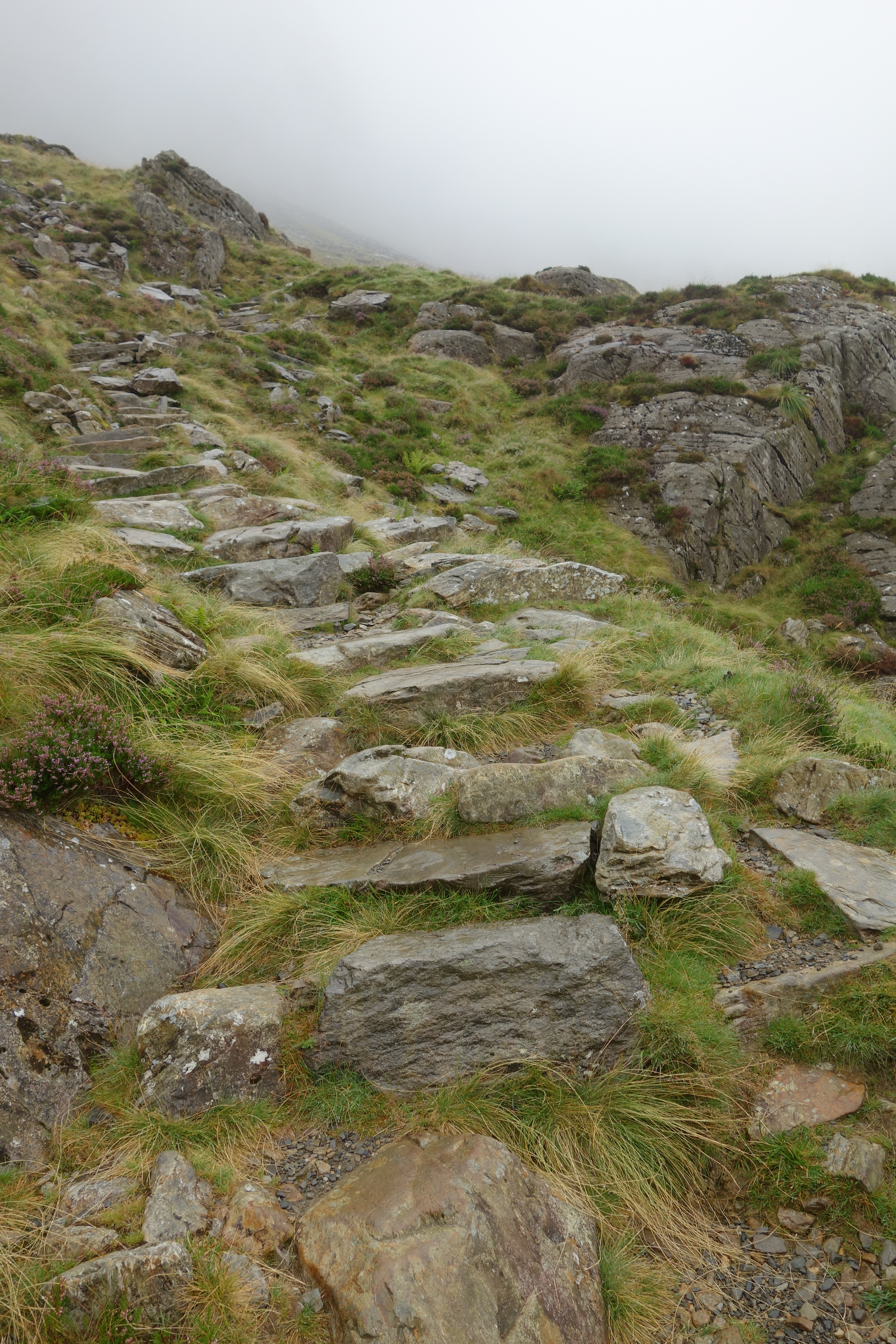
There was more mist, too.  The good news: I could no longer see the steep hillside falling away below me.  The bad news: I couldn’t really see where I was.DSC01588
Then I came to a waterfall.  I had not read the directions before setting out, but now I was riveted.   Be careful if it’s icy, it cautioned me.  But what about if it was just wet? And what about if there was no path?  I was just to slither down and find firm footing on the other side???
I briefly considered turning back, but no.  This picture gives you a view from the first side of the waterfall, looking down. Now admittedly, this is a tiny waterfall, but the point is that there was no path of any kind across it.  I just had to – gulp- figure it out, the way the shepherds must have long ago.DSC01586
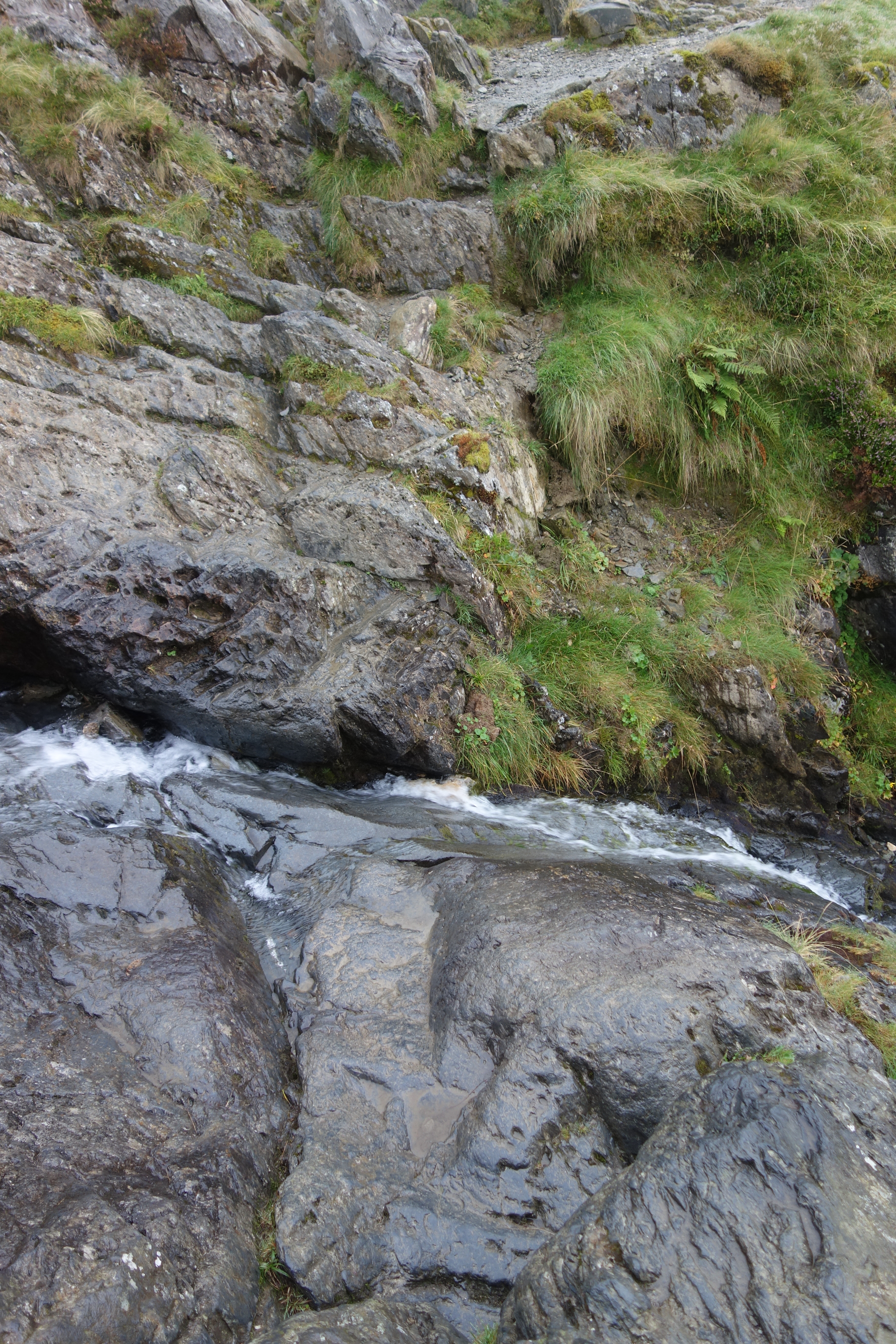
Surely if I just break it down into steps I can figure this out.  And I could. I sat down on the rock and scooted down to where I could see a foothold on the other side.  I put my foot there, raised myself up and just kept going until I could see the semblance of more stone steps again on the other side. DSC01587 
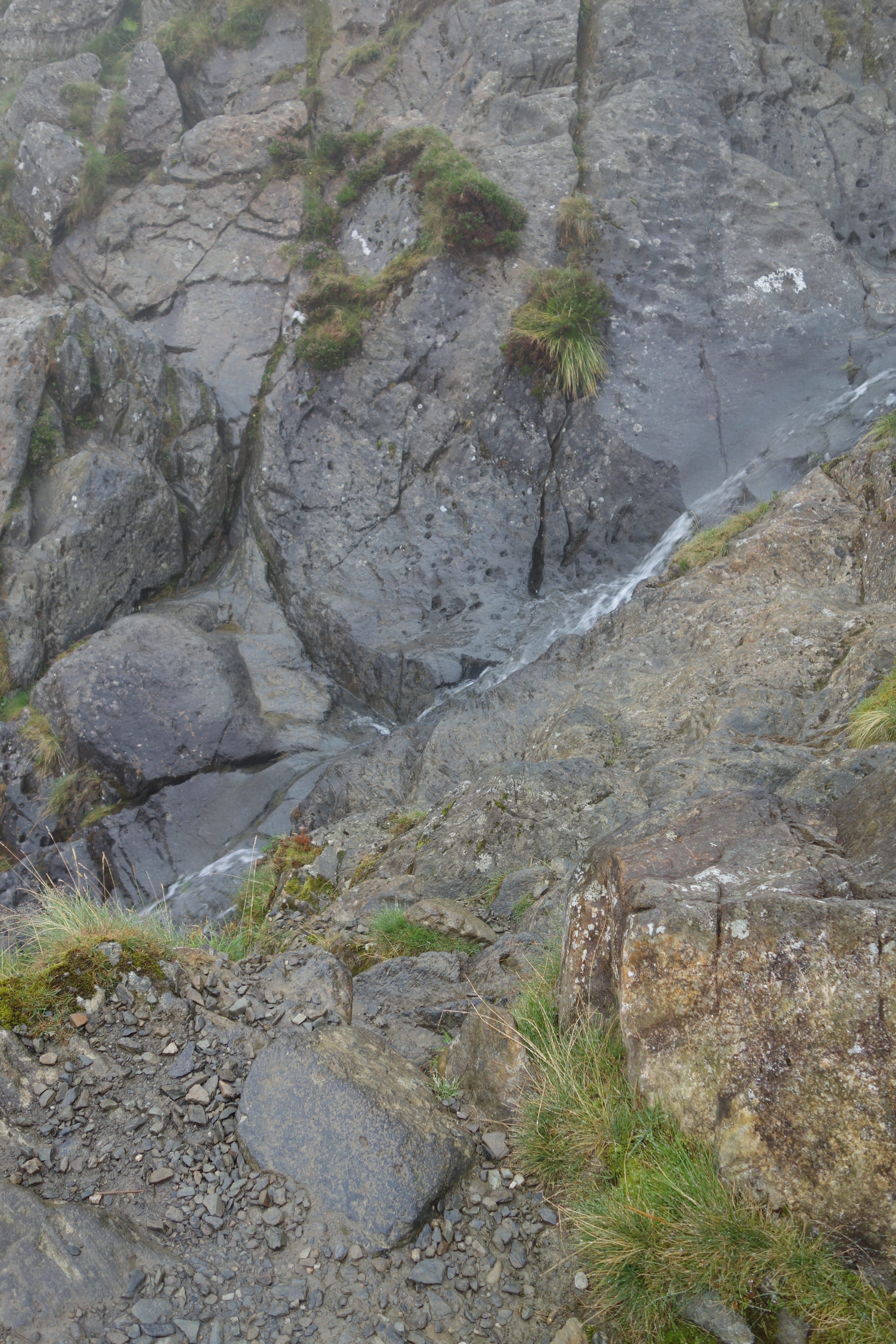
I had made it over the “difficult stream crossing,” with only wet pants to show for it, and I was sure that the worst was behind me.
But, no.  The directions continued, “Once you climb the steep stone steps you will be in the midst of the large boulders by Twil Du, peeled off the cliff by the retreating glacier.”  And did I mention that this mountain, Twil Du, means Devil’s Kitchen?  The problem was the mist.  It made the stones wet and slippery, and the grass was wet and slippery, too.  The mist meant that I could not see very far in front of me and had no idea how extensive the boulder field was, or where the stone steps would start again.  On a dry day, it would likely have been fine, but today it was treacherous and just a bit scary.DSC01592Notice the mist, the slope, and the lack of a trail…
Can’t go over it, can’t go under it, guess I’ll just have to go through it.  So I did, inching my way along lest I twist an ankle, knowing that down was a good direction, and instinctively heading just a bit left when the truck-sized boulders, poised on the hillside, would permit it.  And there, at last, after what felt like half an hour of careful scrambling, were the stone steps again.  DSC01593They rose uphill on my left for some distance, so if I had been able to see where I was going the boulder field would probably have been just a blip on the walk.  Instead…
So I inched my way down the wet, slippery stone steps, and every time I came to a flat stretch I hustled right along.  I finally dared to look at my watch to see if Prince William had been called out yet.  From the start of the climb to the stone steps after the boulders had taken only an hour.  It had felt like two!
As I made my way downhill, the mist lightened just a bit.  First I could spot the lake off in the distance, then the path brought me closer to it, DSC01594then I was rounding the end of the lake.  I loved this slate bridge over the last bit of water.  DSC01596
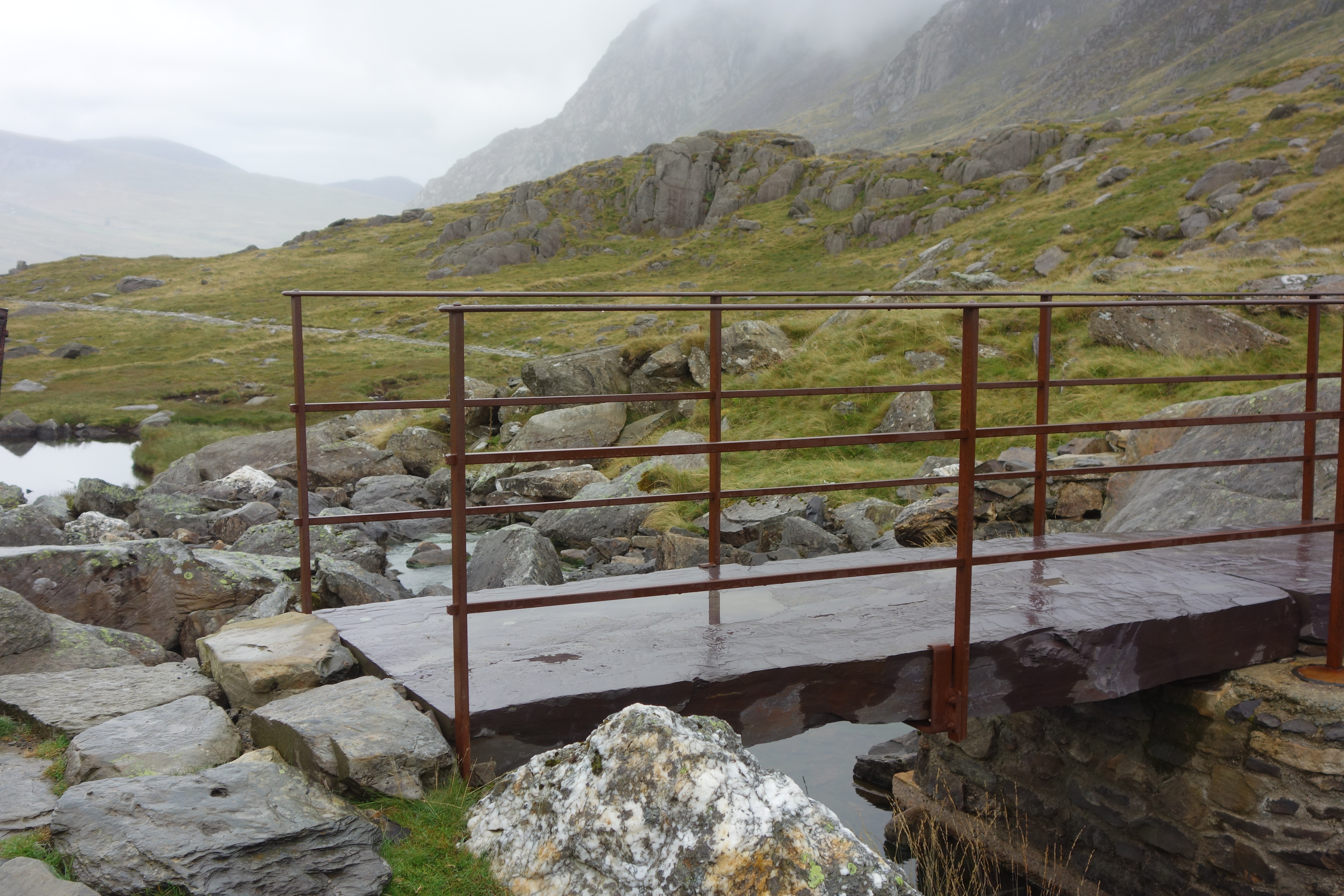
The final stretch was uneventful except for a trio of sheep that meandered over the path and scattered slowly at my approach.DSC01602 
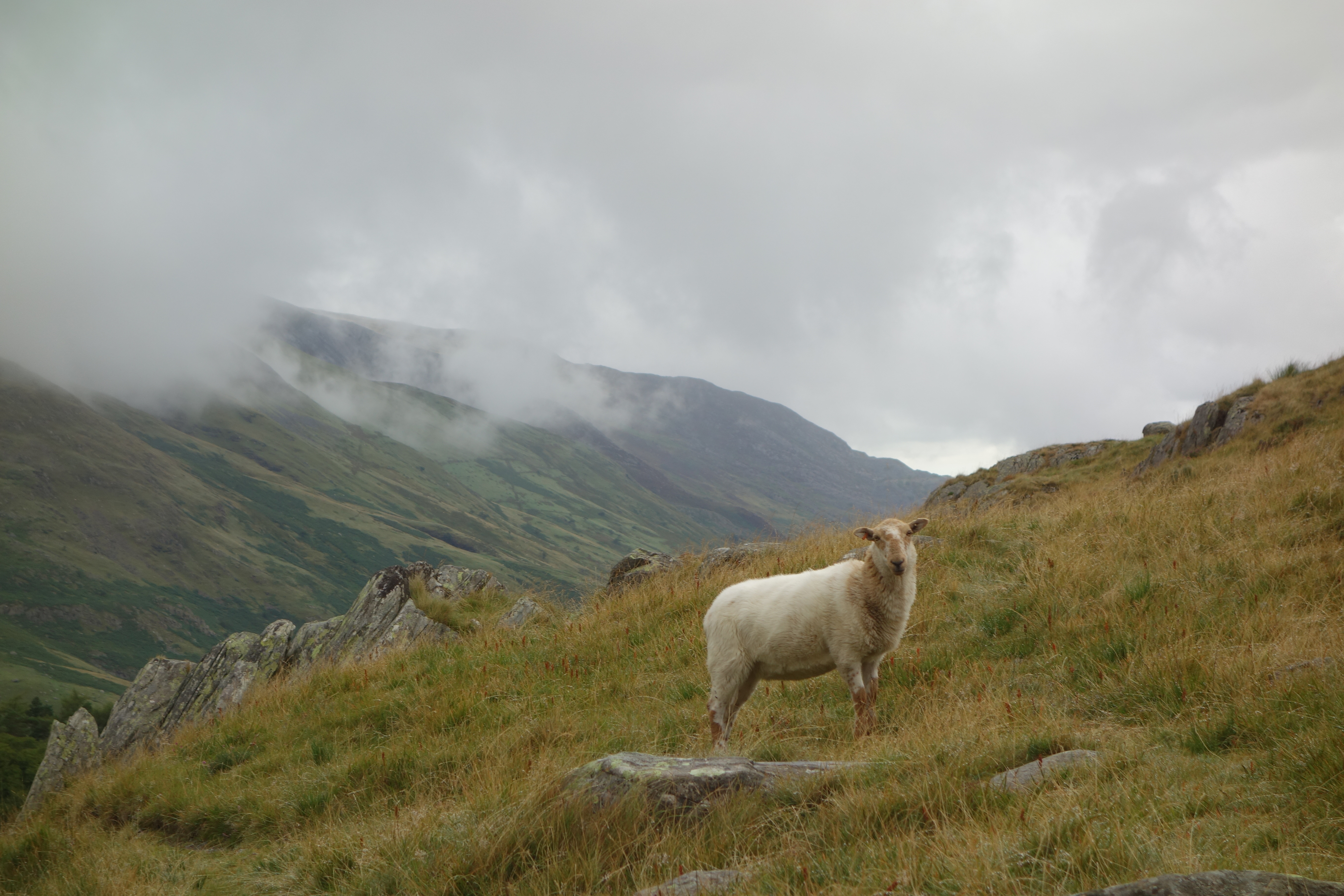
The way ahead brightened and the mist was gone.  Sadly, the cafe had closed so there was no restorative cup of tea for me.  I turned the car around and headed back to the Visitors Centre, where I picked up Alison just on the dot of 4:30 and we drove back home.
Lessons learned:  remember to bring a whistle just in case the worst happens, and learn what signals to give for help.  Read the directions before setting out (you moron).  Try not to hike alone, even on a path like this one where I encountered at least half a dozen people (until the waterfall and then not again until I was on the other side of the lake).
I was heartened to run into a photographer at Bodnant a few days later who was familiar with the path and referred to it as a “nightmare,” especially in bad weather.  So there.  But I was proud to have done it and don’t regret it in the least! Continue reading

Caernarfon Castle and a visit with real Welsh people

DSC01525Today’s plan was to visit Caernarfon Castle, one of Edward I’s ringed fortresses built in the 13th century to control the Welsh.  This meant a trip off the island, back over the Britannia Bridge to the town of Caernarfon.  The castle is right by the river, and the castle walls are still standing, making an imposing statement smack up against the town.DSC01524

While on crusade, Edward had been impressed by the castles in Constantinople, and Carenarfon reflects that style.  The walls are inset with bands of different colored stone, and the turrets are octagonal rather than round.  A good movie and a series of informative boards explained this and the larger history of the area.

The Welsh princes had been ruling their country for generations until the clash with Edward.  The Welsh prince of the time obviously underestimated Edward, refusing to pay homage to him when he was crowned king.  Edward retaliated by burning the grain fields on Anglesey, thus cutting off the Welsh food supply, and in the end the English prevailed and the Welsh were conquered.  Edward promised that one day he would give the Welsh a prince who spoke not a word of English, and this came true when his son was born, speaking not a word of English or, indeed, of any other language, and was made Prince of Wales.  Though the Welsh took the castle later on for a few months, they never ruled their own country again.

DSC01528After walking on the walls and through the tunnel-like passageways, and viewing the slate stage where Prince Charles was crowned Prince of Wales, we were ready to move on.  We had a quick lunch at a cafe on the town square DSC01531and then walked back down to the river for a cruise along the Menai Strait.DSC01533

The Strait was wider here than I had expected, and the wind blew hard.  The captain pointed out the fields of Anglesey, the peaks including Snowdon across the way, DSC01535and a fort  built during the Napoleonic era.  Oystercatchers and gulls could be seen waiting for the tide to ebb (in fact, he told us quite a bit about the tide since of course it matters a lot to a boat captain).   Mild and pleasant, with good views of the castle from the water.DSC01539

We headed back to Anglesey for our meeting with Dewi Jones and his wife Magdalen.  Alison’s brother Proal had become fascinated with the history of Welsh poet Geronwy Owen, who had died in 1769 in Brunswick County, Virginia, where the Heartwells grew up.  As part of the research for the book he wrote about Owen’s life in Virginia, Proal befriended a retired schoolteacher, poet and Owen enthusiast in Benllch and visited him when Proal and his wife came to Wales on the Owen trail.  Alison had called Dewi and Magdalen and arranged to meet them this afternoon in Benllch.

We successfully called them from a phone booth and they drove up to meet us and escort us to their house, high on a hill above the sea.  They are both getting on in years and no longer do much driving, so they could not give us the tour of the area that they had given Proal and Susie.  But we spent a brief, happy visit with them.  Dewi is clearly a scholar.  He explained the origin and meaning of Welsh words and place names in a way that reminded me of Uncle Buzz.  They were gentle and courteous and we felt lucky to spend time with them.

Then in bustled a younger man in paint-stained overalls who offered to take us on a ride to a nearby “mountain” where we could see unparalleled views of the island.  We figured out that he was their son and gladly took him up on his offer.

First we followed him to his house nearby, where we saw gorgeous views of the Strait from his living room.  He hustled us into his little car and off we set.  I was glad that I had agreed to go with him rather than follow him in our car.  He drove fast and talked even faster!  He made his way through twisting lanes, regaling us with stories of how he and some friends had found a gigantic quartz stone that was probably used in ancient times in some kind of ritual and how they had hid it in the trees where no one else could find it, and how this little mountain was on a road that was not signposted so only the locals really knew about it.

Then we arrived, and it was breathtaking.  He started off up the trail, and Alison soon decided to stay put while I went on right behind him.  Rhys (for Alison had finally asked him his name) was right, it was glorious!  Bright late afternoon sunshine illuminated the whole island.  From here we could see Holyhead and the copper mines of Amlch to the north and west, Mt. Snowdon across the Strait, Moelfre to the east, and all around.  It took only about ten minutes to climb but somehow it was situated in such a way to provide these glorious views.  DSC01552 DSC01549 DSC01544We stood there for some time, taking in the light and the landscape, and then Rhys suggested taking my picture at the top.  Done!DSC01553

We returned to earth and he drove us back to his house so that he could show us some musical links.  One is to the Welsh Men’s Choir he belongs to, and he showed us a couple YouTube videos of their performance, quite beautiful.  His daughter, about to start university, acts in a Welsh soap opera that has given her enough money to buy a car and pay for two years of school, and he showed us a video of her performance singing in an eisteddfod.  Altogether, a talented family of musicians and storytellers.  What a treat to have met them.

Tonight we decided to go out to a restaurant in Moelfre that’s about as upscale as it gets here in the country.  Ty Ddrew is a converted farmhouse just up the road from our cottage and down a long driveway.  Inside was very nicely appointed, with a beamed ceiling and just a few tables taken.  We started with rabbit terrine, which was just okay, and then both chose the lamb shanks, which were delicious.  We ended with a platter of Welsh cheeses, quite an excellent way to finish the meal.  When we came outside, we caught the tail end of a dramatic sunset that seemed to embody all the Welsh mysteries Rhys had told us about.DSC01557

Ancient monuments

Our plan was to drive around the island to Holyhead and see the South Stack Lighthouse.  But wait – first, we drove by some ancient monuments and one of us had to stop.  There were three things to see.  First was a ruined chapel, Hen Capel Lligwy, a so-called “chapel of ease” that was connected to a larger church.  It was very poignant sitting in the middle of the sheep fields.  DSC01461Next, up the road was the Lligwy burial chamber, a Neolithic structure that would have been covered in earth when it was made 5,000 years ago.  DSC01459We almost missed the last one, but as we returned to the car a chatty man told us we should also visit the hut remains, where he and his family had found some ancient artifacts, including a brooch that they had sent off to Aberystwth but had never gotten back.

The setting here was appropriately mysterious.  We walked through a silent woods, slightly uphill, and then the woods opened up into a clearing with a complex of buildings – foundations only – that made up the farm and workshop of a first and second century community.  DSC01464You really could start to imagine them living here, perhaps walking down through the woods to the sea to catch fish.  Well worth the walk through the fields.DSC01463
We got back on the road and made our way counter-clockwise around the island through Amwlch and along the coast to Holyhead.  Our plan was to visit the  Maritime Museum and have lunch there, but we were foiled when we opened the door only to be told cheerfully that a, the museum was closed for filming and b, they were never open on Mondays anyway.  On their advice, we drove along the Promenade and had a restorative lunch of mushroom soup and prawn cocktail at a restaurant up the way.
Next up was the South Stack Lighthouse, which some of us viewed with apprehension.  At the visitors center it all became clear.  Walk up the road and then down 400 steps alongside the cliff to a bridge across to the island where the lighthouse is situated.  DSC01467The whole area is now a bird preserve, but the best time to see birds is in spring and summer, when the cliffs are white with seabirds.  Puffins?  Not so much, and definitely not now.
Only slightly daunted, I made my way down the steps which fortunately were bordered by chest-high walls, just enough to feel safe while allowing for amazing views.  It was quite reminiscent of Niest Point in Scotland.  The only really scary bits were a set of very steep aluminum steps towards the end, and the bridge over the water that was no longer a suspension bridge, thank goodness, but still offered too clear a view of where you were walking.  DSC01474I turned down the invitation to walk even higher up into the lighthouse and took a brief tour of the museum.  The best feature was this room full of equipment, none of which I could really understand.  This one’s for you, Pat!DSC01470DSC01471
Guess what!  There were more historic monuments nearby!  We climbed over a stile and came to more hut circles.  DSC01479These lucky Neolithic people had gorgeous views of the sea, though I bet the wind blows cold here in the winter.
From here we drove into the center of the island to visit Oriel Ynys Mon, a museum devoted to the art of Kyffin Williams, among other things. The current exhibit was right up our alley, being devoted to the artist’s views of Venice.  The introductory film gave a very good picture of Williams, who was Welsh and loved the countryside here despite spending thirty years teaching art in London.  He came back to live in an old house on the coast but also paid visits to Venice and, interestingly, to the Welsh settlements in Patagonia, something I’d like to know more about (though I have a faint memory of reading about this in someone’s book about Chile).  The exhibit was all about light and water and very good.


We picked out some trinkets – slate necklaces and books about Williams – and made our way back to Moelfre.  Dinner tonight was at the Kimmel Arms, the local pub with wonderful views of the harbor, and the curries we had were unexceptional but just fine.

Success on the coastal path

After our disastrous morning, I decided to try yet again for the coastal path. My original plan was to take the bus to Pentraeth and walk back to Moelfre, but  I was scarred by the morning and decided to keep it simple, just walking out the door and taking the path out of Moelfre and back again.
It turned out to be a sparkling afternoon, in contrast to the cloudy, humid morning.  I set off on the path right from the middle of town, first paved and then graveled, and clearly marked.  Moelfre Island loomed just offshore, DSC01500home to cormorants, who all seemed to live on the left hand side, and gulls, tucking their heads under their wings on the right hand side.  As the path went along, the cliffs revealed wonderful geological formations. DSC01502DSC01515Wild flowers of all kinds were everywhere (time to consult the booklet on coastal wildflowers for identification).
Then, after a walk along the edge of a field and through a narrow way bordered by high hedges,DSC01514 the most amazing beach was revealed.  DSC01506Traeth Lligwy at low tide is a huge expanse of sand, dotted this afternoon with maybe half a dozen people.  I made my way down some steep stone steps to the strand.  Rippled sand, pools of water reflecting blue sky and the sun on the wet beach were hypnotic.  What a treat to find this!

DSC01509
Reluctantly, I reversed direction and enjoyed the walk back just as much.  I took a short detour, climbing over a stile and up a path to the monument to the victims of the Royal Charter.  DSC01516This was a famous shipwreck, written about by Charles Dickens, who visited a few days after the rescue, and the site of a similar shipwreck 100 years later almost to the day.  A statue in Moelfre commemorates the coxswain who rescued so many people back in 1959.  Both events obviously loom large in the minds and hearts of the locals, for good reason.
Home in time for dinner, this time lamb steaks and this delicious salad, ;both made by Alison.  A very nice end to an up and down day!

In which we get lost but keep on going

DSC01489
This morning was meant to be a simple walk along the coastal path, a circular route that would take us on the coastal path at the start, then around an ancient fort and along some lanes back to the beginning.  It was marked to start at the Llandollan Beach carpark, so we parked at Red Wharf Bay by the Ship Inn, where we would have lunch.
Oddly, the directions to the path didn’t make any sense, but a nice woman walking her dog walked with us to find the start of the coastal path, and we were off.  She noted that the path right along the coast was likely to be “splodgy,” so we took the alternative route just above the coast.  We saw this wonderful fence made of branches, DSC01488while on the other side we saw, of course, sheep.  The path soon went back down to the coast and we followed it along.  DSC01491And then followed it some more.  And more.  It was flat, slightly splodgy, and it just kept on going.  Plus, the directions for the walk didn’t seem to work – where was the little wooden bridge?  And weren’t we supposed to go uphill pretty soon towards the fort?  Of course, the coastal path is pretty easy, right?  Just keep the coast on your left (or your right if you’re walking counter-clockwise), and how can you go wrong?
It was at the carpark we came to next that I realized my first mistake:  the route we were taking was supposed to start here, not at the carpark 45 minutes back.  No wonder the directions to the path had made no sense!  Nevertheless, we kept going.
We came to an intersection on a paved road DSC01497and took the coastal path route to the right.  Now we were walking on a lane that snaked upwards towards some woods.  This seemed to make sense, since we were supposed to come to an ancient fort on top of a hill, so we kept going.  This path, always signed as the coastal path, wended through woods, past blackberry bushes with perfectly ripe berries, up along farm houses, through ferny woods, through a number of kissing gates, and…we were lost.  None of this matched either the walk OR the ordnance survey, which I thought was like the voice of God and always right.

After two hours, the estimated time of the entire circular walk, we emerged onto, wait for it, the coast.  DSC01498Where were we??  We walked by a house where  a man emerged and helpfully told us we were on Red Wharf Bay and pointed the way back to the Ship Inn, just along the coast.  So we set off again, with our destination in the distance.  An older couple walking their dog assured us that we were right for the Ship Inn and that we would be fine, after all we had our sticks (hiking poles).  And indeed, we were seeing signs for the coastal path as we walked, so we just kept going.  We came back to the intersection we had encountered earlier and saw with fresh eyes that it signed the coastal path IN BOTH DIRECTIONS.  DSC01497We took the upper path that went through the woods but clearly we were supposed to take the version that went along the coast instead.  See the little words on the left-hand signpost that say Coastal Path?
After a total of three hours, we were back at the carpark and settled in to the Ship Inn for a well-deserved lunch (ham sandwich and a half-pint of McKellans).  To this moment, I cannot figure out what happened.  The only clue is that our coastal path book states, “There is no true coastal path between here [Penmon Point] and Red Wharf Bay. . .Paths and lanes inland must be used instead.” But why there were signs for the coastal path all through the woods, while the OS map showed it along the coast, I will never know.

I hope this doesn’t sound peevish.  It’s mostly that I am still baffled.  The walk itself was fine, though not outstanding, but the anxiety about the path made it more stressful than it otherwise would have been.  However, any walk is better than no walk, and a good lunch at an old pub makes everything better.DSC01496

Beaumaris and the priory

Today we’re off to Beaumaris to see the castle and the town.  Edward I built his infamous ring of castles around Wales, and the castle here is the last one he built.  It’s not very imposing because it’s not very big, but if you walk all around it, you realize its defensive strength.  First is the moat, and back in the old days you could sail your ship right up to the castle gates to offload your supplies or your soldiers.  Beaumaris Castle moatNext comes a thick wall with arrow slits that allow you to aim and fire but are small enough that the enemy can’t fire back.  Finally comes the castle itself, with 16′ walls complete with more arrow slits and towers from which you could cover the archers’ fire.  The concentric design is simple but effective.DSC01435
The best part of this fairly mild visit was watching two fathers and a group of children touring the grounds.  In England, not only do children fight with play swords and shields, but they do it on the grounds of an actual 13th century castle!English children playing at soldiers
We walked along Castle Street to see what we could see and ended up at a nice waterside restaurant for a steak and ale pie and a bottle of local beer. DSC01443 We scoped out the two butchers and decided to come back later for MEAT.
Off now to Penmon Priory, a few miles up the coast. DSC01453 This is said to have been founded in 547 AD, destroyed by the Vikings (of course) and rebuilt in the twelfth century.  What’s there now is a church and remains of the priory where the monks (Augustinians, eventually) slept and ate.  The church is dim and medieval, not very big, and interesting for its ancient artifacts, two thousand year old stone crosses and a fertility figure of a woman with spread legs, hanging on the wall.  Almost as good was an array of various jars containing the vicar’s chutney, which he was selling in return for a donation to the church fund.  (We had some last night with our lamb steaks and it was delicious!).
The graveyard consisted of contemporary slate tombstones and an older section that was romantically neglected.  DSC01447There was also an old stone dovecote that once supported a thousand doves, raised for food.
From here we walked about a mile down the lane towards Trwyn Du lighthouse and Puffin Island, DSC01449where there were a scattering of people on the stony beach, plus a few scuba divers setting out.  We stoped for tea in the cafe – scones with cream and jam – and sat outside next to a table full of Weasleys, I swear.  Very pleasant.
We went back into Beaumaris to pick up some dinner, and Alison came out of the butcher shop with local beef and lamb steaks. Yum!  By now it was late afternoon, so we headed home for a leisurely steak dinner at the cottage.  Very nice to cook something simple for ourselves at our own schedule – although we do have to do the dishes…

St. David and the plastic puffins

DSC01329

In keeping with our plans for this trip, we had nowhere to be today until our 1:00 boat ride.  After a full Welsh breakfast (remarkably like an English one, sans baked beans), we set out to see St. David’s cathedral, the only cathedral in Wales.

The problem was the Vikings, who had a habit of crossing the sea to pillage and plunder, so the builders sited the cathedral in a hollow where only the top of the tower appears from the town, in hopes that no one would notice it.  Their plan was not entirely successful (the cathedral was sacked seven times, most recently in 1078), but it does make for a breathtaking reveal.  You walk through the gatehouse, having seen only the tower, and there at your feet is an imposing building, hiding in plain sight.  This was all we could see from the road the evening  before.DSC01321

Inside, the highlights are a beautiful wooden ceiling, the playful carvings on the misericords, and a casket holding the bones of St. David himself!  We had a very pleasant walk around and then wandered over to the remains of the Bishop’s Palace next door.  Only walls and what’s left of an extensive parapet are still there, so we made short work of it.  Exit through the gift shop (slate coasters) and back into town in search of an early lunch.

We found sandwiches at a little cafe and packed them along as we set out for St. Justinians, where the boat leaves from the lifeguard station.  Though it’s only two miles away, the boat people recommended leaving half an hour for the trip, I guess because the narrow roads could be filled with traffic from fellow tourists.  We made it in good time and without nicking any other cars we passed, and ate our sandwiches on the site.

The boats for the Voyages of Discovery leave from the St. Justinian’s lifeboat station which we should have visited.  The station is high up in the air, in preparation for high seas, I guess, allowing the lifeboats to be lowered as needed.  Our launch, on a big inflatable boat, was in the water far below the station.DSC01366

We borrowed heavy waterproof jackets that kept us warm but also made us look like Michelin men. Luckily, we will never see these people again, so who cares!  Toby was our guide, obviously well educated, especially in geology, and interested in wildlife.  His commentary was somewhat canned, but entertaining.

We went into caves, of which there are many along the coast of Ramsey, DSC01360 DSC01350and then saw some seal pups onshore, plus the ‘Bachelor seals’ consisting of adult seals and young male seals, who sun themselves on a beach while the pups are born and raised.  The bull seals had the most amazing whiskers.DSC01355

Toby also pointed out the lichens, some of which thrive on sea water, others not so much; the fulmars that have the habit of vomiting a horrible substance that keeps other birds away; a gannet flying off over the water; a shag, and then puffins.  Or were they?

As we rounded another corner of the island, Toby cautioned us to be quiet because this was a great photo opp. Wet thought we wouldn’t see puffins here, but… could it be?  DSC01363No, of course not, it was a joke for the tourists. An infestation of rats about eight years ago made the puffins stop nesting here, but the Royal whoevers have installed plastic puffins to encourage them to return, now that the rats are gone.  This year puffins visited for several weeks, but since they have not yet bred here, it can’t be counted a success – yet.

All in all, the trip was great.  We were both a little wary of this inflatable boat, especially when it bounced up and down on the waves, but we surrendered to it and had a good time.  At the end, of course, the driver felt compelled to make a big figure eight that made us lean first to one side, the to the other, which you either love or hate.  But all in all, well worth it.

Returning to St. Davids, we spent a pleasant hour or more napping, reading, connecting online, and not worrying that the pleasures of St. Davids lay at our feet while we diddled about.  A little before 6:00, we returned to the cathedral for evensong.

A visiting choir was singing tonight.  The soprano, though a bit breathy, sang Mendelssohn’s Wings of a Dove with piercing beauty, well supported by the rest of the choir.  The minister, who read tales of betrayal from both Old and New Testaments, was very jolly as he greeted us on departure (and greeted us again in his civvies at the Saffron Restaurant).  It was a wonderful moment of beautiful music in a most imposing setting.

Dinner at the Saffron, the only Indian restaurant in town, was quite good, spiced up with discussions of faith and the belief in belief.  Goodnight and sleep tight.

Hiking all day, part two

After lunch I took the bus to Solva, only a ten minute ride away, in order to walk back to St. Davids via the coastal path.  With the help of a hikerish-looking couple, I got off at the right one of three Solva stops (meanwhile, Solva is no bigger than a minute) and walked down along the harbor to the path.DSC01390

Up the steep steps I went, DSC01391then at the signpost I followed my guidebook and walked down a driveway.  Coming towards me was another hiker couple, the woman calling out, “Are you looking for the coast path?”  Turns out the signage is confusing, but a nice man at the bottom of the driveway redirected them and they kindly redirected me in turn.  Note to self:  look for the acorn if you want the coastal path, the hiker man is just a symbol for a random footpath.DSC01402

Here’s the view back over Solva Harbour.DSC01393

The terrain was very different from this morning.  The cliffs were still steep, and often eroded, and below there were rocks and arches and caves and foaming waves.  DSC01395But on the other side, rather than hills of heather, I saw fields and pastures and livestock.  It was a less dramatic walk (unless you looked over the cliffs’ edge to the eroding wall of earth and stone) but very satisfying anyway.

On the way down a hill, the path paralleled a pasture, and a herd of horses surged out of their field alongside me (but separated by the fence, thank goodness). DSC01403I spotted the helpful hikers and followed the path up to where they were enjoying a sandwich.  “You must be sightseeing,” the woman said briskly, “because this is not the path.”  I had blindly followed where my eye led me.  I told her I must have imprinted on her like a baby duckling and simply followed her, but she had no time for levity.  I backtracked, trying unsuccessfully to keep my dignity, and got back on the real path.

The next excitement was from a herd of horses scattered along the path farther along.  They paid me no mind as I quietly picked my way between them.  DSC01408Next up was a herd of big black cattle, who were so slow that I was able to exit before they got to where I was walking.  Only then, as I went through a gate, did I see this sign about taking care when farm animals are nigh.DSC01409

As  I got closer to St. Davids, the clouds lifted just a bit and a silvery light appeared over the water.  These are my attempts to capture it – better photographers and painters than I can give you a better view.DSC01412

By now I had been walking for about five hours and I was beginning to feel it.  I asked several people along the way how far it was to St. Non’s, my end point.  My favorite directions came from two hikers, one totally pierced, who looked it up in their guide book and informed me that it was just a few pages along!  At last I came to the sign for St. Non’s where a chapel and a retreat center mark where St. David is said to have been born.  I glanced into the chapel (built in 1937) DSC01413and then made my way down the lane and back to the B&B.  A quick shower and then we were off to dinner – at Bishops again, not great food but good for people-watching.

On the road to Moelfre despite engine failure

This morning we had our last cooked-by-someone-else breakfast and bid farewell to Gloria and Rob.  We had noticed the sign offering the B&B for sale, and Gloria had cheerfully alluded to their need for prayers when we mentioned we were off to the cathedral.  It turns out that they had hope to retire a few years ago and only this week got a firm offer to buy the property.  They are ready for something else to do, and who can blame them?  It must be a hard life, and though Gloria is an effervescent extrovert with a warm manner and great sense of humor, even she must find it hard to greet people every day of the week.  Plus she does all the cleaning and cooking, while Rob hauls the bags, serves breakfast and displays a dry sense of humor. We parted on very warm terms, us wishing them the best and hoping that the offer comes through.

Back into the car we went.  Ah, the car.  On the first day out of Cardiff it gave us an alarming message, Engine Failure, Repair Needed, complete with a loud warning bell and flashing red exclamation marks. Nothing happened, however, and though the message came up a few more times the car continued to drive normally.  Once in St. Davids we managed, with some difficulty (why do mobile phones work only intermittently when you’re abroad, why?) to contact the company who contacted a mechanic (whom Rob happened to know, which was heartening) to check it out.  In the end, he topped up some fluids but could find nothing wrong, so we are going on regardless.

The road from St. Davids to Aberystwyth, our first stop, revealed a new side of Wales.  If, like me, you think of Wales as mining and mountains and dark woods, you’ll be surprised at how many sandy beaches it has.  Some of the views were spectacular.DSC01432 The mostly level land around St. Davids gave way to hillier country where you could look over and see fields and sheep and cows and hedges (no stone walls here).

Coming in to Aberystwyth, we kept our eyes peeled for the National Library. I was hoping for a look at one of the original copies of the Mabinogion, but it and the Black Book of Carmarthen are no longer on permanent display, unfortunately.  Instead we wandered through some mildly interesting exhibits, one on communication in Wales that probably meant a lot to the Welsh but was too insider for us, and another on great Welsh writers that included John Cowper Powys.  I knew the name, but that’s all.  Based on the exhibit, he is worth a better look.

After a light lunch in the cafe (featuring this classic library sign), DSC01429we were on our way again.  The countryside changed as we went farther north.  Somewhere above Aberystwyth we realized that we were seeing stone walls instead of hedges.  Also, the terrain changed dramatically, until we were staring up at hills that reminded us of Scotland or the Lake District: steep, bare and subtly colored in shades of brown, gray and green.

The country leveled out again as we neared the Menai Strait, the river-like sea that separates Anglesey from the mainland of Wales.  We were searching for the Britannia Bridge (not the more famous Telford Bridge), after which we were to take the first exit and turn right.  Well, we took an exit but it didn’t seem to be the right one.  Reversing was a bit scary, especially when I came to a fork and couldn’t quite work out which side we were supposed to be on.  But apart from a little honking and blinking of lights, the reversal was successful, and on our second attempt we found ourselves on the right road for Moelfre.

We found White Pebble Cottage without any trouble.  Despite its name, it’s not a cottage so much as a townhouse kind of place, fairly newly built and very nicely done.  The main floor flows from kitchen and dining table to living area, to a deck bordered with a small garden.  DSC01625Beyond is a little stream, separated from the walkway by a low fence.  Two doors down appears to be a year-round resident, complete with dogs and washing on the line.  The houses on either side of us appear to be empty or on holiday.  Upstairs are two bedrooms and bath.  All is new and Ikea-like and very comfortable, if not exactly what you picture with the words “a little cottage in Wales…”DSC01605

At the cafe next door we asked about a grocery and were directed down the street to a small store that provided all the necessities except for ground coffee.  We got back in the car and drove to Benllch where we’d spotted a Tesco and, with some difficulty slotting the car into the tiny car park, we successfully rounded out our shopping.  Home again to scrambled eggs with cheese, toast and bacon.  Yum!!

Hiking all day

All of Wales is encircled by the Wales Coast Path, the only country that can claim such a thing, and in this region it’s known as the Pembrokeshire Coast Path.  This morning, Alison and I planned to hike from Whitesands Bay to St. Davids Head along the path, so we set out in the Peugeot for the Bay, just a few miles away.  Having paid and displayed, a great British invention, we hoisted our poles and set out.DSC01369

On a sunny day, Whitesands Bay is apparently thronged with people, but today was cloudy, damp and cool, so there were only a few cars. DSC01372The path started uphill next to a farmer’s field, and as we climbed the views of the sea got more and more spectacular (a word I can use only once per post, so take it as a given if you don’t see it again).  Wildflowers were everywhere.DSC01374

The path wound uphill and downhill, aiming towards St. Davids Head, once an Iron Age fortress.  DSC01380Alison found a seat on an obliging rock (squint and you can spot her), DSC01383while I made my way between the stone ramparts onto the head.  Great views, lots of heather and rock and, at the very tip of the point, two men who were surveying the scene with powerful binoculars, documenting the wildlife they could see for a scientific survey.  I did not dare take their picture and regret that I didn’t take a picture of the view from the head – great sweeps of sea dotted with rocky islands.  But here are the beautiful heather and rocks, reminiscent of Maine.DSC01381

We left the Coast Path to make our way to Coetan Arthur, an ancient burial chamber.  (Its connection with Arthur, if any, unknown to me.)  DSC01387Then we followed one of several footpaths over the heather and down the hill to another path that went back up a hill  to Carn  Llidi.  By this time the mist on top of the Carn had descended to our level and was rapidly turning into real rain, so I skipped the detour to the top and we booked it back to the car park, arriving drenched but triumphant (if this is what triumphant looks like, maybe we were actually fussy – and this was before it rained).DSC01389 By the time we made it back to St. Davids, the rain had stopped and our quick-dry pants were nearly dry.  Time for a sandwich eaten on a bench outside, and then we parted ways, Alison to explore the town and me to take another coastal walk.  To Be Continued