
 Today began with a gentle but relentless rain that did not let up all day long. Luckily, it was not too cold so we put on our rain pants and went on undaunted. After a look at the River Dee,
  just down the street from our guest house, we drove first to Craigievar Castle, stopping on the way to see the Howe of Cromar, a patchwork of countryside, from a roadside layby called the Queen’s View. Even (or especially) with the mist, it’s a quintessentially British view.
Craigievar Castle proved to be a really good one. It’s made of local pink sandstone and the turrets are said to have inspired Walt Disney. 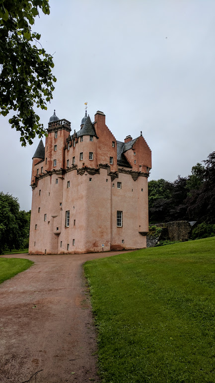 It was built by “Danzig Willie,” more properly William Forbes, a trader with Germany and the Baltic states (shades of Niccolo!) in the early seventeenth century and remained in the Forbes-Semple family (again with the Dunnett references!) until 1963.
The castle features amazing carved plaster ceilings and a huge carved plaster royal coat of arms over the fireplace in the banqueting hall. No photos are allowed, but if you go to this page you can see an image of the coat of arms. Or try this photo from another traveler:
The antlers! The plaid!
We went from floor to floor up steep winding stone steps (not for the faint of heart or weak of leg). The family used to spend six months a year here despite the lack of plumbing, heating or running waterup, until they gave it to the NTS. They did install a tub on one of the bedroom floors, but since it had to be filled by hand with hot water from an adjacent wood stove, it was still no bed of roses. It was interesting to see the castle without electricity; if it had been any cloudier, it would have been hard to see some of the details. We loved the photo of the three sisters who were the last children to live here, now in their seventies and still visiting annually, but in the photo lively and curly haired children just a few years older than we were then.
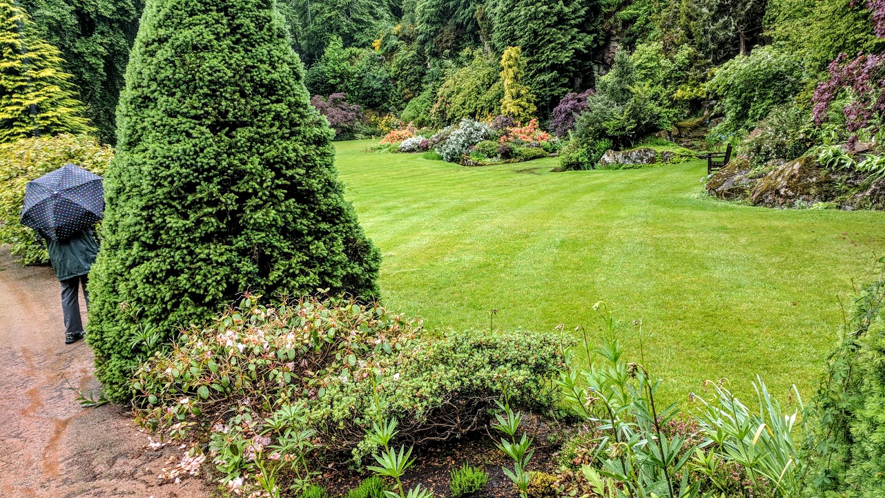
Having had a substantial breakfast, we settled for tea and a date bar from the little shop. It would have been nice to walk around, but the rain was relentless, so we soldiered on to Kildrummy Gardens and castle. It took a while to get there, again on tiny back roads. The satnav led us astray or at least didn’t correct us at one point, and we had to back and fill on a one-lane road, but we made it at last.
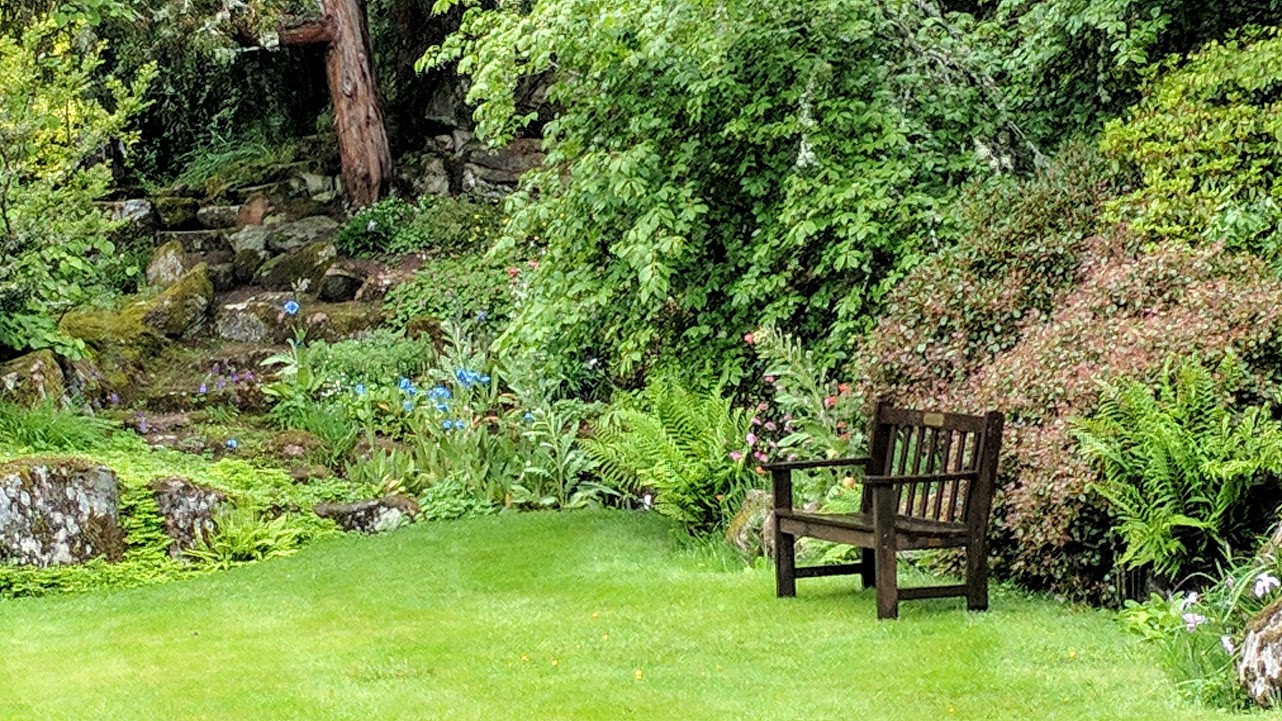
The entrance was confusing and we had to leave and start over again, but at last we figured it out. The gardens were designed in the early 1900s on the site of a quarry from which the stone for the neighboring Kildrummy Castle had been taken. It was influenced by Japanese gardens and that’s all I know. The quarry area was just perfect, the pink stone forming a stunning backdrop for trees, rhododendrons, and perennials (including blue poppies again). 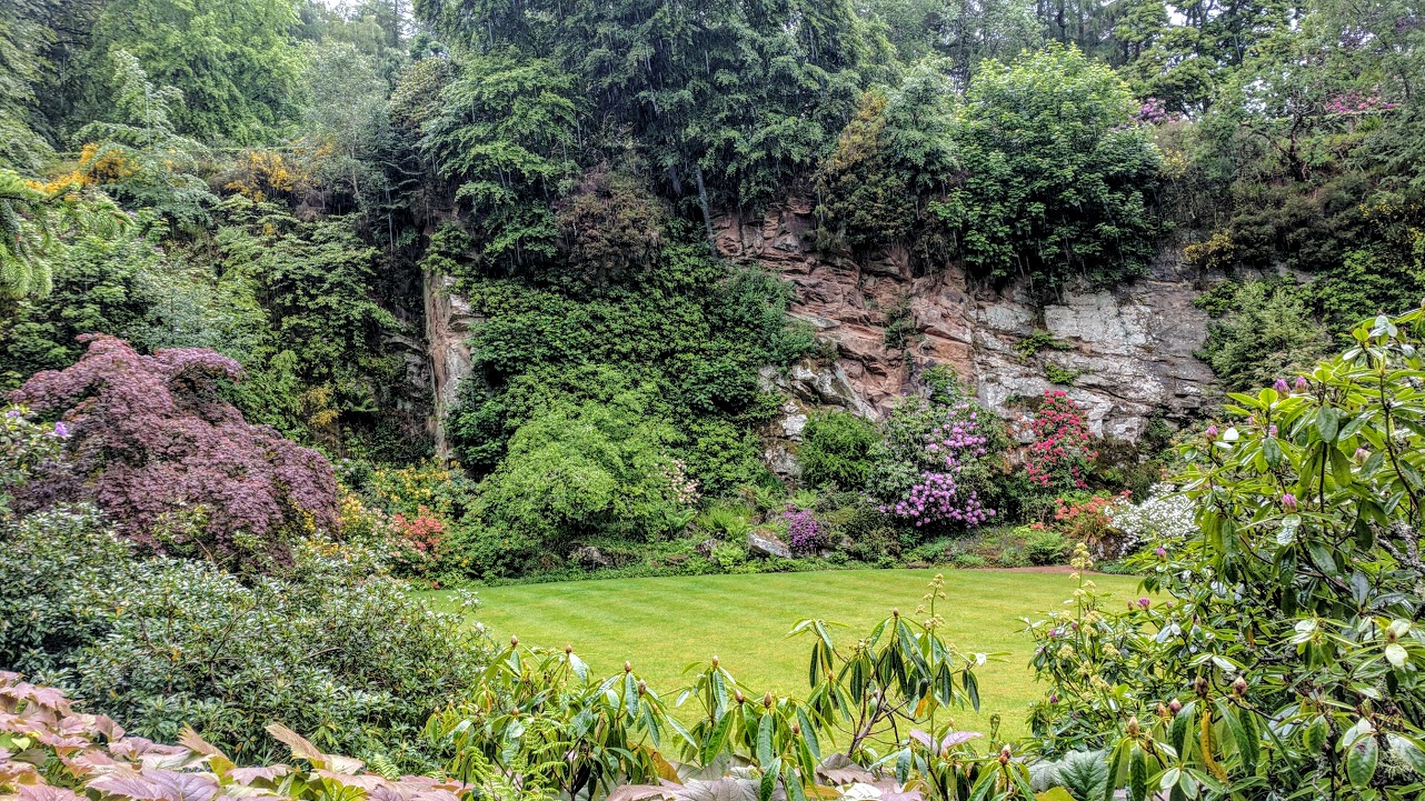
 It continued to rain gently but relentlessly, as you can see in this video. If you’re suffering in a hot and humid Virginia summer, just play this and you’ll feel better.
Paths led through the garden to the water area, spanned by a bridge inspired by a thirteenth century bridge in Aberdeen city. 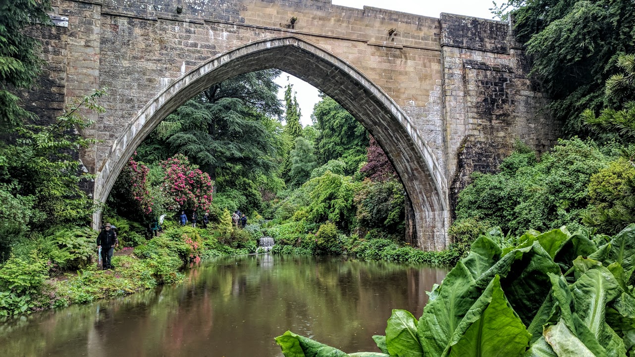 We could see the ruins of the castle on the hill above us
 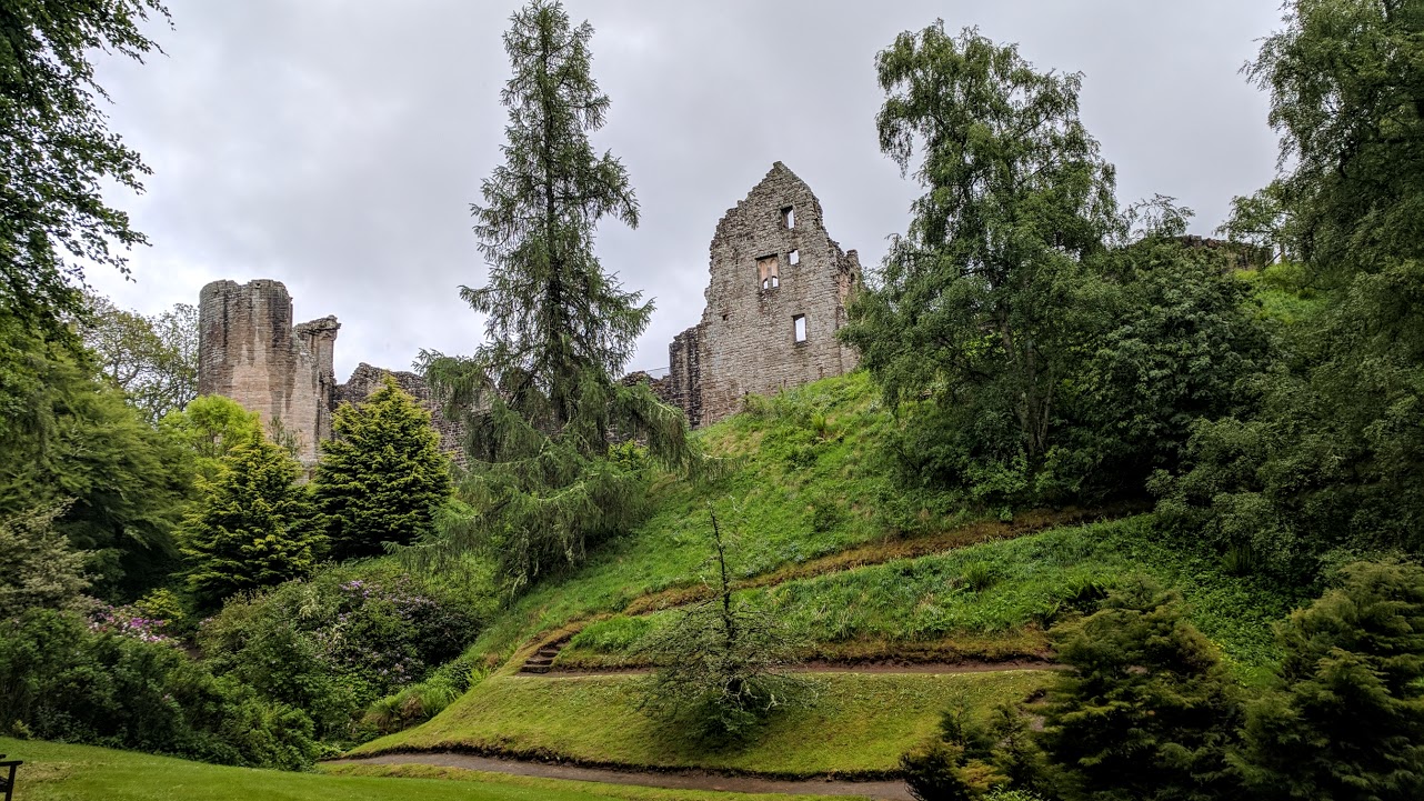 and decided that that was really all we needed of that. The gentle, persistent rain was actually a great backdrop to it all.
Alison was a very good sport, enjoying the bird and squirrel feeders outside the tiny reception/visitor center while I took one more path so I could see the bridge and the water gardens. We both got to see the famous red squirrels, though they were too quick for me to record.
So now we were headed for home, Ballater, following the instructions of the satnav lady. Alison, looking at the map, murmured from time to time that she was taking us on a strange route – “not the way I would have chosen” – but we innocently proceeded, along the River Don, through small villages and eventually on to a bleak, atmospheric moor. 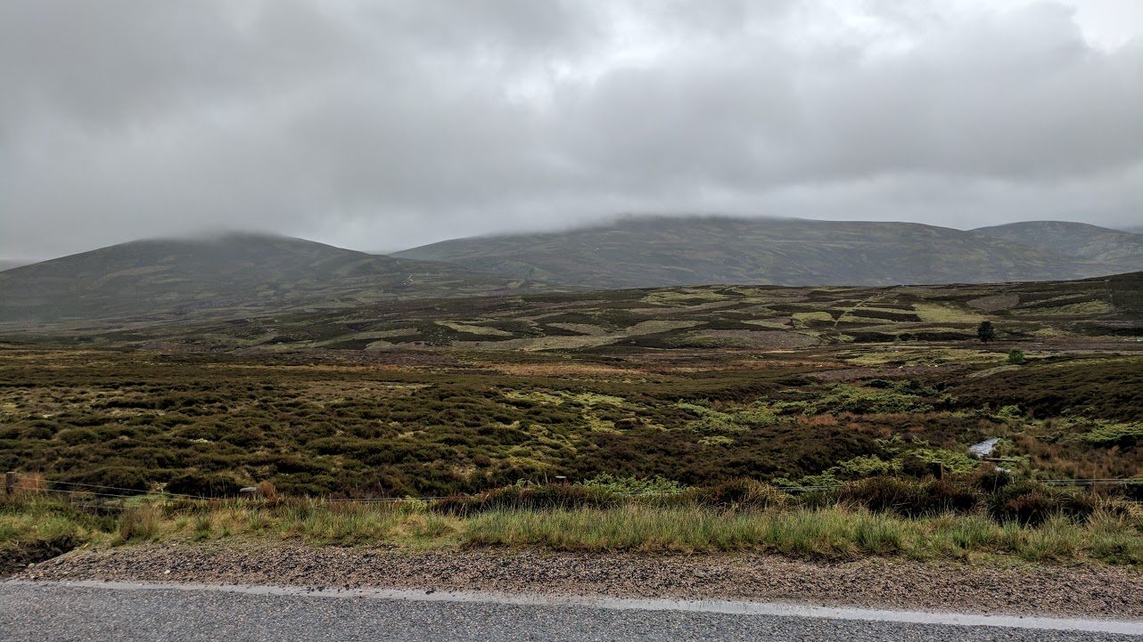 I love this country and stopped for a quick photo but AO finds it spooky so we kept going.
Then, just as the moor was turning back into ordinary green landscape, there was a sign: Caution, 20% grade, showing a vehicle at an alarmingly steep angle. And, it was a blind summit so I couldn’t predict what was facing us once we went over the top. Talk about scary! I hate steep roads anyway, and not to know how steep was alarming. But there was no choice, so I inched along and then could see the hill below. It was very steep, but I did not really think we would tumble upside down if we tried it. Coming up in the opposite lane was a lumbering bus and two cars, one of which darted around the bus just as we were coming down. I said aloud, “This is fine, there’s no problem, it’s going to be okay,” and apparently was convincing enough that Alison believed me. It was only when we were back on a level road that I let out my breath and confessed that I had been scared to death!
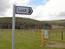
I’m still not sure where we were, but the photo displays as Strathdon. All Wikipedia can tell me is “Strathdon is an informal geographical area. This means that there are no precise boundaries in terms of where it begins or ends. ” So perhaps we were in Brigadoon?? The photo at top is of a village called Lost in Strathdon, so that must have been where we were.
From here it should have been a straight shot to Ballater, but the satnav kept trying to send us to Braemar. We ignored her and followed a road sign, finding ourselves parallelling our moor route but this time at the bottom of a valley, and soon enough we were home again. Looking at the Ordnance Survey map later, we saw where she had led us and marvelled…
Dinner tonight was an indifferent meal at the Alexandra Hotel with the advantage of lots of locals. We had enjoyed the day despite the rain but were happy to lay our heads in our beds.

Yikes! Frightening driving scenario! May that be the last.